
Date: 17th August 2026
Start: Glen Nevis Youth Hostel
End: Glen Nevis Youth Hostel

Distance Travelled: 15.17km
Song Currently Stuck in Head: Silk by Wolf Alice
Righto, Wales is too hot. Time to go somewhere with a more reasonable temperature that still has plenty of mountains to climb. Well, not straight away. The day after finishing Snowdon, arms lathered in aloe vera but still very red, I had another one of my very convoluted travel days with enough connections to make a normal person curl up into the fetal position and cry for 2 hours. First we had a bus to Bangor (it was gonna be Blaenau Ffestiniog but the heatwave had cooked the air conditioning on half of TfW’s trains so the entire line was shut for the day), a quick dash to the train station and onto a train (obviously) that transported me to Chester, an hour wait followed by the final train up to Liverpool. We then had 4 hours to kill before boarding a ferry across to the Isle of Man, finally arriving at my hotel after 11pm. What’s that, 3 different modes of transportation?
What then followed was 2 days of exploring the island on its heritage rail lines using three different modes of horsepower to get around: electric, steam, and, well, a horse. Yes, there’s a horse tram in Douglas and it’s amazing.

Wish I could’ve stayed longer, but there was a mountain with my name on it – not literally, obviously. So, rinse and repeat, ferry to Liverpool, train back to London, kill time for 4 hours in the transport museum, then mosey on over to Euston for a rather special train taking me north to Scotland.
The special train in question is the Caledonian Sleeper. As the name suggests, it’s an overnight train between London and several destinations in England’s northern neighbour. There’s two daily departures from London, the Highlander, and the Lowlander. The latter only goes as far as Glasgow and Edinburgh, the former departs earlier and travels deeper into the country to Aberdeen, Inverness, and Fort William, the last of which was where I was headed.
Now I must admit, I did splurge a bit on my ticket. You can get just a seat for around £50, but there was zero chance I was gonna enjoy that. Instead I went with a Club cabin, which comes with an ensuite and access to the lounge in Euston.

There’s a selection of complimentary soft drinks and snacks available here, but there’s also a proper kitchen attached to the lounge where you can order dinner before you board. As I wanted to go to bed fairly early, I figured it was best to eat now instead of on the train. As it was a Scottish train, it was only fitting that I get the haggis, tatties and neeps.

Absolutely superb meal, would’ve ordered a second if not for the price. Anyway, time to board.


I realise I am dithering on a bit again about non-hiking matters on a hiking blog, so I’ll make my train review quick: it’s quite possibly the best train journey I’ve ever taken. Staff were amazing, the bed was super comfy, the tracks were so much smoother than they are in Australia, and the views that met me when I woke up genuinely made me cry a bit.
Now time for the mountain bit, and it’s a big one. The biggest in the UK, in fact, which to be fair isn’t saying much: Ben Nevis. Leaving my pack in a hotel in Fort William, it was a short ride to the trailhead opposite a youth hostel, and without a moment’s hesitation we were off.

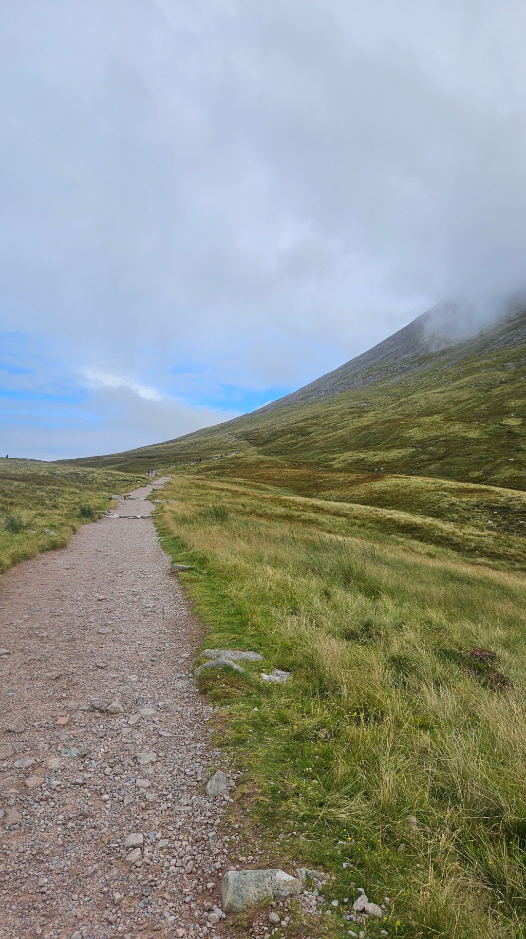
There was a lot of climbing ahead of me. The track starts near sea level and Ben Nevis, although on a global scale not that tall, was over 1300m above me, and that’s no easy feat. Well, I didn’t come here for flat, smooth trails, did I? No, I crave the challenge that will hopefully reward me with some speccy landscapes.

The mixture of school holidays, decent-ish weather, and the title of “tallest mountain in the country” meant the path I was on was very busy. There is another route to the summit akin to Crib Goch on Snowdon, but it was harder to get to from Fort William and I was under a bit of time pressure. No matter, a hike can still be enjoyable even if it’s crowded. Arguably it can be more enjoyable looking at people’s choice of attire and footwear for this arduous climb. In their defence, it’s not a technical trail, most of it was stone steps.

There’s not much of a forest on the slopes of Ben Nevis, but even so they were lush with green grass and hardy alpine flora. A stream cascaded down a valley, and about a third of the way up was this beautiful dark alpine tarn.

Below me I could see the valley where I had started this hike. It was quite the drop, but my Garmin gave me the bad news: I wasn’t even halfway there.

Well, no use crying over that bleak fact, just gotta keep walking up, and up, and up, and… you get the idea. At the very least, it wasn’t a New Zealand path (i.e.: straight line to the top regardless of gradient). It has switchbacks and carefully skirted up the face of Ben Nevis to make the climb more palatable. Plus the less technical nature of the trail meant I could spend more time admiring the scenery than watching for uncountable numbers of trip hazards.


I passed by families, solo travellers like myself, the odd trail runner or two, every demographic you could think of was out on this path. It was a constant stream of people in both directions. Most were wearing your standard active attire because, y’know, climbing generates heat and all that. For the last couple kilometres though, the layers had to start coming on. The grassy slopes had been replaced by jagged rocks as far as the eye can see, and we were now being guided by large rock cairns.

The clouds rolled in and the wind made its presence known causing temperatures to drop into the single digits. On went my windbreaker and I picked up the pace ever so slightly. Shout-out to the human body for being an excellent thermal generator when it needs to be.


Having zero clue where the top was, I just had to trust in the cairns and the handful of people walking in front of me. Thankfully they all pointed me at the summit, arriving rather unceremoniously to tap the cairn, grab a photo or two, and sit down behind a rock for a quick lunch next to what I believe is an emergency shelter.

Wouldn’t exactly be the most keen to stay here, but I guess that’s why it’s only supposed to get used as a last resort. Also on the summit are the ruins of a weather station that operated for only 20 years in the late 19th Century. Apparently it was actually rather useful, albeit very expensive to keep running.

Once I had downed two hot cross buns (shout-out to Tesco for making these outside of Easter, Coles and Woolies could learn a thing or two from you guys) I started my descent. The forecast I had last seen had rain coming in the afternoon and I wanted to get as much of the hike in as I could before it hit. So down I went, past the cairns that guided me up to the top and onto the greener sections of the trail. But now instead of the wonderful views I had earlier on, I was met with grey fog.

Annoying as the fog was, it wasn’t dangerous. There were still plenty of other hikers still up here and I at least had a couple hundred metres of visibility. The rain began in earnest once I passed the halfway lake (I’m sure it has a proper name, that’s just what I’m calling it). It’d be an uncomfortable end to the hike but not a dangerous one, and at least now I had descended below the fog and could see things again.

The rocks I had clambered up in the morning were now very slick, so the last couple of kilometres were walked very gingerly. There was no point in rushing as the bus I needed to catch back to Fort William was still 50 minutes away. The track levelled out and I crossed the bridge opposite the youth hostel to a very unceremonious arrival at the side of the road, rain still falling. The only creature congratulating me on my achievement was a cute robin.

Back to this bus. See, I’m not staying in Fort William tonight, I’ve still got more travelling to do, and I need this bus in order to complete said travel. Yes I’m being overly coy with the details, all will be revealed in the next post.


Leave a comment