
Date: 20th June 2026
Start: Mount Barney Trailhead
End: Uh… Mount Barney Trailhead
Distance Travelled: 15.2km
Song Currently Stuck in Head: the Hamilton soundtrack
Number of Other People’s Feet I Used as a Handhold: one (I’ll explain later)
Here’s the thing about being a hiker who lives in Queensland– well, one of the things: we don’t really have a lot of big mountains to climb. Sure, we have plenty of small and still reasonably sketchy mountains on offer (looking at you, Glass House Mountains), but not a whole lot over the 1000m mark. Yes I’m acutely aware that that’s a pretty low benchmark compared to literally any other continent on this planet, but that’s what I grew up with and is now the gold standard for mountains in my book.
Anyway I’m getting sidetracked. When it comes to tall mountains in this state, you’ve really got two major options: Far North Queensland (home of the tallest mountain in the state, Mt Bartle Frere) or the Scenic Rim near the New South Wales border. Far North Queensland is… well, it’s in the name. Not really a good place to go just for a weekend. The Scenic Rim on the other hand is only a couple hours away from Brisbane and happens to contain a number of (locally) iconic peaks. Most of the summit routes in the area are, shall we say, unofficial; unmarked, unmaintained, more of a general vibe than an actual track. The most notable exception to the rule is Mount Barney, the second highest peak in all of South East Queensland with a pretty infamous reputation, with rescue stories on this mountain being frequently covered on the nightly news.
A tall mountain with a sketchy, technical summit route and the promise of excellent vistas from the top. Ticks all the boxes for a fun adventure in my books! So, with that idea firmly planted in my head, I called up Hamilton (of Overland Track fame), set a date, and very early on a Saturday morning drove to the trailhead.
There’s two marked summit routes to the top (notwithstanding a handful of unmarked but still well-known routes not on the official maps): the South Ridge (also known as Peasants Ridge) and the South East Ridge. Peasants is longer horizontally but is less demanding and South East is… well, the exact opposite. Through a delightful mixture of (over)confidence in our abilities and a suspected malfunctioning of our brain cells, we decided to go up South East and return down Peasants. I should remind you, this is our first time going up this mountain.
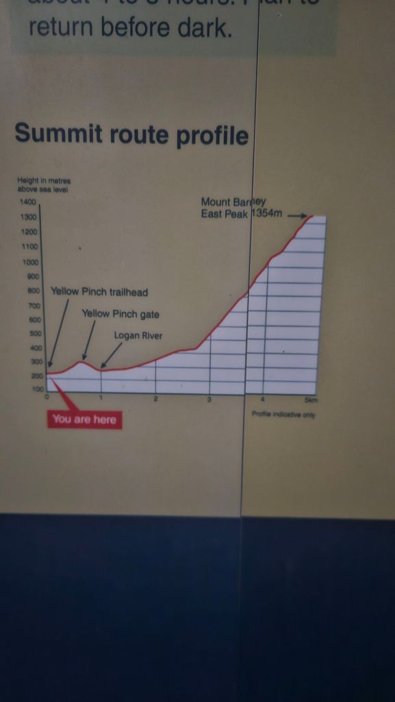
The walk started off peacefully in the early morning light, not really getting a proper sunrise due to the clouds. At this stage we were feeling pretty optimistic about the climb with the track gently rising away from the Logan River through the bush.
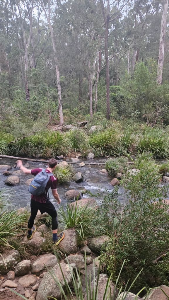
Honestly not being able to see the top of Barney from inside the forest probably helped us a good bit. It didn’t set in until quite a bit later just how far we would be climbing today. For the time being, Hammy and I got settled into a rhythm of steady yapping about anything and everything whilst the trail’s gradient subtly grew steeper.
2.5km in, we stopped for a snack break on a fallen log that was being used, presumably, as a clothes line for a flannel shirt. On the menu today for Hammy was a marshmallow sandwich, the bread being replaced with chocolate chip cookies. The man’s diet continues to amaze me on a daily basis. I just grabbed a handful of lollies for a quick boost of energy and then got back underway.
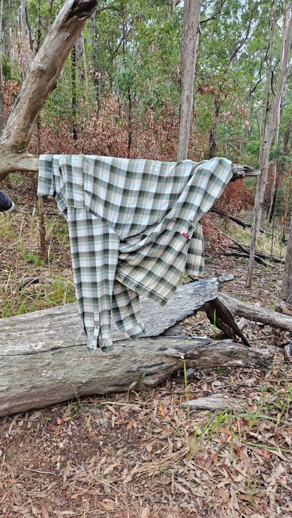
Despite the cool winter air, climbing up a mountain still produces a lot of heat and subsequently a good amount of sweat too. Trouble is, that sweat doesn’t evaporate, it sticks to your shirt, so throwing an equally sweaty pack on your back is a rather unpleasant feeling.
Anyway, gross sweaty backpack aside, as soon as we stepped over the log it felt like we were on a completely different track. It got really steep, really quickly. No more easy kilometres for us, it was time to put those calf muscles to work to haul our bodies over a multitude of rocks and roots.
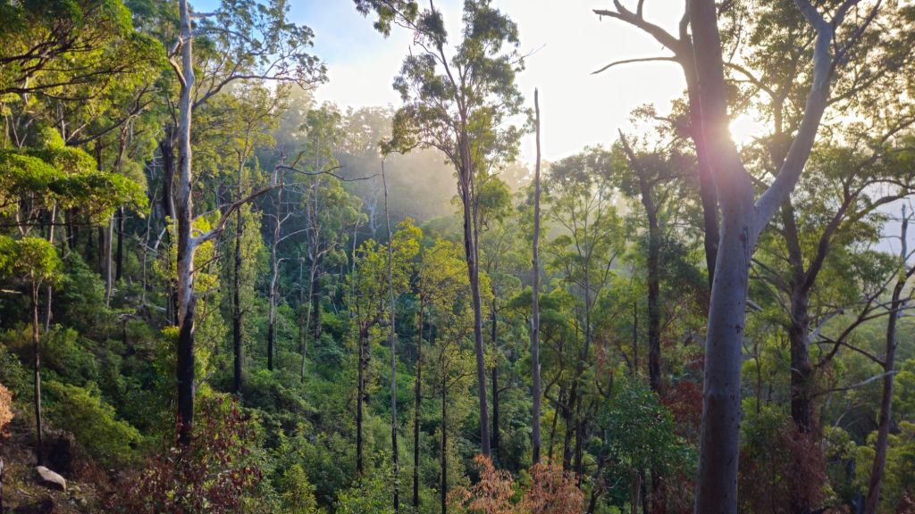
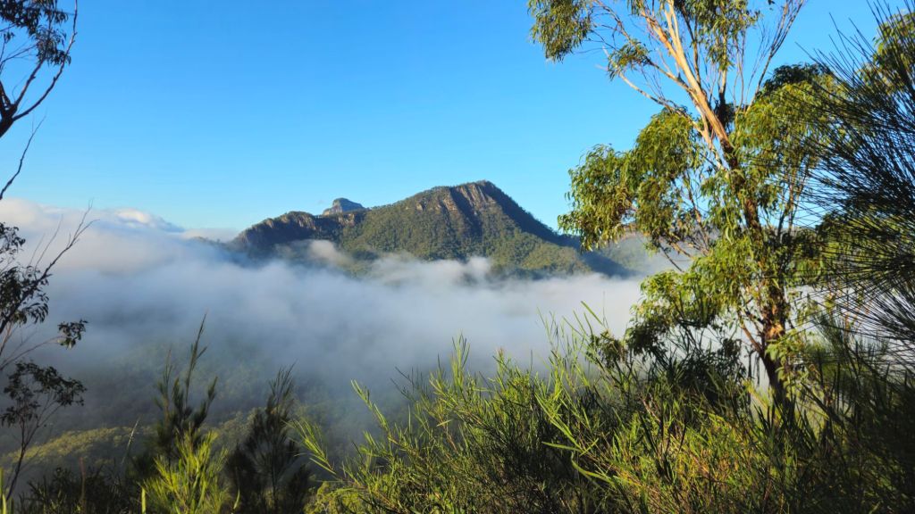
In a strange turn of events, we were overtaken by two guys who were absolutely flying up the mountain. Presumably they’ve done this track a good few times now. We had a quick chat with them at a lookout and yeah, they’re both pretty experienced hikers, one them having recently done the Annapurna Circuit in Nepal. We tried to keep them in eyeshot to find the best route up the ridge, but that sadly didn’t last long. So, we slowed down, stopped at any vista we came across, and marvelled at the awesome views of the Scenic Rim.
Speaking of “best route”, the summit route guide published by QPWS suggests the two main tracks to the top of Barney were marked with labelled orange markers. Basically the same design as those in NZ and Tassie, but with some additional location info that could help locate you in an emergency. I suppose technically there were markers on this ridge… but to call them helpful would be a stretch.
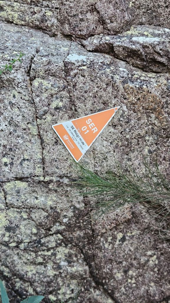
Far too many times we’d be following something that resembled a trail, only to have it end abruptly at a sketchy drop off with All Trails yelling at me that the actual route was 20m to my right, a pretty big distance on this narrow ridgeline. Didn’t really feel like an official QPWS-sanctioned route at all, and once we came to that realisation, I was pulling out my phone every 5 minutes or so to confirm that whatever rock chute was in front of us was actually the trail we had to follow.
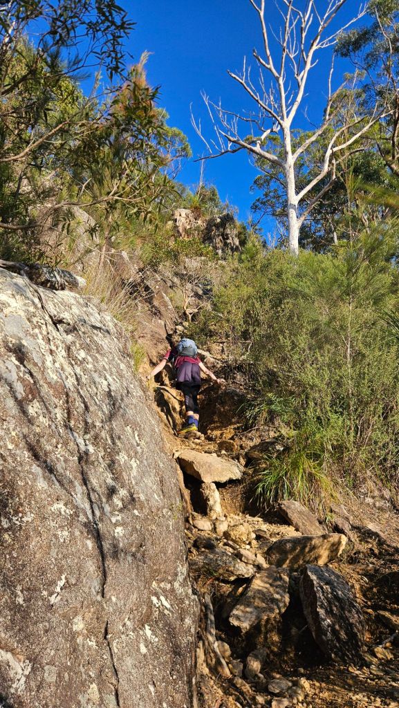
We were now very much in the scrambling half of the route by this point and to call it sketchy would be doing it a disservice. There were numerous smooth rock slabs to contend with, some of which conveniently were covered in run-off from prior rainfalls. In one instance, Hamilton, bring the tall lanky guy he is, could just reach up to a tree root to haul himself up one of these slabs. Me, not being tall and lanky, did not have the same luck, and I really couldn’t find any good foot or hand holds that filled me with confidence. Stumped for options, Hamilton then came back down, grabbed onto a nearby tree, and extended his foot in my direction to help boost me up. Really not a great option, but faced with nothing else reasonable I gave it a crack. Thankfully it worked, although Hammy later admitted to me that in contrary to his words of encouragement that he was fine and I was ok, he was holding on for dear life and was close to letting me go.
Ah well, at least the view was nice.
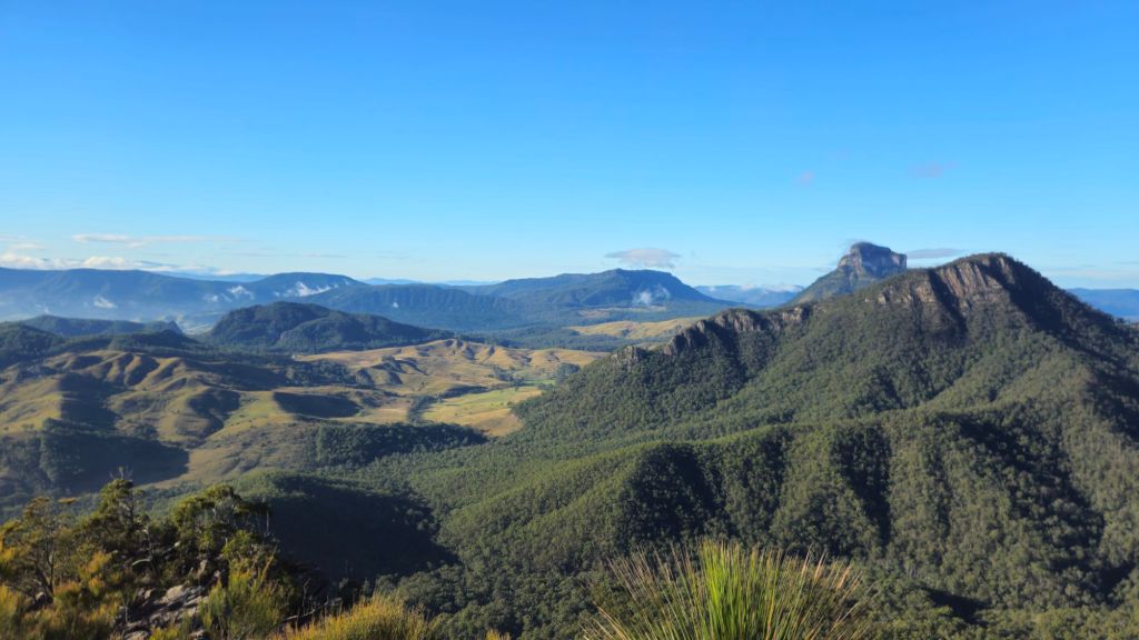
The scrambling didn’t let up in the slightest for the next hour and a half. Each step was hard won, stopping to seek out the best foothold I could find and diligently testing it before putting my full weight onto whatever rock or tree root I was trusting my life with. It’s the sort of challenge that I find really fun, a cocktail of problem solving, exposed terrain, and the always present risk to life and limb.
That said, it was really annoying seeing Hamilton make the climb look so easy.
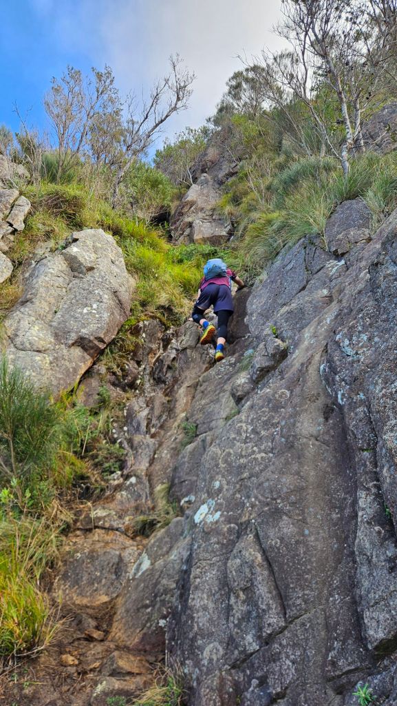
Rainfall in the preceding week had made the ground just a wee bit slick and my hands were slowing being caked with a thin layer of mud from grabbing onto dirty branches or… honestly just pressing them down into dirt. There’s a false summit a couple hundred metres from the true top, once we were over it the route eased up slightly as we passed by the junction to Logan’s Ridge, the first ridgeline up Barney to be traversed by a European. The European in question was Patrick Logan, commandant of the Moreton Bay Penal Settlement and the guy that the city/river/lots of things south of Brisbane are named after. It’s known for being next-level brutal, so no chance of either of us attempting it for our first Barney ascent. Maybe one day if I’m feeling particularly silly I’ll give it a crack.
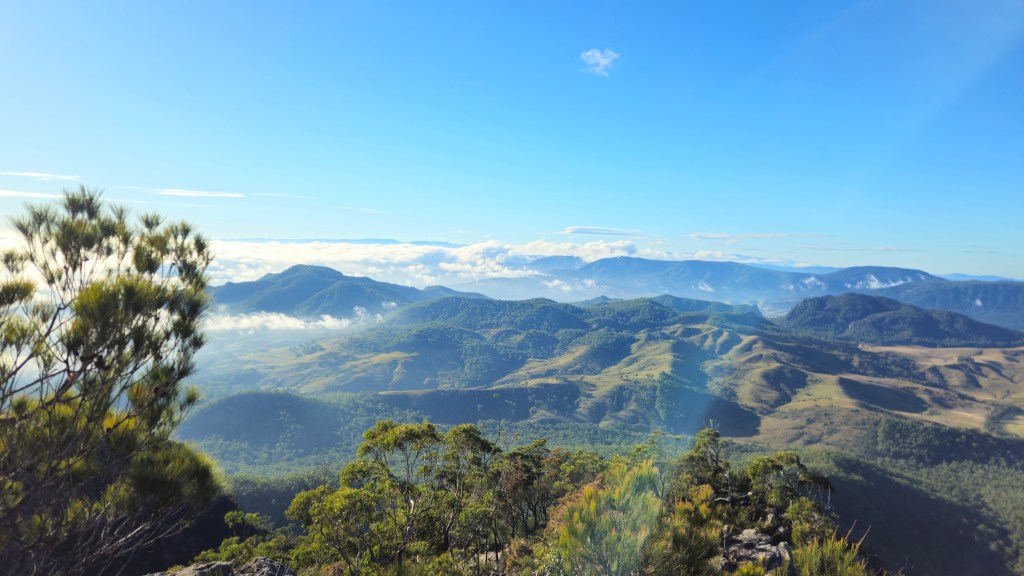
The top of Mount Barney is nearly completely free from vegetation, almost like the mountain is rewarding your efforts with stunning 360 degree views across the Scenic Rim and down into New South Wales. Thin bands of clouds still lingered in the valleys beneath us, really putting into perspective just how high Barney is. It’s not the tallest in SEQ (that honour goes to Mt Superbus), but it dwarfs the surrounding land over 1000m below us.
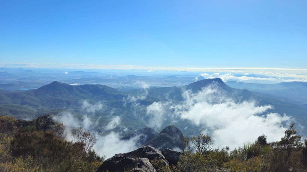
Ok, we technically weren’t at the top of Mt Barney. It has a second peak only a short distance away that is also part of the same mountain (for complicated geology/prominence reasons that I won’t go into because I don’t understand them) which is climbable but is off the main tracks.
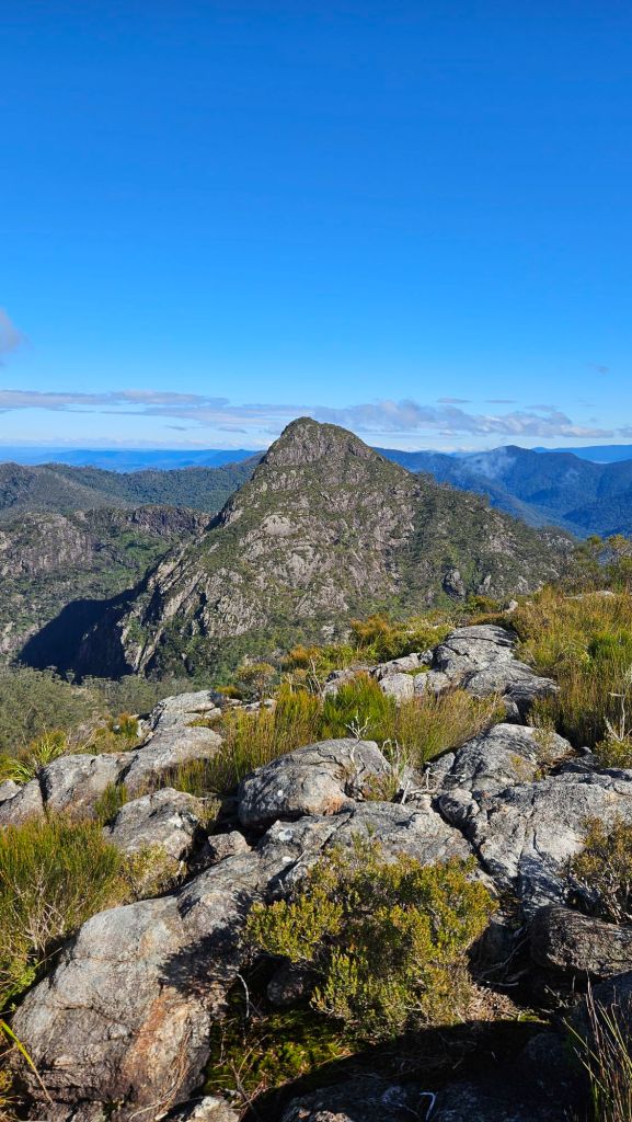
Hammy and I rested at the top for an early lunch, although calling this a formal meal is a bit of a stretch considering culinarily there wasn’t a whole lot different in the food Hammy was stuffing down his throat compared to the snack break we’d had earlier. I at least had a cheese and garlic pull-apart (i.e.: something that could be considered by a normal human being to be a lunch foodstuff). Stomachs full we started on the descent. Thank you for your service, calf muscles. Quads, it’s now your turn.
Now, remember how I mentioned earlier that the track up was poorly marked and easy to venture off? Yeah, well the start of the descent wasn’t poorly marked inasmuch that it just wasn’t marked at all. We really just had to follow our noses and look out for “paths” that could possibly be the trail whist continually confirming that with All Trails. There were no sheer drops to contend with, but we would sometimes be faced with a vertical drop off a boulder that was just a bit too high, which was probably a good sign we should look elsewhere for a route.
We dropped down into the saddle between the two peaks, to a place called Rum Jungle. No clue why it’s called that, guessing that’s a question for whatever 19th/early 20th century European settler named it that.
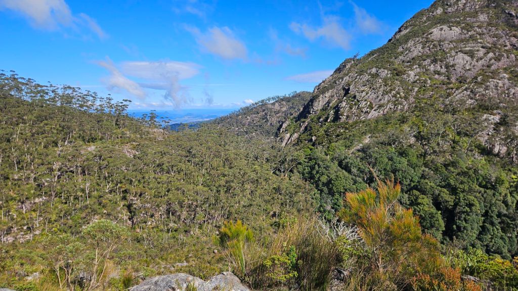
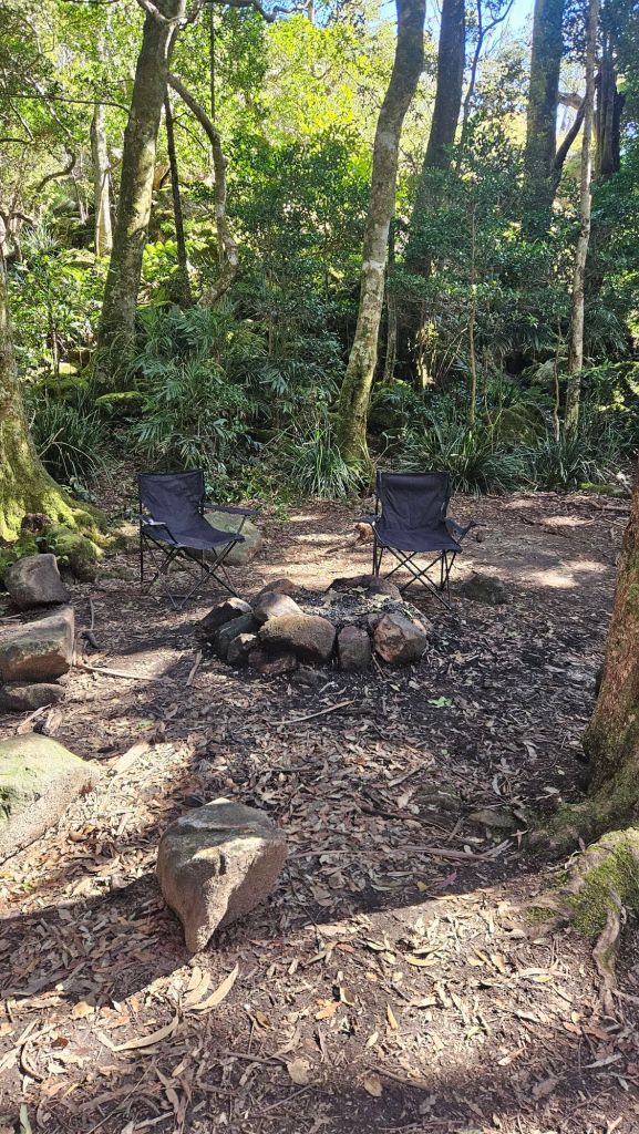
Rum Jungle plays host to an official-but-only-just campsite for hikers to stay at overnight. I say “only just official” because the campsite is essentially just a flat bit of dirt big enough for probably half a dozen tents and nothing else. No water tank (there’s a small stream nearby), no tent platforms, and no toilet. I was half tempted to make this an overnight trip, but Hammy and I both agreed doing the entire thing in a day would be more feasible. The campsite itself is in quite a nice spot, the forest protects you from the worst of the elements and there’s still a sweet view off the saddle.
Our route to the bottom was down Peasant’s Ridge – no clue where it got this name from – and mercifully it was way less demanding than South-East. Ok, I do realise “way less” is being badly skewed by the sheer ruggedness of our route up the mountain, an average hiker would still find Peasant’s pretty challenging. It is however more sheltered and has less of the how-on-Earth-am-I-supposed-to-get-up-this granite slabs that made the trek up so demanding. Plus, this route actually had trail markers.
Our pace was still pretty slow, but we felt way more comfortable and turned to singing various musicals to pass the time (Hamilton is very much a closeted theatre kid). Boulders gradually gave way to dirt paths as the gradient eased off, passing by a number of creek beds through a rather pretty grove of palm trees.
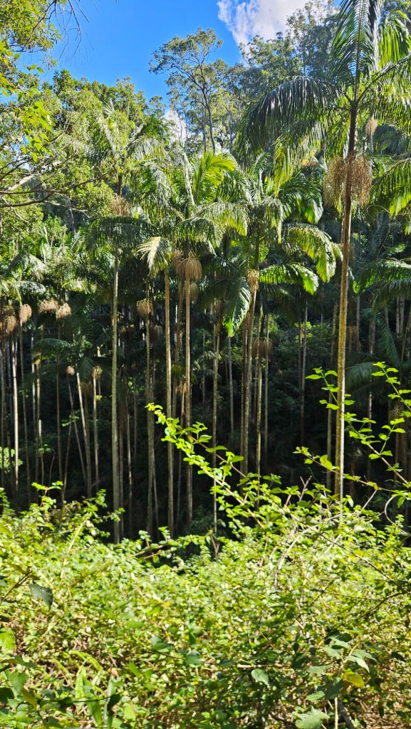
The path soon widened to a 4WD track which would last the rest of the way back to the carpark. There’s two bush camps situated on the banks of the Logan River that would’ve been lovely to stay at if we were looking for more of a relaxed trip, but where’s the fun in that? One annoying thing about this route is having to cross the river only 2km from the end over a concrete ford. The water was just high enough to enter my shoes. Look, I don’t mind getting wet feet, but to have it happen so close to the end was a wee bit frustrating. Hammy, in his infinite wisdom, did manage to find a way to rock hop over; once again, all that extra height was coming in handy.
Wet feet aside, we were in good spirits crossing through a small patch of farmland. As I was just mindlessly looking around, I caught a glimpse of Mt Barney through the trees and frankly, it gave me a bit of a fright.
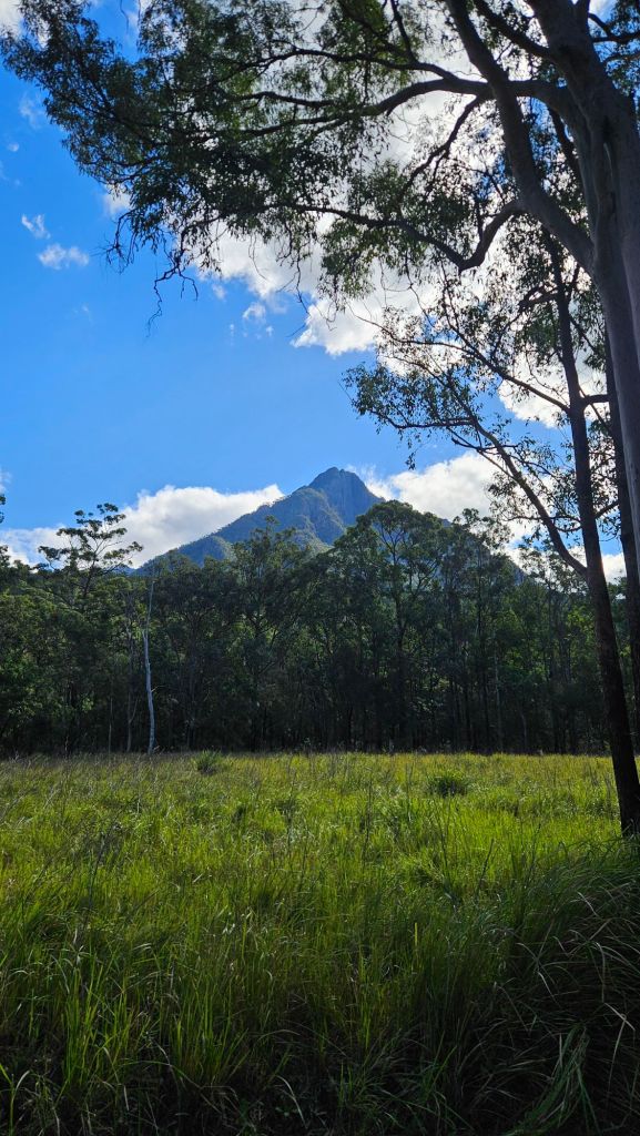
We’d started before sunrise so we really hadn’t had a good look at the sheer scale of the mountain until now. It totally dwarfs the hills I’m used to seeing around greater Brisbane and put into perspective just how hard the summit climb had been. From down here it’s daunting, but if you just take one step at a time and focus on the track in front of you, the climb feels way more manageable.
It took us another 20 minutes or so to return to the carpark, one that was littered with the weary bodies of about a dozen other intrepid hikers who’d made the journey up and over Barney. Hammy and I left feeling relieved and satisfied, setting a course for the pub in Boonah in time for an elite post-hike feed.
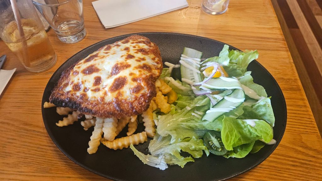
Bellies full, we drove back to Brisbane in quiet reflection, thinking of what mountain we’d tick off next. There’s a lot more where Barney came from.


 A Dangerous Business
Leave a comment