


Date: 26th February 2024
Start: Lower Wairaki Hut (km 2842)
End: Birchwood Station (km 2877.7)
Distance Travelled: 35.7 km
Total Distance Completed: 2724.2 km
Song Currently Stuck in Head: Conditions Of A Punk by half•alive
Mt Linton Station Scenery: surprisingly beautiful
I didn’t wake up in a good mood. For all I knew I had another stupidly long day of hiking without much in the way of a reward for it other than getting just a bit closer to Bluff. It also didn’t help that we’d begin the day by immediately climbing and that once again the rest of my trail family had left before I was ready to go.
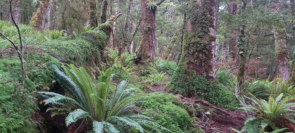
It was more of the same forest as yesterday with an added dash of climbing to do. It started off pretty steady, dodging around small mud puddles as I made my way through more fern groves. I thought they were supposed to be silver over here…
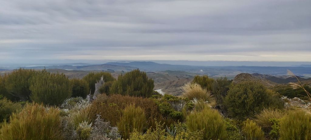
But of course it wouldn’t be the TA if the climbing didn’t get stupidly steep near the top. Somehow I passed Till on my way up despite my frequent breaks just to refill my lungs with some much needed O2, my constant yawning coming from a mixture of tiredness and a desperate need for air. Unexpectedly I was rewarded for my efforts, with sweeping views over Southland.
The trio was also up the top and before heading down we took an obligatory photoshoot. Then they left me again because I still suck at descending mountains and I’m adamant on keeping my slow, methodical approach to them. Call me crazy but I don’t like falling over on rocks.
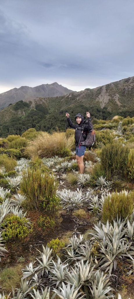
One more thing about this mountain: it’s cold up here. We’re getting to the end of summer and were in the southernmost region of Aotearoa which isn’t that warm even during the peak of summer. I don’t think I’ve ever had to put on a layer during a climb before. It did warm up a bit as we came back down into a valley filled with more tussock and the occasional bog.
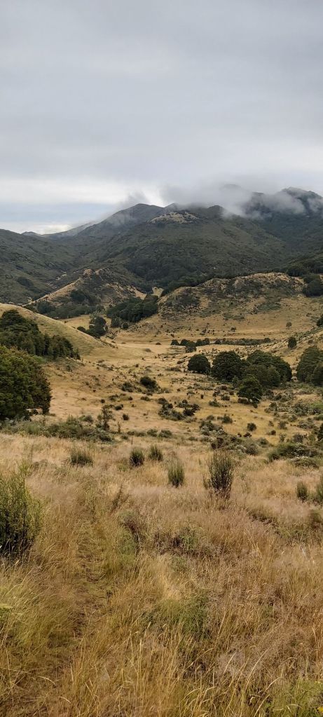
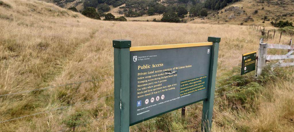
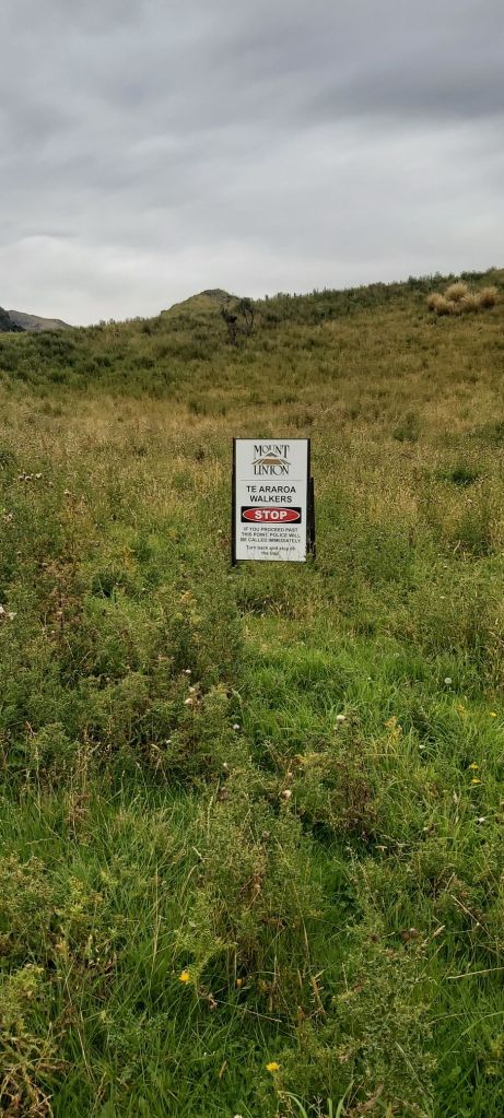
At the bottom was a rudimentary campsite which is little more than a grassy clearing with a long drop and a healthy population of sandflies. Only stopping briefly to get water, we hopped over the stile into Mt Linton Station, one of the largest privately-owned stations in the country. The route through it is a crucial link for Te Araroa as there is no decent alternative to get hikers from Mavora Lakes to the south coast without large sections of road walking. That being said, the station has had its fair share of problems with TA hikers not sticking to the marked trail and even breaking into private huts along the way, forcing changes to the route up and over hills that could’ve been avoided. It is of utmost importance if you’re taking this track that you always follow the marker poles and keep an eye on Far Out or an alternative map app to ensure you don’t accidentally trespass. There’s plenty of signs listing all this out and notifying you of what will happen if you fail to comply.
After crossing the Wairaki River, we were led up a steep climb away from the much nicer 4WD track that followed the river, a payment for the sins of past hikers. To my surprise my energy was quickly sapped away and I soon fell behind the rest of the group. I gave up trying to stick with them and decided to just set my own pace, including taking lunch much earlier than the rest of group likely would. Catching up would be a challenge as they’d likely take a shorter lunch break and would be walking at a similar pace to me anyway. I didn’t mind, and I figured going solo would give me a chance to calm down and clear my head.
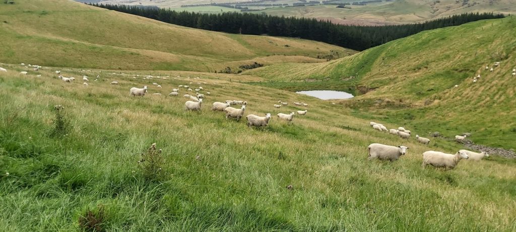
Setting off just before 1, the trail led me back to the river where I caught a glimpse of the gang crossing it. By my rough estimation they were around 800 m ahead of me. That’s further than you think but it wouldn’t be impossible to catch up, depending on the terrain ahead. After crossing the river myself – and accidentally touching an electric fence – I followed a 4WD track up onto a ridge and through a sheep paddock.
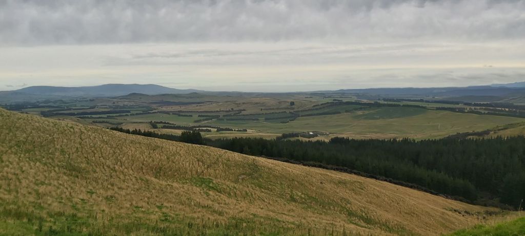
On the other side of the paddock I then had to follow a fenceline up a steep hill to another 4WD track. This was the highlight of the Mt Linton track. A flat trail overlooking widespread Southland fields and *shudders* Longwood Forest. The final major obstacle of the TA was now only a stone’s throw away and as tempted as I was to hitch around it, at this stage that would be cheating in my eyes. Not gonna skip anymore sections, one way or another I’m getting to Bluff.
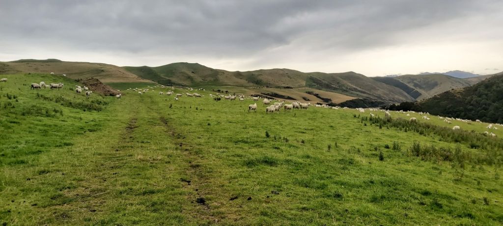
Thanks to these sights and the nicely laid track, my mood had lifted significantly and I was having a great time, much to my surprise. I was definitely expecting something more akin to the farm tracks I travelled on up north (fenceline, steep, muddy) and although there was a bit of that, for the most part I’ve been on these nicer 4WD trails through sheep paddocks, some of whom had been freshly sheared.
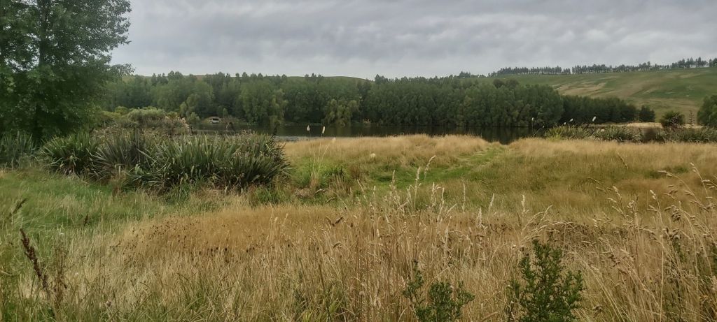
When I descended off the 4WD track, it was a return to fenceline following through flat fields. Nothing major stood in my way so I just let the kilometres roll by listening to some music. I hadn’t caught up with the others, still maintaining that 800 m gap. Nearing the road I went past this nice lake known as Loch McGregor, the McGregor’s being the owners of Mt Linton Station.
The final couple of kilometres were the roughest of the day and was more like what I expected the whole trail to be like. A bit overgrown with thistles and not as interesting as the rest of the track.
Despite travelling 5 km further than yesterday, we’d gone substantially faster and arrived at the road just after 6pm. Tonight we’d be staying at a private hut on Birchwood Station, set up specifically for the TA. Matt had texted me the directions for how to get there, arriving just as the others were beginning to get dinner ready.

The hut was well supplied with amenities, including a hot shower, flushing toilet, kettle, loads of beds, and pizza. Oh yes, there was pizza, homemade by the owners of the station. It was just what the doctor ordered, along with the lovely shower afterwards. With tomorrow being a rest days I stayed up late catching up on social media, finally hitting my pillow close to midnight.

Leave a comment