

Date: 13th February 2024
Start: Top Timaru Hut (km 2555.7)
End: Stodys Hut (km 2569.3)
Distance Travelled: 13.6 km
Total Distance Completed: 2415.8 km
Song Currently Stuck in Head: too busy panting up the climb to the hut to worry about music
Time Lost on a Sketchy Ridge: half an hour, felt like an eternity
There was frost on the ground outside this morning. Actual frost. In February. Quite unexpected considering how toasty it was inside the hut. I don’t know what sort of insulation they’re using but it’s very good.
Right, no more dilly dallying, I’ve got friends to catch up with. Before leaving Tin Hut yesterday, we agreed to rendezvous at 8am at the intersection of the TA and Melina Ridge tracks. For once I didn’t want to be late, leaving the hut at 7:45 for the quick dash down. Oli was there to greet me when I arrived, Team Camera coming in a few minutes later. Little did I know this would be the last quick but of track for the rest of the day.
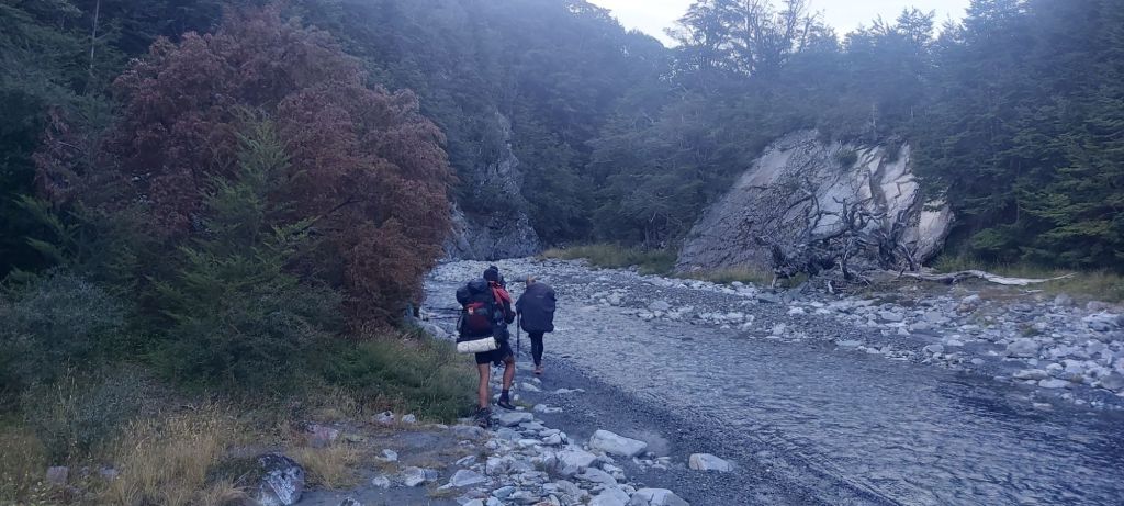
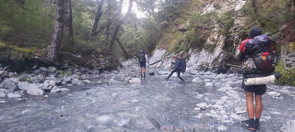
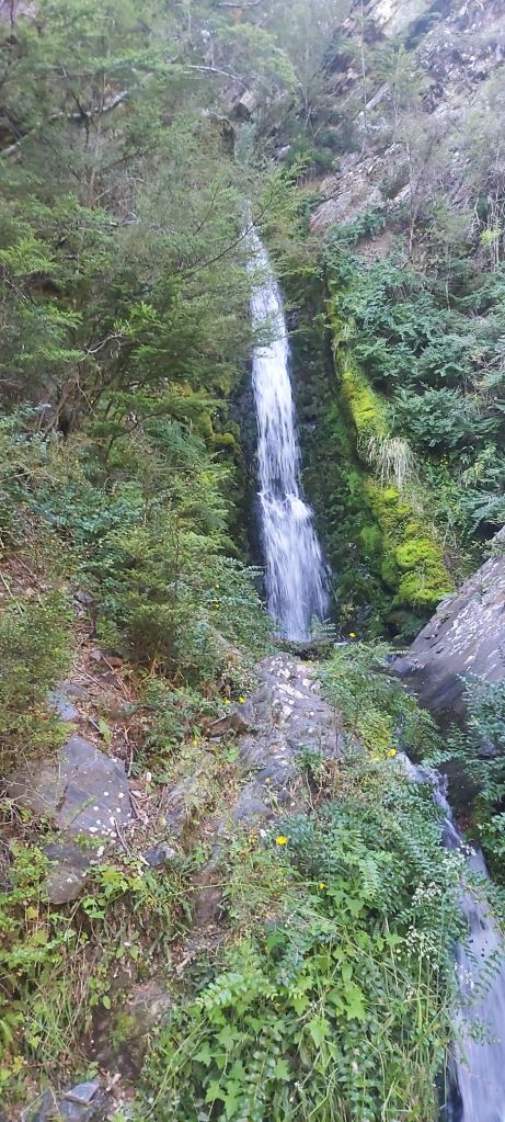
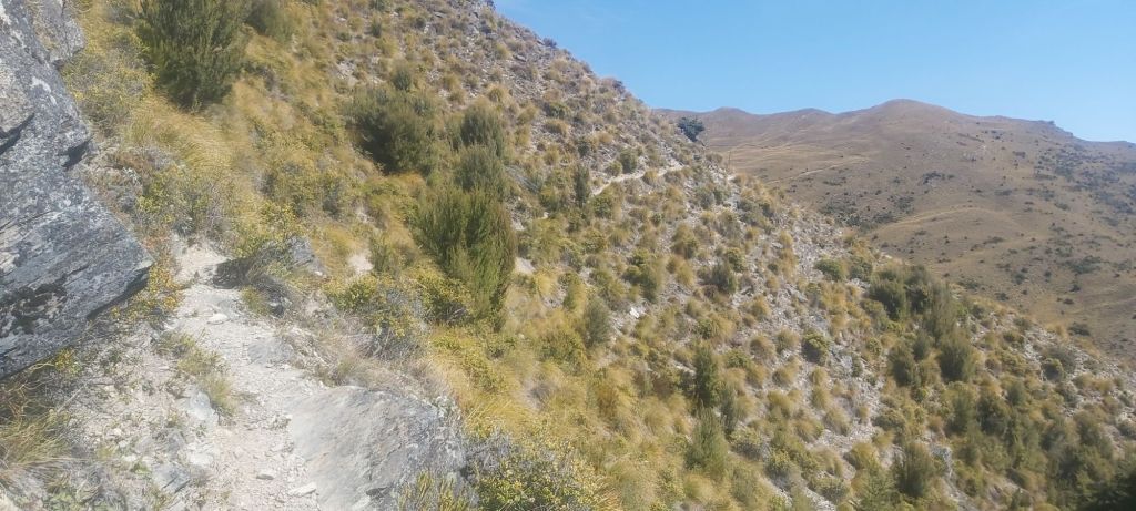
For 10 km we’re supposed to follow the Timaru River downstream. In typical TA fashion, we have the choice between staying in the riverbed or taking an all-weather track above it. Both would be slow, but many of the comments we read recommended taking the river route. Starting off we did, crossing it several times as we skipped between rocks and banks. But for some reason we didn’t stick down there for long. Oli was in front and after only 2 km or so he went up the flood track and I haven’t asked him why. Yes, there is a part of the river where it gets a bit too deep to cross safely, but that’s still another 2 km down the river. Whatever his reasoning (keep in mind he doesn’t have a phone/map), we now found ourselves sidling along a track that can best be described as annoying. It went up, it went down, it went along narrow paths, it really wasn’t that fun. At least we saw a nice waterfall.
The sides of the river were steep and rocky. From the flood track I could look down and see a nice pathway through the river below me, but here I was stuck looking down at it, passing over one of many steep, slippery, short descents.
At points the “flood” track even ventured onto the river itself and I’m kicking myself for not speaking up and suggesting we just follow the river for the rest of the way. Instead, our trail led us away from the Timaru and up the mountainside on a ridiculously slow section that only accomplished making me impatient and agitated.

Including breaks, it took 5.5 hours to get from Top Timaru Hut to the track junction up to Stodys Hut. 11 km in 5.5 hours. Feeling a bit fed up, I decided to have lunch down here, letting the others go on ahead as they wanted to get all the way to Breast Hill today.
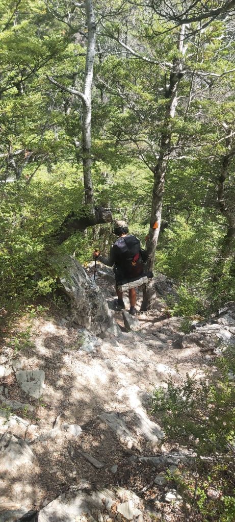
Now let’s discuss this climb to Stodys Hut. It’s 2.1 km horizontally but 500 m vertically away. That’s a pretty steep track. No matter, I thought, I’ll just take things slowly and stop frequently to catch my breath, I’ve got plenty of time.
The first thing that went wrong was that I ran out of water very soon after starting the climb. Annoying but not the end of the world, I can survive an hour without a drink.

From there it just got worse. A lot worse. During climbs, I’m normally hunched over looking at the trail, meaning I don’t always see the trail markers directing me up the mountain. About 500 m from the junction, I followed what looked to be the trail, but when I looked up to check no orange triangles could be seen. Far Out confirmed it, at some point a missed a turn to the left. Ok, no need to panic, I can just walk across 20 m or so to reach the proper trail. Once I started assessing the surrounding terrain, I realised that would be that easy. I was on a steep ridge, the ground was covered in slippery leaf litter, and there were trees blocking some routes. Oh, and I had completely lost my bearings. Many times I thought I was heading right towards the trail when in actual fact I was walking parallel to it. I think this was the first time I felt like I was in genuine peril. My hands frantically clutched at any branch or rock I could find, with panic setting in when said branch or rock wasn’t secured properly. I never trusted that my feet would hold, forcing me to keep on moving, quickly making decisions on which path to take and praying it was in the right direction. More than once I considered stopping and triggering the big red button on my Zoleo, but I also knew the trail was just there.
I lost track of time, but it must’ve been close to 30 minutes before I noticed a well worn patch of dirt just ahead of me. When I got closer, I then saw the most beautiful thing I’ve ever seen in my life. An orange triangle. I had found the trail. Taking 5 minutes to calm down, I knew there was still a lot of hard work ahead of me. And I still had no water.
I’ll spare you the details of how the rest of the climb went. All you need to know is that it sucked big time. I was tired, dehydrated, shaken up by my earlier ordeal, and just generally fed up with the trail after everything I’ve had to endure today. I didn’t even celebrate when the track levelled out near the hut, because it turned into a narrow sketchy ridge sidle the rest of the way there.
When I arrived to Stodys Hut, in frustration I flung my pole at the ground, dumped my pack and went inside to cool down. I wasn’t going to do another single inch of the trail today. I was done. When I spoke with the other hikers there, I learnt I wasn’t the only one to get lost on the ascent, at least three other walkers making the same mistake I did.
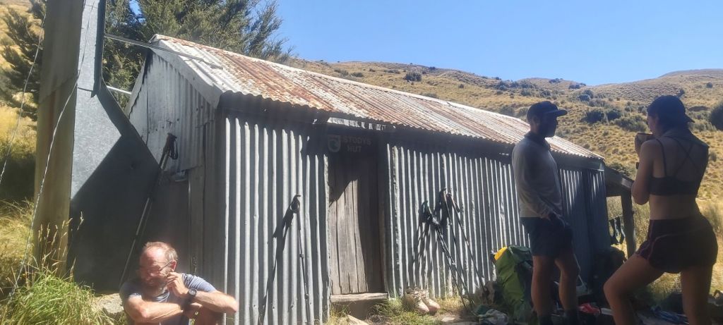
Matt, Melly, and Oli then left for the summit, leaving me with Team Kiwi for another night. Stodys Hut is another old musterers hut built out of corrugated iron. Its main feature is a dirt floor covered in wool bags. Despite my first impressions, it turned out to be very comfortable inside thanks to some insulation that had been put in when it was renovated in 2010. Despite the age gap, I loved talking with Team Kiwi and learning more about their lives and their experiences. All the hardships of the day seemed to melt away that evening, but I was still pretty tired, going to bed earlier than normal. Tomorrow ought to be better, reaching the summit of Breast Hill and reuniting with my family on the way down. It just goes to show that when it comes to long distance hikes you really shouldn’t quit after a bad day.

Leave a comment