

Date: 4th February 2024
Start: Comyns Hut (km 2291.5)
End: Manuka Hut (km 2312.8)
Distance Travelled: 21.3 km
Total Distance Completed: 2150.5 km
Song Currently Stuck in Head: Real Gone by Sheryl Crow
River Crossings Just in the First Half of Today: 67 (I counted this time)
So that had to have been the coldest night on trail so far, not helped at all by the lack of insulation inside the hut; corrugated iron isn’t the greatest at keeping heat in. Sleep was sporadic and it appeared that everyone else was in the same boat, with very little movement before 7am. Eventually I hauled my shivering body out of my sleeping bag and got some water boiling for a much needed coffee to give me the heat and caffeine I needed to get everything packed up. Little by little, the hut became less busy as people left and started up the Hakatere River. The last to leave, as is custom, were Oli and myself, along with Nicole (last spotted in Havelock), Jonas (introduced in Lake Coleridge), and Zach (Canadian whose face I’ve seen on trail before but never met personally).
The theme for the morning was river crossings. Lots and lots of river crossings. Oh, and did I mention that it was cold? Yeah, that extended to the river as well. The first crossing was barely 100 m from the hut and it instantly numbed my feet. For the next hour until the sun rose above the mountains, I maintained a walking pattern of freezing my feet in the river, then stumbling across rocks and such for about 20 metres (complete with lots of angry grunting) just to cross the river again.

To keep my mind distracted from the pain my feet were in, I started counting how many crossings we did. Some estimates suggested we’d have to do as many as 80 crossings so I wanted to check for myself. An hour in, I had already logged over 30. It’s not like we were trying to cross as many times as possible, that’s just what the trail forced us to do, going from bank to bank as on either side we were flanked by steep cliffs.

At least the crossings weren’t difficult, at most the water came just below my knees and was never flowing fast enough to cause any problems. Even better, now the sun was high enough to shine down the valley, warming my feet and the water I was passing through. Crossings were also becoming less frequent, the banks of the river increasing in size making for more dry hiking. At long last, in sight of the Clent Hills Saddle, we left the waterways and started a final climb through tussock.
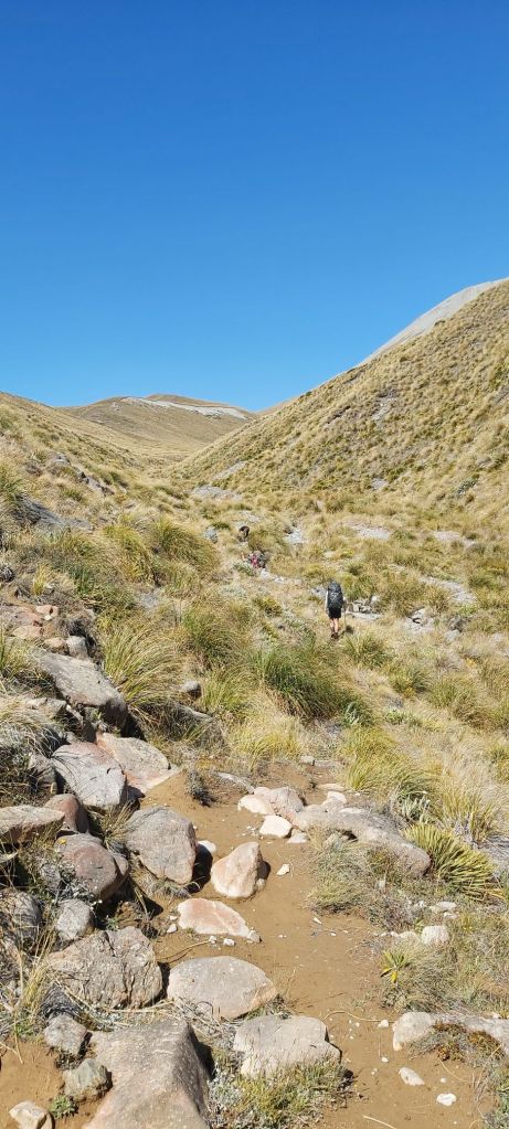
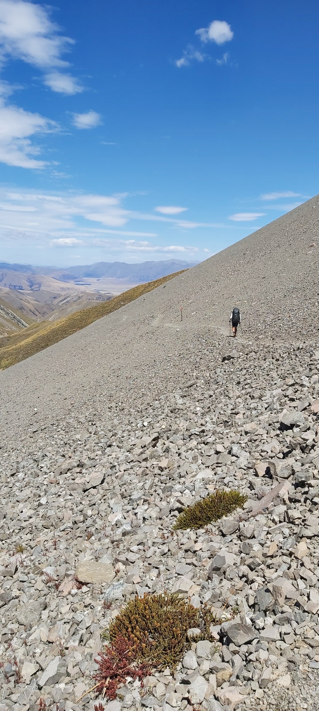
I almost wished I was back in the river with the sun now beating down hard on my tired self. The climbing itself was pretty easy (granted I think most climbing is pretty easy after Waiau Pass) and with a final activation of my calves I stepped foot on top of the saddle, just in time for an awesome lunch break looking over the dry valley ahead of me.

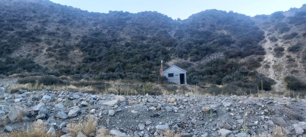
Based on the elevation profile I was seeing on Far Out, I was fearing a pretty steep drop into the valley. I needn’t have worried. After skirting past the scree-covered side of the mountain as shown above, we steadily lost altitude following an ancient fenceline, a relic from when this land was part of one of the massive sheep stations that cover large swaths of the South Island. The only traffic that we came across were two hunters heading up to the saddle who we wished good luck to. All the animals hunters go after in New Zealand are introduced pests that threaten native wildlife so I’ve got no dramas with them at all.

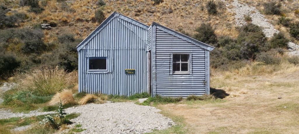
Oh, here’s another thing I was bracing myself for that never came to pass. I was expecting the track to be heavily overgrown with thorny/prickly bushes, but apart from a few small sections, it just wasn’t. All of this meant that we were down off the saddle in no time and were now following a 4WD track all the way from here to tonight’s hut. It wouldn’t be the first hut we came across though. That would be Double Hut, and like the rest of the huts in this area is one with a tonne of history behind it. Namely, it was visited by one Sir Edmund Hillary back in the day before he was a Sir.
He even left his signature behind on one of the walls, neatly protected by a perspex panel.
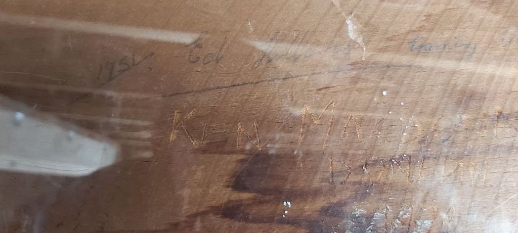
I was tempted to stay just so I could say I slept in the same building as Ed, but the next hut was only 5 km down a flat 4WD track and is also where Team Camera was planning on getting to today. The only noticeable thing on this part of the trail was more rusted fences and a couple dry lake beds leading up to Manuka Hut.
It’s of a similar age to Double and Comyns huts but feels much nicer inside than either of them. There’s loads of floor space to move around in and it has actual windows unlike Comyns. To make things better, there were two free bunks for Oli and I; no sleeping on the floor tonight! The other bunks were taken up by two SOBO girls (one Canadian and the other an Aussie) and two NOBO’s (one German and one Czech). Being only mid-afternoon, I got to relax for a couple hours prior to dinnertime, exactly what I love to do at these huts.
Now to the question of Team Camera. When would they show up? There’s no question that they wouldn’t, they’re both too determined for that. Oli predicted 6:15, I went with 6pm on the dot under the assumption they’d left much earlier than us. Yeah, we were both very wrong, they rocked up close to 7pm. Firstly, they’d started later because of the cold and secondly, well they’re called Team Camera for a reason. No matter, it was good to see them again, and it seemed that Melly’s feet were on the mend. That bodes well for tomorrow’s walk, a monster 30+ km day to the trailhead. At least it should be flat, right?
Right?

Leave a reply to Ian Stephen Missenden Cancel reply