


Date: 17th December 2023
Start: YHA National Park (km 1162.7)
End: Coupers Crossing, Kaitieke (km 1190.4)
Distance Travelled: 27.7 km
Total Distance Completed: 1117.4 km
Song Currently Stuck in Head: O Holy Night
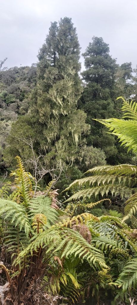
Erua Forest Prettiness: surprisingly high
The abrasive sounds coming from my phone at 6am seemed to be trying to tell me to get up and get ready for another day of walking, but no motivation to do so could be found. In fact it was almost an hour later when I finally rose and went to the kitchen to eat the bowl of spaghetti I’d left in the fridge. Once it was heated up and I had a mug of coffee made, I sat down with the others to discuss today’s walk. Vicky would not be joining us as she’s having more problems with her feet, seemingly a repeat of the issues she had further north. She’ll be taking the coach to Taumarunui, getting some help from the hospital there and rejoining us when we start the Whanganui. Sonja would also not be walking today. She began feeling quite ill on the way up to Tongariro so had turned around and hitched to National Park with some other friends.
Once again I would be walking today with Team Camera, checking out of the hostel at 9:30 and passing over the railway line onto the Fisher Track.

The track is part of a collection of routes that make up the Mountains to Sea Cycle Route from Mt Ruapehu to Whanganui, so I was expecting a good track surface with easy gradients. I got… a good track surface with easy gradients! Most of the “track” is just a gravel road that sees very little traffic on it, although it was apparently a much busier route before the railways came along when freight and passengers wishing to travel north used the Whanganui River. It felt like your typical rural gravel road at first until it rounded a bend, showing off a lush green valley beneath us.

There was a small section of the trail that was actual trail. For the most part it was still wide enough to fit two bikes alongside each other, or in our case three hikers and a friendly local on a dirt bike. It hugged the hillside as we descended off the central plateau, falling below 1000 m ASL for the first time since we began Tongariro.

Sadly once we were back on the road the track became boring again. The three of us stopped for lunch and afterwards began a cracking pace to the finish line, averaging over 5 km/h. It was by no means comfortable for me and I could’ve easily decided to hang back and go at a slower speed, but I didn’t for whatever reason. I think it was mostly down to me getting a bit competitive and not wanting to lose Team Camera (again, how are they going that fast while carrying that much glass?). The only real highlight of this bit was seeing a big chunk of treebeard.
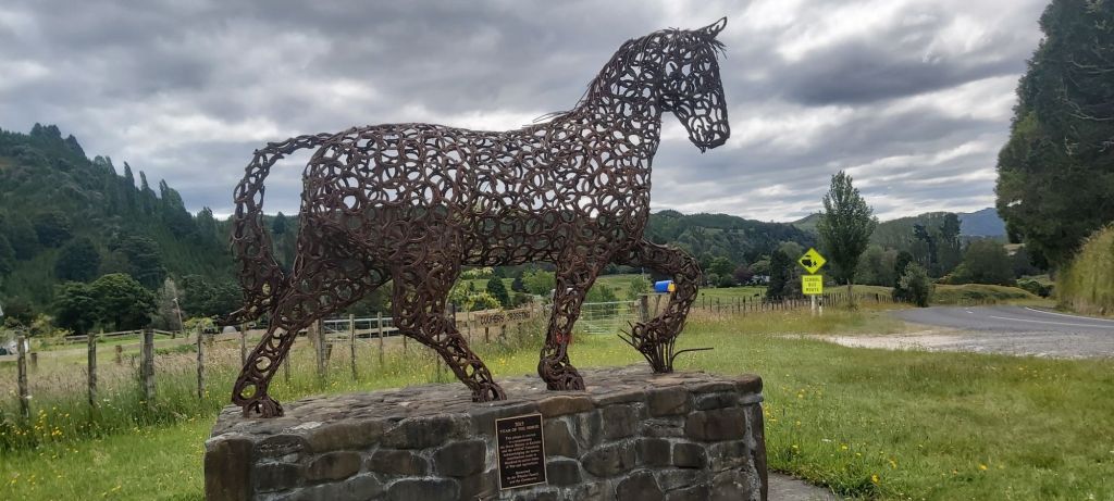
There is one obvious advantage to going fast: reaching camp earlier. Tonight, that would be at Sharon and Roger Couper’s place which they’ve named Coupers Crossing. They’re located more or less at the halfway point between National Park and Whakahoro at a memorial dedicated to the horses who served in the ANZAC ranks in WW1.
The Coupers have put a lot of effort in making their place a perfect pit stop for hikers to stay at. As seems to be the theme with many trail angels, they’ve converted their garage into a hiker hangout space, with couches, charging station, and a bathroom. There’s space on their lawn to pitch a tent along with an option to stay in a bunk bed for a bit more money.
Team Camera and I were some of the last people to arrive, already quite a crowd had made themselves at home. This is gonna be a real test of my memory of everyone’s names. Righto, we had Anne, Maud, Snacks, Lisa (Germany), Neil, Alex (both UK), Pam (NZ, and just a straight legend), Melly, Matt, and me. Most of us would be starting the river on the same day, so this made for a great opportunity to sus out who we wanted to paddle with down the river and who would make good captains. Actually that’s a lie, I spent most of the afternoon doomscrolling through social media. After an uneventful evening, I made my way to my tent, with the rain beginning to pour not long after I settled in. Tomorrow would be more road walking to Whakahoro. Yay.

Leave a comment