


Date: 1st December 2023
Start: Rangiriri (km 713.4)
End: Ngaruawahia (km 747.3)
Distance Travelled: 33.9 km
Total Distance Completed: 743.9 km
Song Currently Stuck in Head: Who the Hell is Edgar? by TEYA and SALENA (poepoepoepoepoepoepoepoepoe)
Mental Energy Left After Today: next to none
I think I deserve a round of applause, because I finally got up and got packed when I said I would! At 7am I was ready to go, just after a quick brekkie at the cafe next door…
…that quick brekkie turned into an almost hour long brekkie. I think most of us were just enjoying the comfort of the cage just a bit too much, knowing what awaited us up the trail. Our courage finally picked up at 8am, heading on our way over the Rangiriri Bridge.
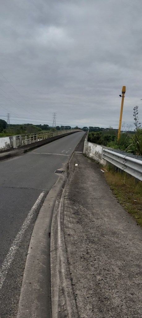
There are two options once you get over the bridge: stay on the road or hop on a grassy levee track. I went for the latter, it was alright. Not much to speak of, the grass was semi-long but not crazy slow, although I did see a couple people go past me on the road. The stiles did get a bit annoying after a while so I resorted to just opening and closing the gate between fields if it was an option. Not a very interesting walk, but certainly productive, which after a couple hours led onto Huntly golf course.
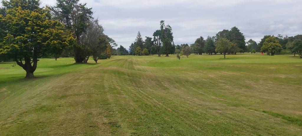
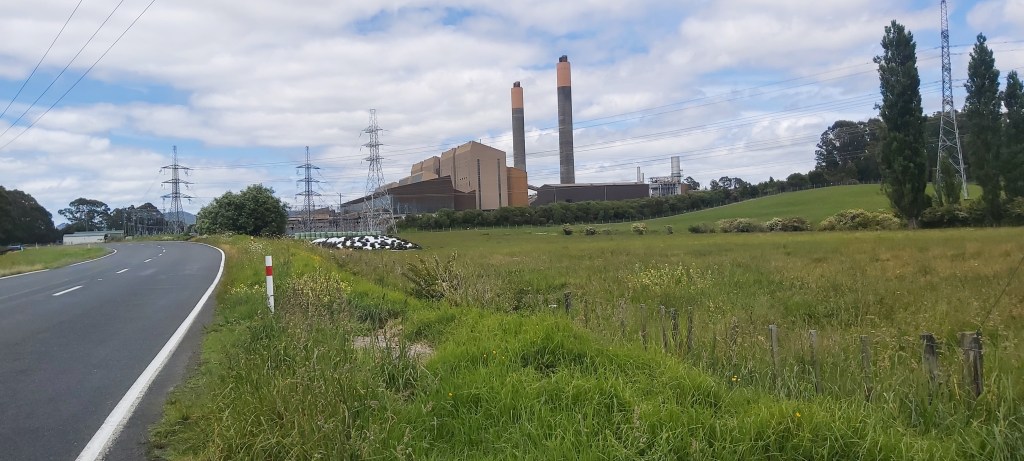
I suppose as a disc golfer I have a small interest in ball golf too, pausing a couple times to watch some people play. A couple more farm fields followed the golf course before we were back on the road approaching Huntly power station. Producing 953 MW, it’s New Zealand’s largest power station and has been operational for over 40 years. I was a bit surprised to learn that as I thought New Zealand was big into their renewable energies (to my credit, 81% of their power generation does come from renewable sources), so to hear that their largest power station is run off coal and gas was interesting.
I met up with Matt and Jazz Hands in Huntly for an early lunch. Huntly, to put it nicely, does not have a good reputation. Speaking with some locals at the dairy confirmed that. They were nice, but they did warn us to put our stuff away and not stick around for long. I had no intentions of sticking around any longer than I had to anyway, so it was back to the road towards the Hakarimata Range.
I arrived at the entrance to the walkway at 1:45pm, a bit later than I would’ve liked but still with enough time to get through it and be out in a timely fashion. Now I had seen the elevation profile on Far Out, I knew it was going to be steep and slow going. But Cathy told us the pathway was very well formed and was basically stairs all the way up.
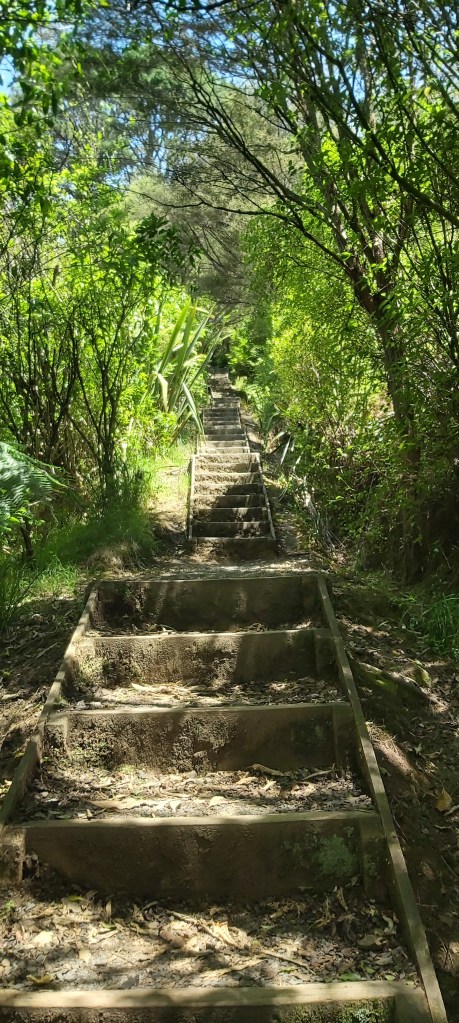
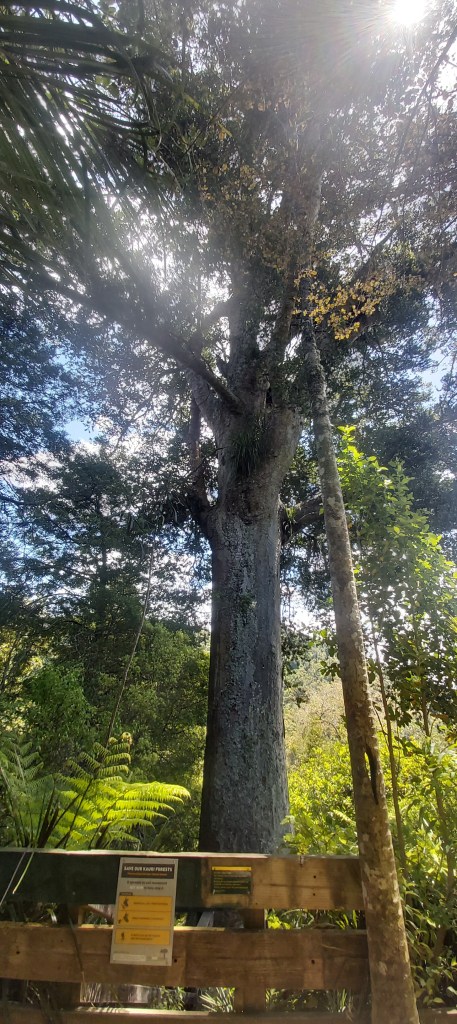
The start of it (foreshadowing?) was just that, lots of stairs up to a beautiful Kauri grove. Seriously, these trees are a sight to behold.
You know what isn’t a sight to behold? A sign about 1 km later warning me that from now on I’d be on a tramping track.
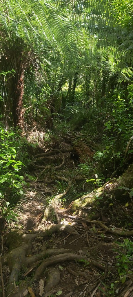
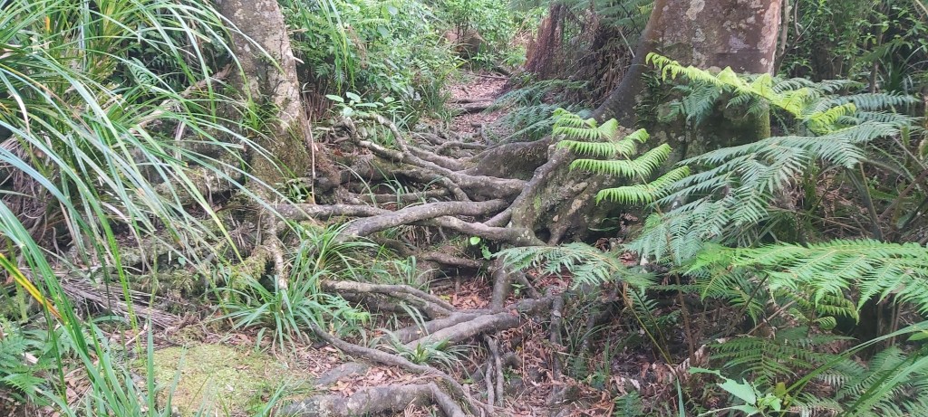
I’ve been hoodwinked, bamboozled, lead astray, run amok, and flat out deceived. This was not the nice, easy path I was prepared for. This was trip city. A track covered in tree roots forcing me to fight for every step. There was mud in places but not to a great extent, but it was still very slow. And I wasn’t mentally prepared for slow.
That’s perhaps one of my biggest weaknesses. A lot of other hikers I’ve met seem to be able to just walk up to a trail with very little knowledge of it and take it as it comes. I’m not like that. I need to know what I’ll be facing so I can mentally brace myself for what’s to come? If I know the night prior that I’ll be averaging 2 km/h on next day’s walk but I’m only going 18 km, I’m cool with it. But today, I knew I had to cover close to 34 km and I presumed most of the time estimate on this range traverse was just due to the climb. So when the stairs stopped, I wasn’t in the right mindset for the challenge I was then faced with.
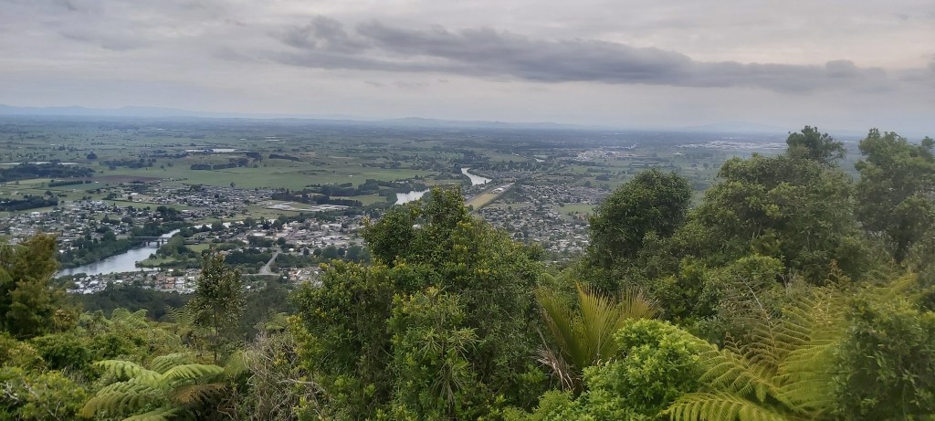
So to cut a long story short, I struggled big time. As the trail wore on and my GPS dot on Far Out jumped less and less each time I checked my progress (something else I really need to stop doing), my brain got tired with each and every step. It became a grind, forcing my way through the forest because what other choice did I have? Despite the day wearing thin, I had to stop a couple times to rest my mind and my feet which were becoming incredibly sore, finally reaching the summit at 6:30pm.
The path returned to gravel from then on, but now I had to get back down the mountain. Via 1500 steps. A wished my knees good luck and started down, passing many locals “running” up to the top. Most of them then passed me again on the way down. I made several brief stops on the way down, along with a 5 minute breather near the bottom right as the trail levelled out. Motivated by a hot meal generously provided by trail angel Richelle, I tried my best to finish strong, not helped by the fact that I was chafing really badly (slightly TMI, sorry). I found her place just before 7:30, along with many a hiker, including Vicki and Sonja. Dinner was served soon after, a lovely feast (in hiker terms) of rice, dal, and potato curry. Going to bed, my feet were still in complete agony, although I dozed off with the confidence that they would recover after a good night’s sleep.

Leave a comment