


Date: 1st January 2026
Start: Windermere Hut (km 17.8)
End: New Pelion Hut (km 32.7)
Distance Travelled: 24.71 km
Total Distance Completed: 58.67 km
Song Currently Stuck in Head: Not Giving In by Rudimental
Understanding of How to Play 500: we’re getting there, slowly
Someone should’ve warned me that these huts are incredibly well insulated. Here I was worrying about freezing overnight and instead I’m taking off layers at 1am because I’m overheating. I definitely felt like I slept better than in previous nights, but my infernal Garmin begged to differ. Frankly I don’t know what it’s talking about.
Today is the longest stint between huts on the Overland: 16 km. It’s mostly flat with a short climb at the end, but we were coming off two days of hard tramping so there was some uncertainty as to how well we’d go.
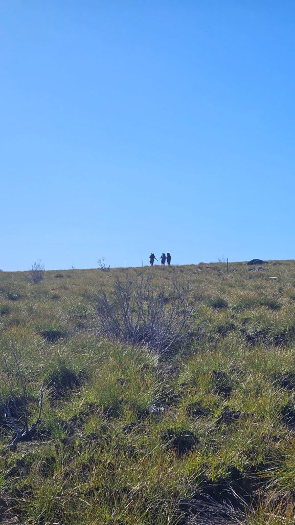
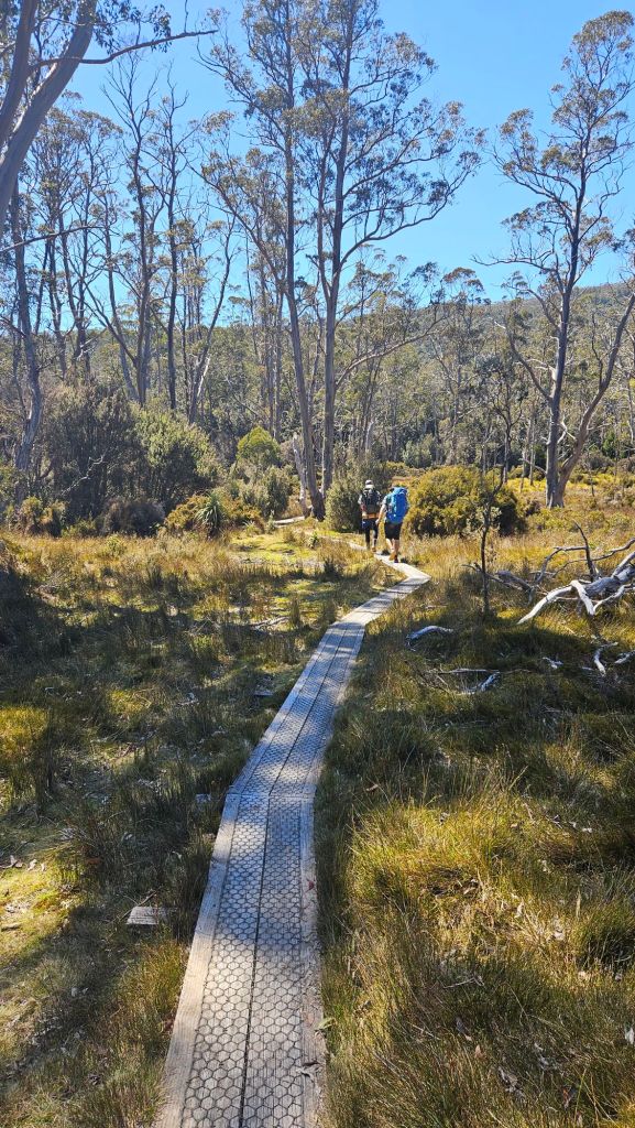
Starting off was easy, more of the same duckboard walking as we had yesterday, treated to views of the many peaks sprinkled over the surrounding landscape.

Hamilton took the lead early on and set a cracking pace. Bit surprising considering the length of today’s walk, but also… he’s an athletic teenager with not a lot of hiking experience so I guess that’s to be expected. I was still going fairly quickly but not pushing at all, wanting to conserve my energy and take time to stop, take photos and set up shots for the inevitable YouTube video (coming in 2-3 business years).
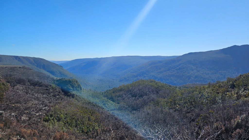
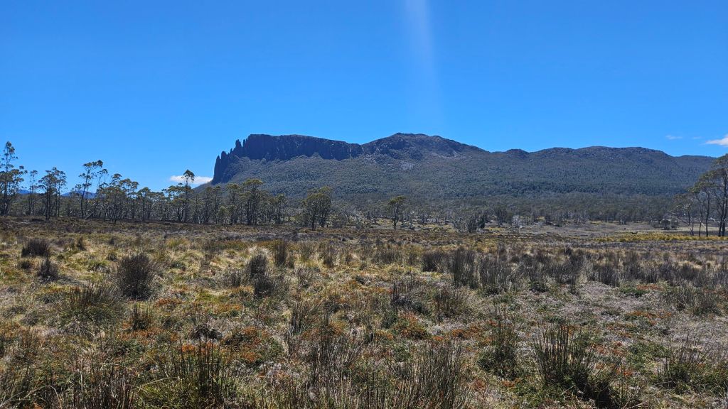
At the end of the undulating hills was a lookout over the Forth Valley, offering yet more awesome views. Seriously, Tassie is such a pretty place.
Next came a quick up-and-over a forested hill with our first taste of proper mud. Nothing compared to the monster mud holes I found in NZ, plus the dry weather has probably helped reduce their size too. Side note, DOC really needs to take some notes from TasParks at how to construct boardwalk over muddy pools, that being to use them as bridges, not diving boards.
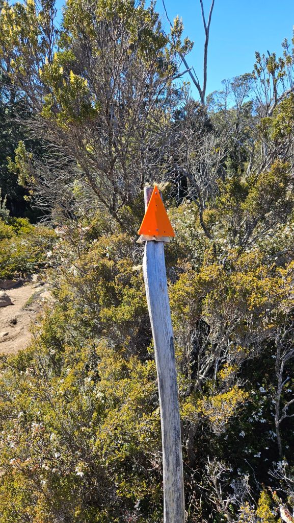
Plus, it appears TasParks has taken a liking to the iconic orange trail markers, so I reckon it’s time for them to return the favour.
After briefly catching up with the crew at a stream, they quickly bolted off again during a gradual descent to the lowest point on the Overland Track at Frog Flats. The wet, muddy, root-covered trails made me feel like I was back in New Zealand. I was in my element and rather enjoyed the trail, searching for the best foot placements whilst admiring the moss-covered trees. That said, I was glad to see duckboard at the bottom. You can’t beat duckboard.
Once again, I caught up with the gang at the flats, but this time instead of them running away, we stayed fairly close because we were now climbing. This is my strong suit. Dan and I stuck together to the top when the trail opened up onto a buttongrass moorland, with a great view of Mt Oakleigh only a stone’s throw away.
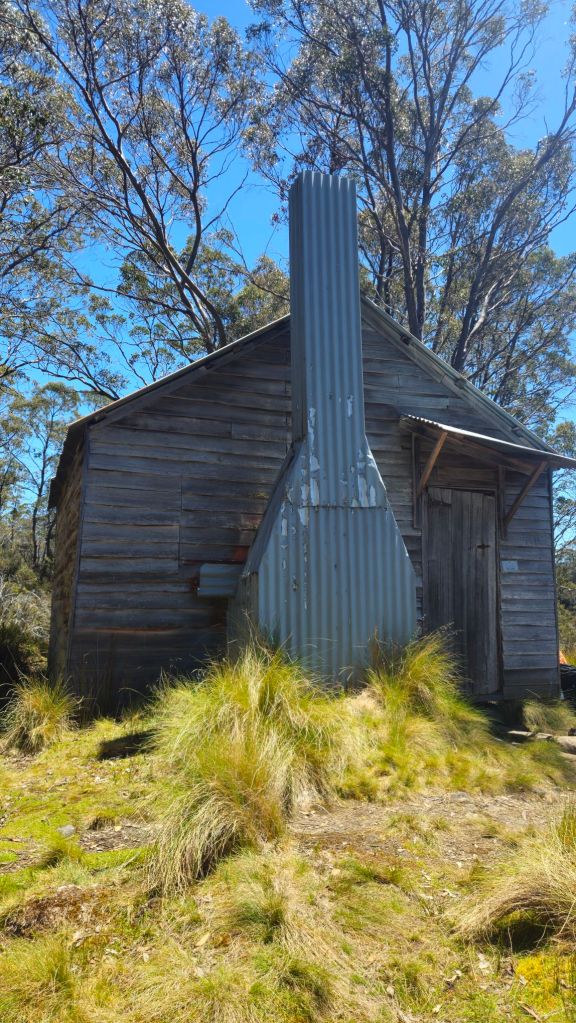
Tonight’s hut is called New Pelion Hut, its name implying the existence of an Old Pelion Hut. Well, I have good news! Only 10 minutes from the modern hut is said old hut. It was built for miners in the early 20th century hoping to extract copper nearby. The mine never turned a profit, being way too remote and the deposits way too small to be economically feasible. The hut – and mineshaft – stand to this day as a legacy of that period of history.
Douglas Creek runs nearby the hut and makes for an excellent swimming hole after a long day’s walk. I didn’t fancy getting into the presimably freezing waters, satisfied with just dangling my feet in. As expected, it was very cold. Bek was the only one of us brave enough to actually get in.

After the dip, Dan and Bek went to explore the old mine whilst Hamilton and I hightailed it to New Pelion Hut so we could climb up Mt Oakleigh. I was already pretty tired, but figured it couldn’t hurt to give it a crack.


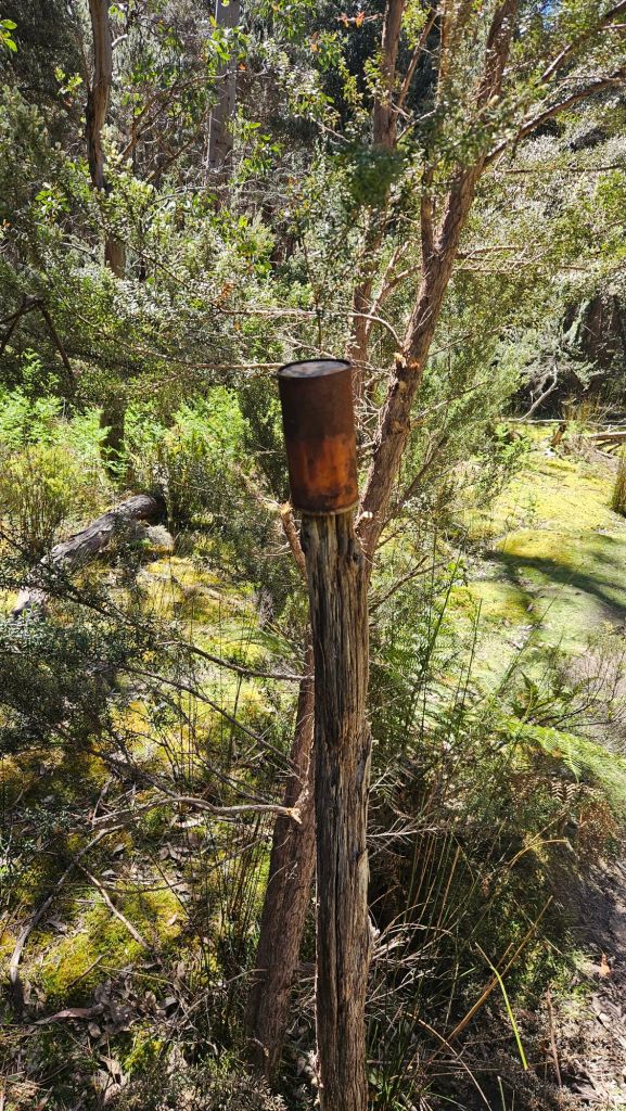
The track to the top started with a duckboard walk over the moorland. Many maps warn hikers to expect wet shoes going through this area, so I’m guessing the duckboard has been installed quite recently. Our feet stayed dry until the actual climb started. The first part was quite muddy and required a lot of hopping between tree roots, all the while searching for a rather ghetto way of marking a trail.
Then it got steep. Real steep. Nothing out of the ordinary for me but I could see Hammy starting to struggle. We took things slowly, climbing up stairs made of roots and squeezing through narrow, overgrown sections. Towards the top it started to open up and we followed some proper rock cairns all the way to the summit for another round of spectacular mountain views.
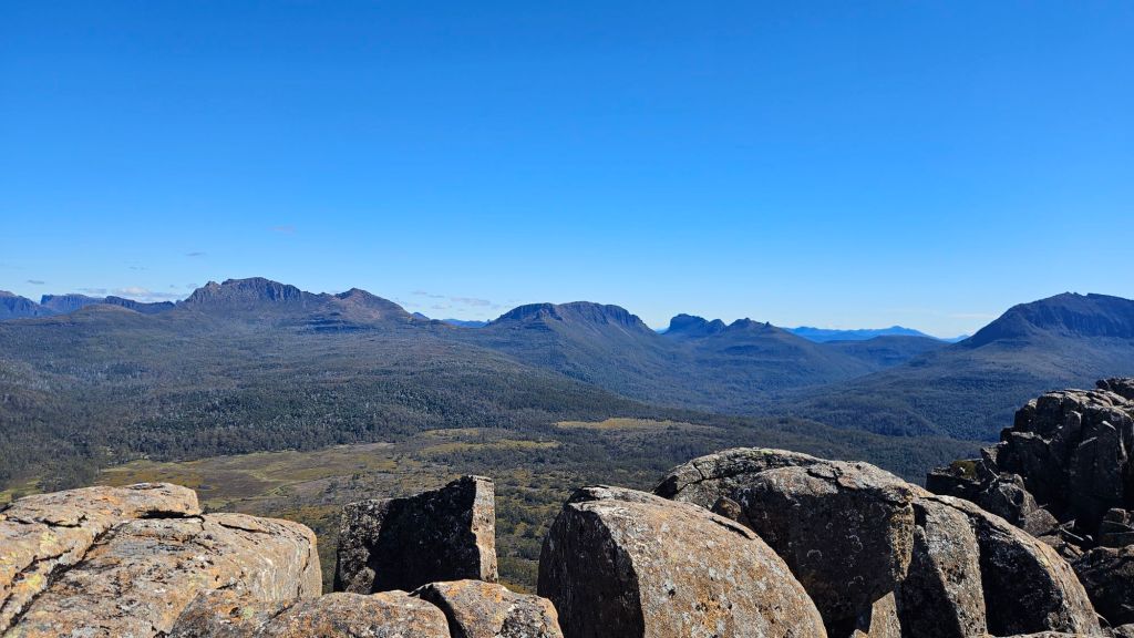
Honestly I don’t know which mountain has had the best views. Well, Cradle is struggling in that regard (thanks clouds), but both Oakleigh and Barn Bluff were just awesome. Heck, we could still see Barn Bluff from up here! So glad I put in the effort to come up here.
But it was getting late (not really, we still had a solid 4 hours of daylight left, I was just getting hungry) so we made our way down nice and slowly, not wanting to aggravate a calf tweak Hamilton had picked up. We were back at the hut by 5:30pm, having finished the 4-6 hour trip in 3. Yeah, we were pretty sore, and I was feeling the beginnings of a cold coming on so here’s hoping it doesn’t affect me all that much.
We relaxed at the rustic hut with dinner, countless rounds of 500 (which I’m slowly understanding) and another round of trivia; we won again but it was very much a team effort this one. We finished the night with a “team meeting”. See, unlike what most normal people would do with their hiking group before going to bed – quick discussion on the walk tomorrow, when you’d like to get away by, etc. – Dan and Co. have opted to instead tape a paper map of the trail to one of the verandah beams and essentially do anything but discuss the actual trail.
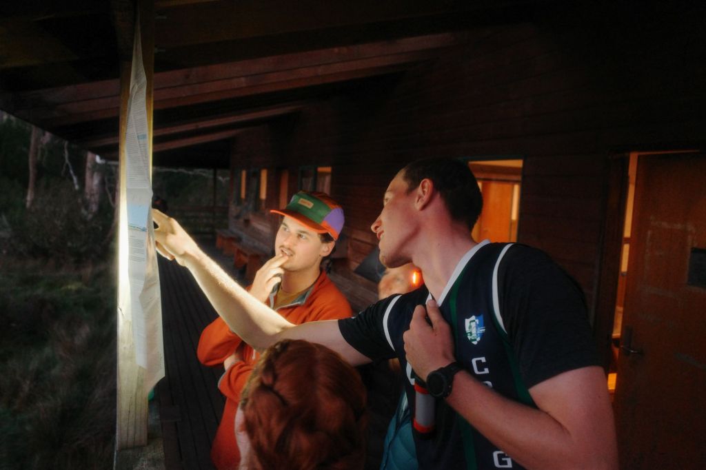
Once I got there I managed to get everyone to focus and talk about tomorrow’s walk… for about 5 minutes. Ah well, no harm in being a little silly.

Leave a comment