

Date: 13th October 2024
Start: Yarram Campsite (km 110.5)
End: Djardji-djawara Campsite (km 138.1)
Distance Travelled: 27.6 km
Total Distance Completed: 138.1 km
Song Currently Stuck in Head: Glorious by Macklemore
Feet: battered
I feel… alright? That honestly surprised me a bit. If this was 2 months into Te Araroa, recovering quickly after a long, hard day’s tramping was expected. But I don’t have that sort of fitness behind me, yet I’m fine. Works for me, because we’ve got a lot more kilometres in store today.
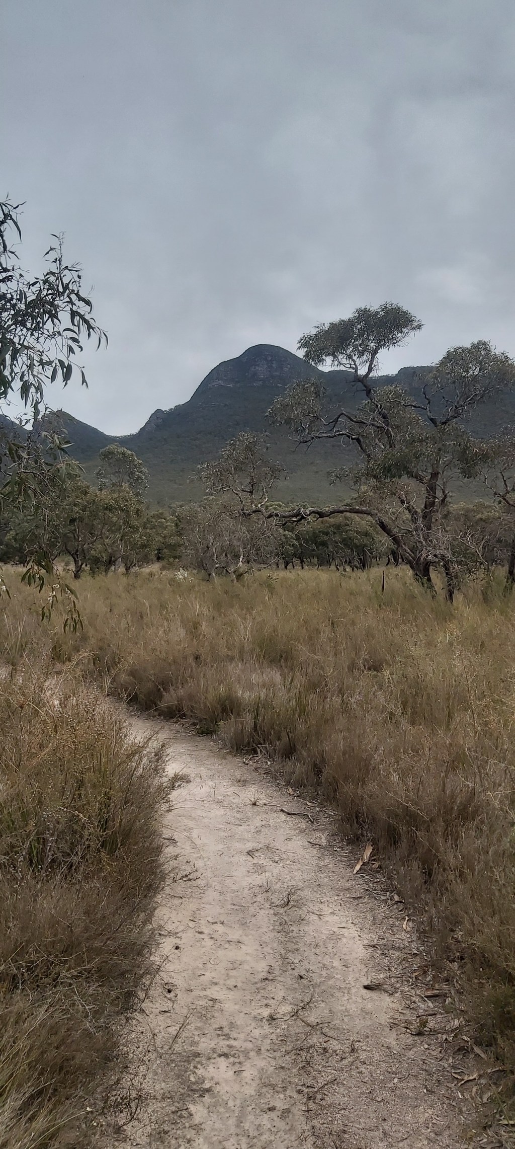
The track leading out of Yarram is thankfully much nicer than the track coming into camp yesterday. A few small rocky sections but otherwise a well manicured trail.
The landscape was typical dry Aussie bush, with eucalyptus and grass trees lining the track, accompanied by a host of flowers that included a range of orchids (much to the delight of Matt).

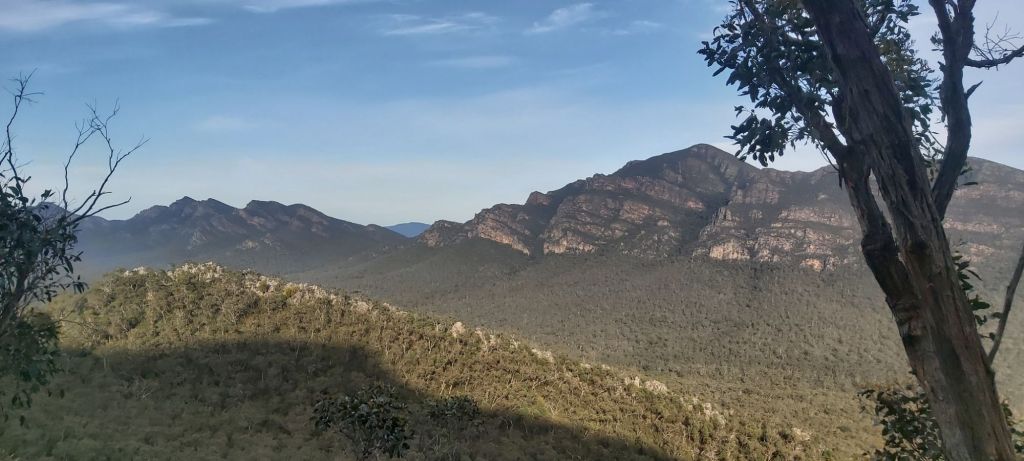
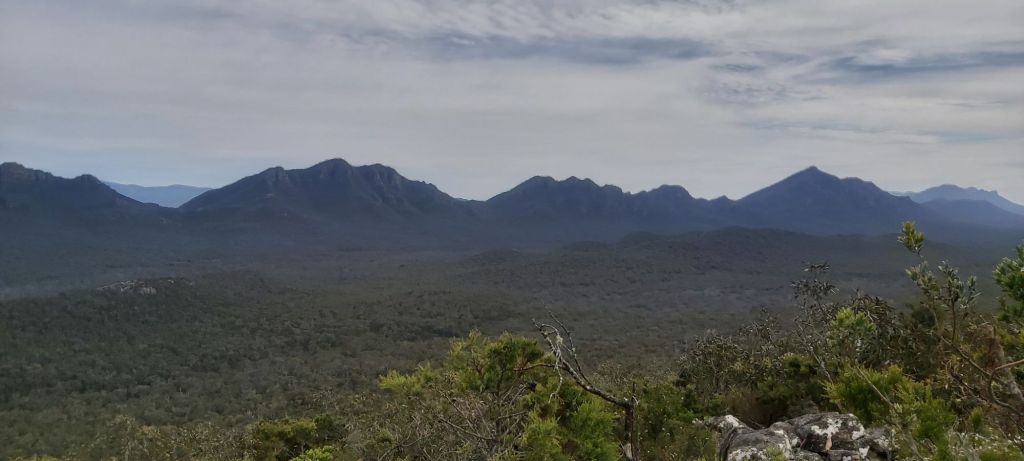
The Grampians National Park (or to give it its indigenous name, Gariwerd) becomes quite narrow this far south. From the tops of the mountains, you get to see farmland sprawling out in all directions, exposing just how prominent this mountain range is compared to the surrounding land.

The wildlife I’ve encountered on the GPT has also been a huge highlight of the trip. Amongst the dozens of species of birds has also been echidnas, shingleback lizards, a couple of snakes, and of course many kangaroos and wallabies.

Today’s lunch stop was at Wannon campsite, located in a lush, grassy bowl. If it wasn’t for the wind (and lack of shelter) I would’ve loved to have camped here. It does feel like a bit of a rip-off that these campsites are the exact same price as those with the fancy shelters. Even so, the facilities Parks Victoria have provided on this trail have been excellent.

From Wannon, the trail descends off the Mt William Range and crosses a dry grassy valley to the picturesque Serra Range. There wasn’t a whole lot happening in this valley, the flat track made it easy for Matt and I to go into autopilot and rake in a few easy kilometres on our way to the start of our climb up the range.
The climb itself was long but not overly steep. In essence, the southern section is similar in difficulty to the northern part, which after the gnarly, technical scrambles through the central section was quite the relief. Still, the track remained rocky underfoot, so my feet were still getting a pretty good battering in order to get the views we were after.

Having been on the move for over 6 hours by this point, Matt and I had to stop several times to catch our breath. This turned out to be a massive stroke of luck, as in the tree above me…
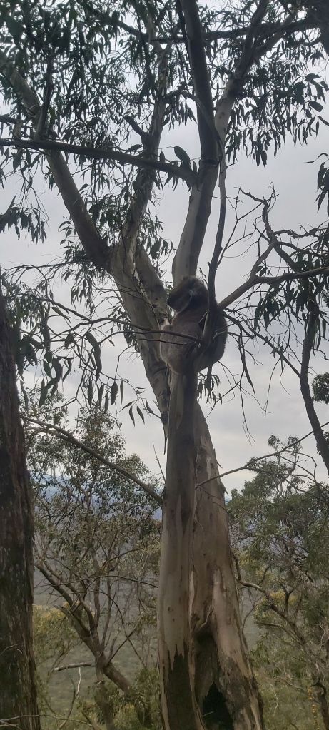
I genuinely didn’t even know this guy was here until Matt pointed him out. You’ll be pleased to know that he stayed in his tree and didn’t try one of his special drop attacks on either of us.
A fairly easy descent off the range followed, as did a few drops of rain. Honestly it’s pretty lucky that this is the first bit of rain I’ve felt for the entire journey so far. It was nothing to be alarmed at, no need to don rain gear. That was, until we got a visual on tonight’s campsite.
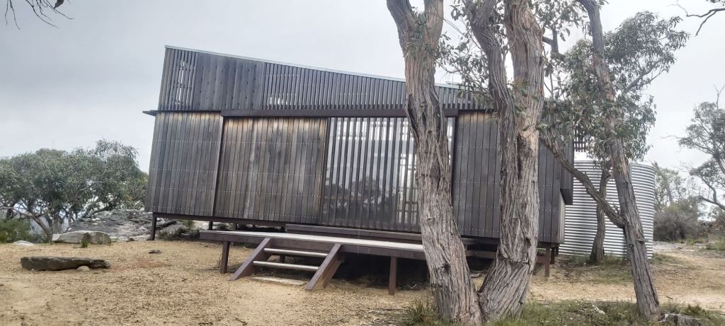
To our surprise, the shelter was unoccupied. Every other campsite so far had been fairly well populated so it was a bit strange to suddenly be met with an empty one, and unless there were some late running NOBO’s coming, it would stay that way.
Rain showers came and went, and I set about nursing my poor feet that were looking (and smelling) worse for wear. The descents were also giving my right hip and knee a bit of grief. Yes, I know it’s a bit rich for a guy in his mid-20s to be complaining about sore joints, but I would like to continue don’t this sort of thing for many years to come, so I’ve still got to look after them as best I can.
With no one else joining us at camp and the rain continuing to make its presence known, we decided to just sleep in the shelter. Dinner was eaten, hot drinks consumed, and good chats were had before settling in for our last night on the GPT.

Leave a comment