


Date: 18th February 2024
Start: Roses Hut (km 2657.1)
End: Arrowtown (km 2680.4)
Distance Travelled: 23.3 km
Total Distance Completed: 2526.9 km
Song Currently Stuck in Head: bad idea right? by Olivia Rodrigo
Gold Discovered in Macetown: no shiny rocks today
The first alarms started blaring at 6am but I had no desire to rise from my horizontal position, instead choosing to catch up on my bible reading plan and on this blog. I’m behind a few days on both of them so there may be some things that happened in the following days that I’ve already forgotten about.
Right, let’s see how good my recollection of this day is. Well it was cold, I remember that well, and I remember saying goodbye to Roses Hut around the same time as yesterday, 8:30am. We then began the final of the 4 major climbs of the Motatapu Track up to Roses Saddle. Side note, it only dawned on me during this trip that the names of the huts commonly refer to its proximity to a nearby landmark. Fern Burn Hut is near Fern Burn, Highland Creek Hut is near Highland Creek, Roses Hut is near Roses Saddle. I mean, logically that makes sense, but I can be pretty slow to catch onto stuff like that at times.
Perhaps it’s because I had fresh legs, but I found this to be the easiest of the four climbs. Not objectively easy – it was still steep – but comparatively easier. Excluding breaks, it only took one hour to reach the top of the saddle.
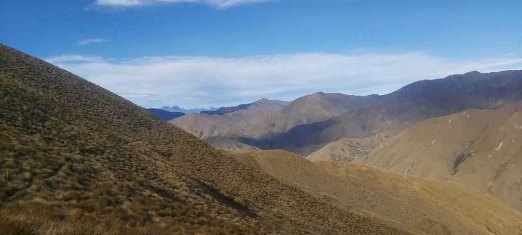
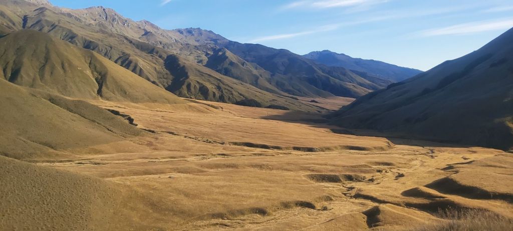
The easiest climb it may have been, but it also came with the most underwhelming landscape. It wasn’t bad by any stretch of the imagination, it’s just that the others were cooler. All we could see were mountains with barren, rocky tops.
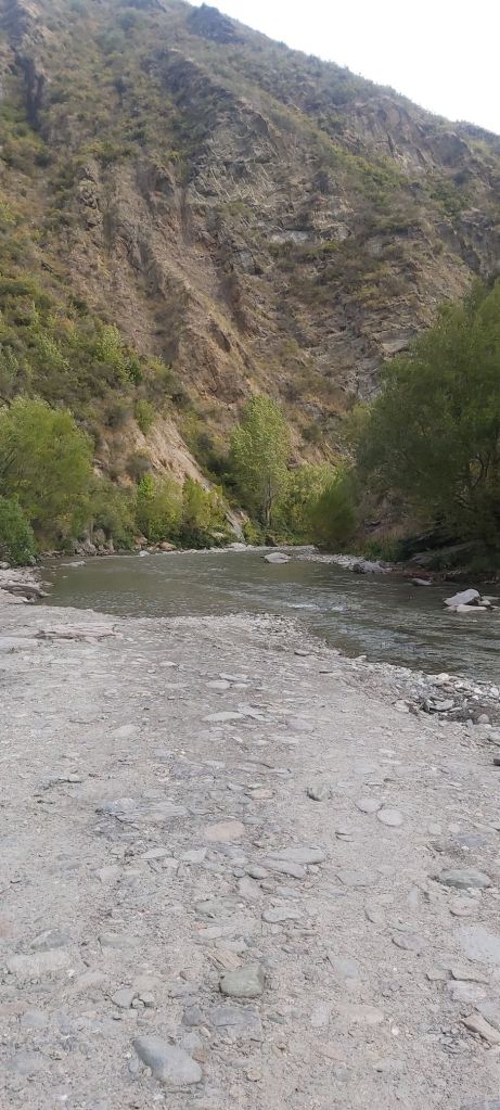
With the final climb also came the final descent of the Motatapu, also being the easiest of the trail. Comparatively it wasn’t nearly as steep and had a few switchback sections towards the bottom. It was here that we had a choice to make, a classic TA choice: low water or high water? Either we follow the Arrow River all the way to Macetown or we take an undulating flood track above it. The sun was out, it had been dry for several days now, the decision was easy. It’s river walking time.
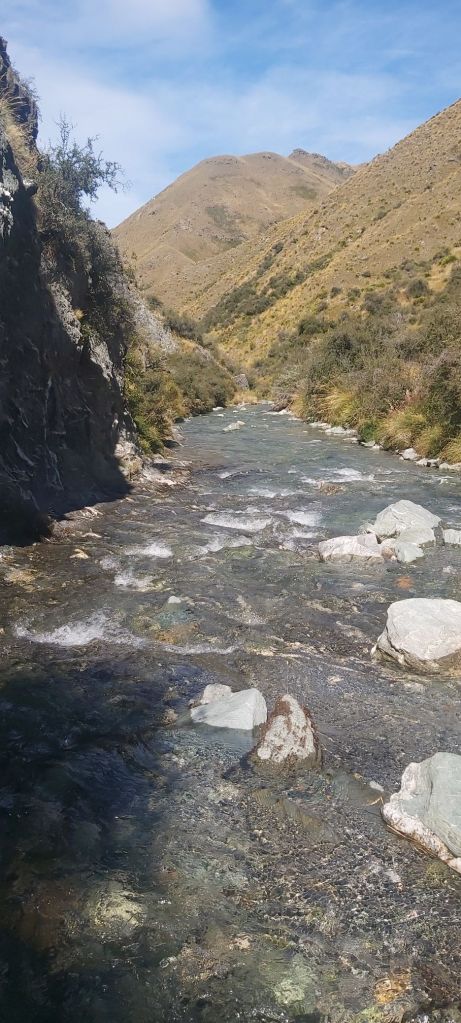
Orange triangles were, ironically, absent from the Arrow, but navigation was very easy. Hug the shallower side of the river, cross to the other bank if necessary, and if you spot a path heading out of the water, take it.

It never got more than knee deep, most of the time only licking at my ankles. The river itself was super clear, the bottom covered in green rocks that sadly weren’t greenstone (not that we could’ve taken it, all pounamu is property of the local iwi where it was found). The area is known for its gold mining history and for most of the walk Oli persistently tried to sell me “gold” that he’d found in the waters. It very clearly wasn’t gold, but that wasn’t going to stop him. We’d definitely made the right call in following the river. None of the actual crossings of the river were bad or dangerous (although Paul and Maria weren’t used to doing such crossings and held hands over all of them which I found very adorable) and the river bed wasn’t slippery at all.
Towards the end a 4WD track began out of nowhere, soon linking up with the true trail that had gone above us, marking the official end of the Motatapu Track. One final river crossing and we arrived at the site of the old mining settlement of Macetown. Until 1920, the town was bustling with gold and quartz mining, but as it became increasingly less viable, the mines shut down and people left. Over time the village became ruins still seen today, small stone walls lining the road, the restored bakehouse making a great lunch spot.
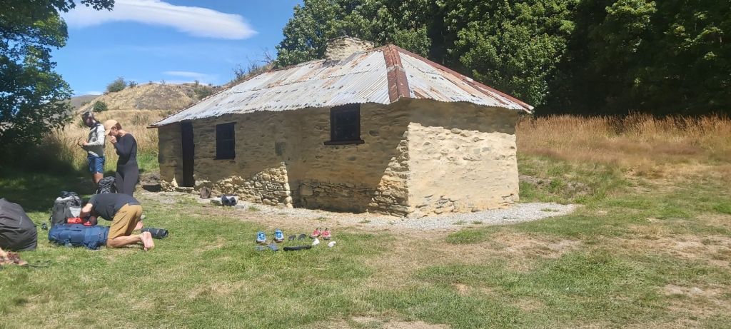
The sun was shining, a light breeze passed by keeping us cool, and there was plenty of shade under the tree. Is it any wonder that we spent an hour here? Now it was time to move, leaving the bakery behind and going to Arrowtown. There are two choices of route: go up and over Big Hill (yes I know, very original name), or follow the Macetown Road. The official TA route takes the former, but the latter is gentler and follows the Arrow River through a gorge. I like gorges and I particularly love gentle gradients, so mine was an easy decision. Only Oli and Matt chose to take the hill. They’ll probably still beat us to town.
The only downside with this road is there were more river crossings to do, a minor issue compared with the pretty gorge I walked into.

The only traffic we came across was a solitary dirt bike, otherwise we were left alone. I got a good rhythm going and soon left Team Deutsche behind. Weirdly, even as I got within a kilometre of Arrowtown I didn’t see any sign of it. Sure I’m still in the gorge but I expected to see some evidence of civilisation by now. Eventually I did, but only when I was basically on top of the town, and only after completing yet another river crossing.
Walking past a sea of regular tourists, I made my way to the holiday park where I was greeted by Matt and Oli. Tent pitching was a bit of a hassle thanks to the rocky ground, but once that was done we went back into town to find the pub. My pork belly sandwich was nice but wasn’t enough, my hunger finally satisfied by sharing a pizza with Matt. This also marked the last day for Zilla and Lisa, a German hiker we’d shared the Motatapu with. To celebrate we went to a cocktail bar down the street. It was a small, cosy venue with a very charismatic bartender. The only gripe I had with it was that they had a musician playing and the speaker was far too loud to have any sort of decent conversation. I only had one drink there (cocktails are crazy expensive) and then went back to the holiday park where I sadly discovered my tent was on a slope. This doesn’t bode well for my sleep tonight…

Leave a comment