

Date: 7th February 2024
Start: Stone Hut (km 2364.7)
End: Camp Stream Hut (km 2385.4)
Distance Travelled: 20.7 km
Total Distance Completed: 2223.1 km
Song Currently Stuck in Head: Cold Water by Major Lazer
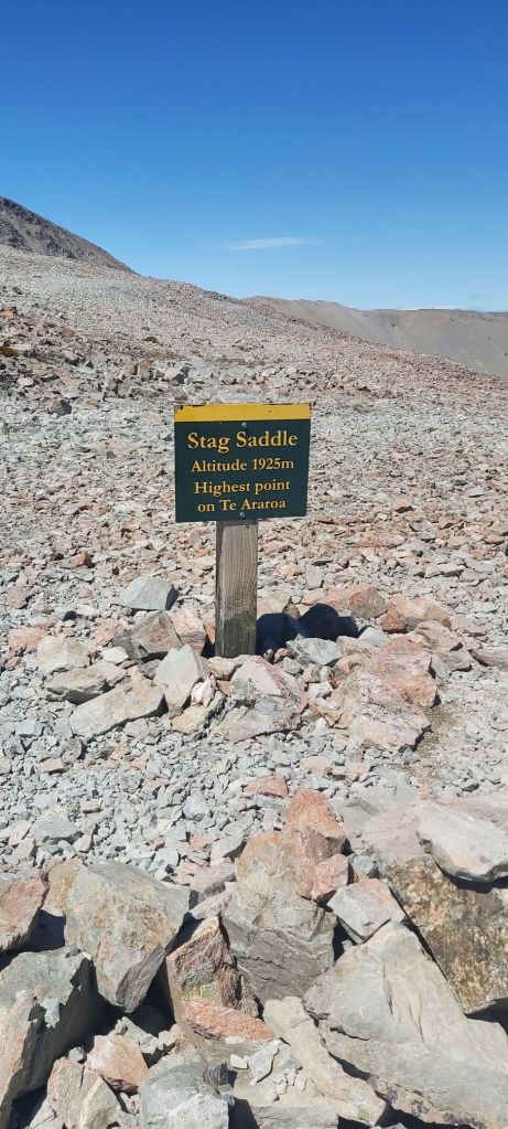
Number of Stags on Stag Saddle: none, I want my money back
Those blue mattresses are even better than I imagine. Probably my best sleep in a hut so far, and it was a shame when my alarm woke me up to get ready for another day of tramping. Granted I was very excited to get going as today promised to be one of the highlights of the trail, going over Stag Saddle.
The climbing would have to come later, with a 6 km stint to Royal Hut first on the cards that included another crossing of Bush Stream and a walk through tussock fields on a sometimes untraceable trail.
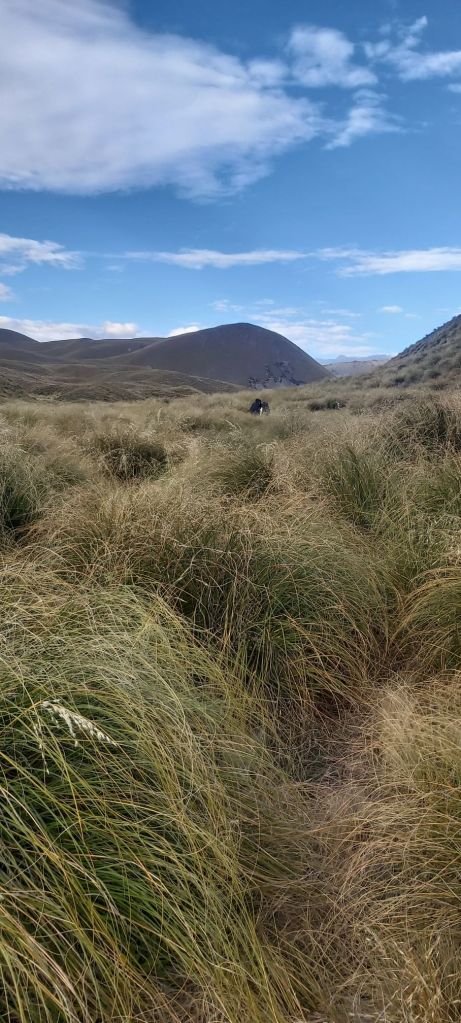
I get that these conservation parks aren’t as well visited as the country’s national parks, but it would be good to see more markers to help you along. Today’s conditions were perfect for walking, but I can imagine if visibility is low it would be rather dangerous to attempt to walk through here, even if it is a valley.

Another consequence of this was that despite the flatness of the terrain we still took 2 hours to reach the hut, a good portion of our time being spent looking for a way through the tussock to the next marker (if one could be seen). Still, all four of us were feeling great as we pulled up at the hut, named as such due to Prince Charles and Princess Anne visiting here as children. Presumably they weren’t responsible for the 4 (empty) tequila bottles lined up on one of the walls.

Right, now we start climbing and, bear with me, I’m about to say something very nerdy. The elevation profile of the climb mimicked a quadratic curve; gentle at first, gradually getting steeper.
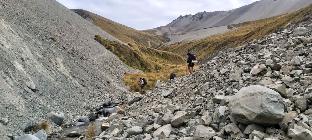
I think my view of what constitutes a hard climb has been skewed by Waiau Pass, because getting up to Stag Saddle still required a lot of hard yakka to get up there but I was still averaging over 2 km/h to get up to the top.

Towards the top, the confusion as to what track to take got worse. Team Camera and Oli were about 100 m ahead of me following a “route” through the tussock, but here I couldn’t make out a track even slightly. Far Out suggested a different route that wasn’t poled but I could actually make out a path up to the saddle. With no way of communicating that to the others, I went up it. Turns out the route they took was poled and there was a bit of confusion when I got their attention. In the end our different paths reconnected for the final few hundred metres to the saddle. Right at the top the tussock ended, red and grey gravel guiding us up the final gentle few metres to the top of the TA.
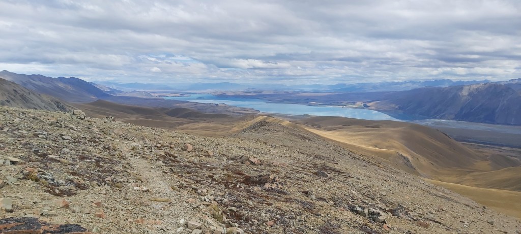
Conditions couldn’t have been more perfect. No wind, no clouds, perfect visibility. We could see all the way to Lake Tekapo and back at the mountains we’d left behind.

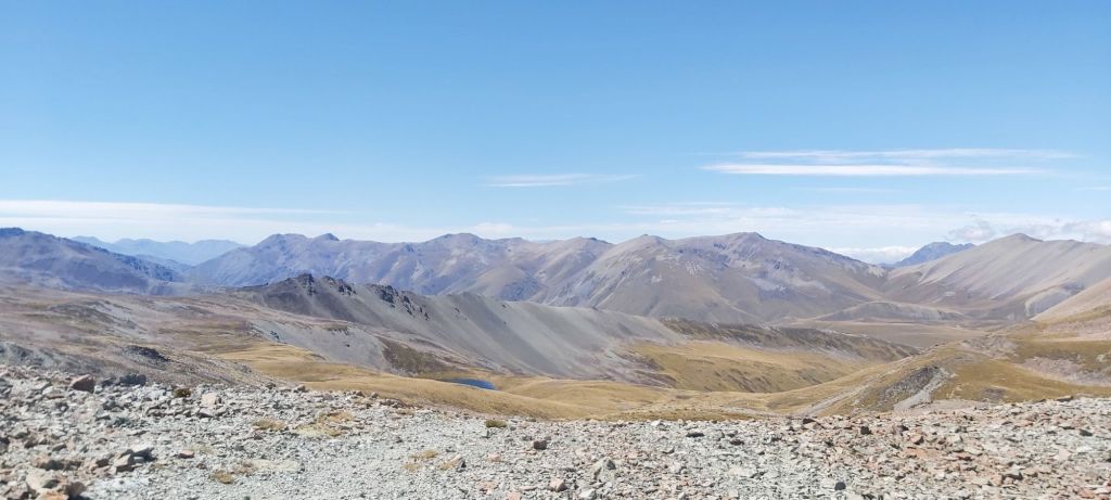
In the end we spent over an hour at the top. It’s not every day you get these sort of views, so might as well soak them in. I felt a mixture of awe and gratitude. The sights that my eyes were seeing, in the big scheme of things, will not be seen by many people. I can count myself among the lucky few that did get the chance to do so.
We couldn’t stay there forever, so we packed our lunch away and started our descent. At least that’s what I assumed we’d do. Instead, the other three wanted to climb up to the summit of Mt Beuzenburg nearby. I didn’t, so I sat down on the ridge and rested for a while.

I finally set off again at 3pm, the others still up the top. There are two paths one can take to reach Camp Stream Hut. A poled route drops steeply down into a valley and follows Camp Stream all the way to the hut and can be used in all weather conditions. The alternative unpoled route, which should only be considered in good conditions, follows a ridgeline, descending very gently down into the same valley. Well, I had as perfect weather as you could hope for up here, so I might as well take the ridge. As advertised, the path was super nice. Easy to follow, pretty views of the lake all the way down, the only complaint being that it was very dusty.
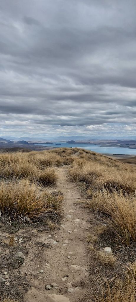
I kept looking back as I expected the other three to embrace gravity more openly than I did and come down even faster than I. But they never showed up, even when I stopped to chat to a couple of NOBO’s for a good while. That being said, I was loving the path, not getting sick of the views at the slightest. When I began reflecting on the past 100 days and those which I consider to be the best of the best, I realised quickly that this one will easily make the top 5, perhaps with time even grab the top spot. It’s had the gorgeous views, a high quality track, superb weather, the lot. Really the only let down were my feet, still in quite a bit of pain.
The poles resumed a few kilometres from the end, taking me off the ridge and down towards Camp Stream.
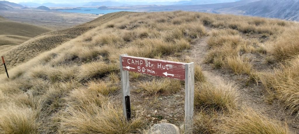
It was just a bit over an hour between this sign and reaching the stream where I stopped to fill up on water. The hut is rather inconveniently not near the stream so it’s best to fill up here before reaching it. That gave the gang enough time to catch up who also did the same thing. The hut itself was another 700 m away, up and over a small hill on a 4WD track.
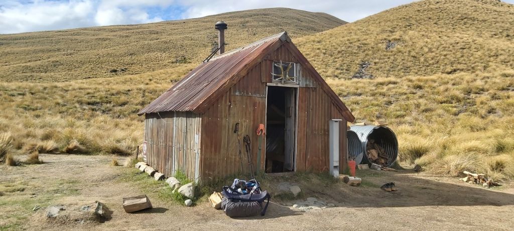
Yes, this hut is old. Very old. It was built in 1898 and is maintained by the Mackenzie Alpine Trust. If you’re hoping this is a tardis situation where the interior is larger than expected, don’t get your hopes up. Six (small) bunks have been squeezed in, between them a stove and a typical metal benchtop. And that’s it. Surprisingly, only two of the bunks were occupied, but even with beds free, I was the only one to take a bunk, the rest opting to camp.
As I watched the sun set lower over the mountains as I ate my dinner, another trio of Nicole, Zach, and Jonas rolled in. We saw them on the road towards the Bush Stream trailhead trying to hitchhike there and didn’t think much of their chances. It took them a number of hours before they got a ride and only made it to Crooked Spur Hut yesterday. After their arrival I got settled into my bunk, tired but content after a lovely day of hiking. It’s hard to believe that this will be all over in about a month’s time. This trail has been my whole life since late October and I’m both concerned and interested to see how I go about reintegrating with “normal” life back in Australia. These thoughts had better not keep me up at night…
Oh, before I go, I worked out what was giving me feet so much grief over the last couple days. Matt took one look at them and immediately diagnosed me with athlete’s foot. Annoying but it’s good that I know what the problem is now. Even better, he still had some antifungal cream on hand from when he got it in Nelson Lakes. I applied that and made a note to get some for myself once I find a pharmacy in Lake Tekapo. Hopefully that helps alleviate the pain.

Leave a comment