

Date: 6th February 2024
Start: Rangitata River (km 2345)
End: Stone Hut (km 2364.7)
Distance Travelled: 19.7 km
Total Distance Completed: 2202.4 km
Song Currently Stuck in Head: towards the end of the day it was a lot of Colin Buchanan. Thanks brain!
The Face I Made When Cresting the Saddle: awestruck but probably a bit silly
For anyone that doesn’t have the TA maps handy, Geraldine is nowhere near the trail, nor even the road bypass around the Rangitata River. It’s actually quite close to the east coast which I presume gives it a warmer climate than the high country. At least that’s the best explanation I have for the very warm night I just had.
The morning was a bit frantic as we had to meet the shuttle at a cafe at the edge of town. Our plan was to have breakfast there, but there was a slight problem with that. It’s Waitangi Day and the cafe was closed. There was a bakery open further down the road, but my the time I finished my resupply and got my food, I had barely any time to eat it before dashing back up the road for the shuttle.
It was then a 90 minute drive down the southern bank of the Rangitata to the trailhead of the Two Thumb Track. The carpark really was in the middle of nowhere, a small map and toilet being the only facilities here. Surrounding us was Mesopotamia Station, a narrow path being our only legal right of way to reach Bush Stream. Yes, once again, Te Araroa is taking us up a rocky river valley littered with crossings.

A quick read of the trail notes helped put my mind at ease that there wouldn’t be as many as when I went up the Hakatere a few days go. That relief was balanced by also reading that some of these crossings would be more sketchy. The first few were alright, with the main challenge coming from the algae-covered rocks on the banks making things pretty slippery.
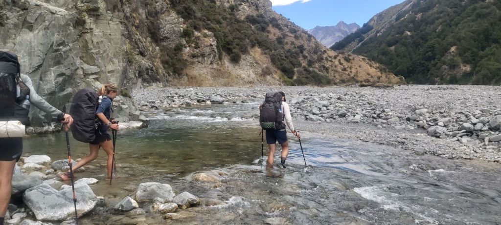
I started getting the feeling that the comments suggesting these crossings would be tough did this trail after a day or two of rain. Three days of dry, hot weather meant that Bush Stream was hardly worse than any of the previous rivers I’ve come across; the Taiharuru and Deception rivers currently hold the top spot for most difficult crossings. The lower number of crossings also made the walking more breezy, but no less slow thanks to the uneven rocky riverbed.
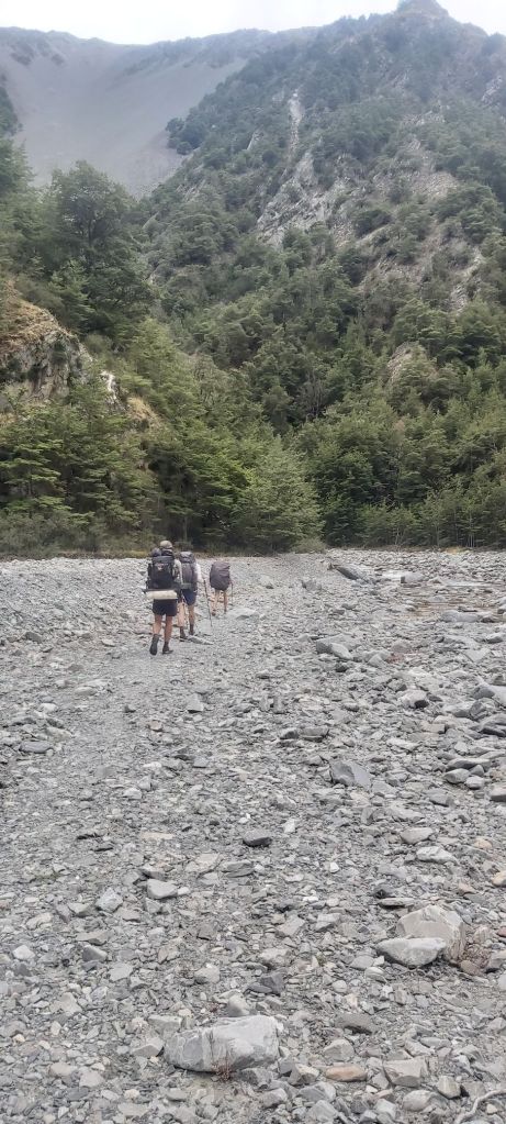
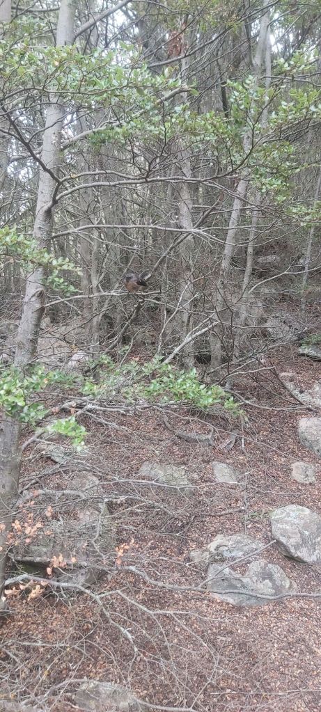
There was some variety in the walk, although it definitely feels like said variety was forced on the route setters due to small sections of narrow gorge necessitating a path up on top of a cliff through a forested patch. Climbing up wasn’t fun (or coming down for that matter), but at least there were birds.
One of these gorge sections required a much bigger climb and drop, leading to the final crossing that some reports had labelled as the sketchiest crossing on the TA so far. When we got down to the river and looked at it where the eponymous orange arrow was on the other bank… yeah, that’d be a pretty rough crossing. 30 m downstream, however, is perfectly doable, not even coming up to my knees.
And so marked the end of our journey up Bush Stream and the start of our journey up… That’s the end of the sentence, we just went up and up and up.
This first climb would take us to the first hut along the track. Oli showed why he’d earned his trail name of ‘Back and Forth’ by darting up to the hut and running down to retrieve Melly’s pack (which she had loaded full of bricks – presumably – to make it weigh 23 kg). At the top waiting for us was an old mustering hut, built when this conservation park was grazing land for sheep, complete with an old horse paddock.
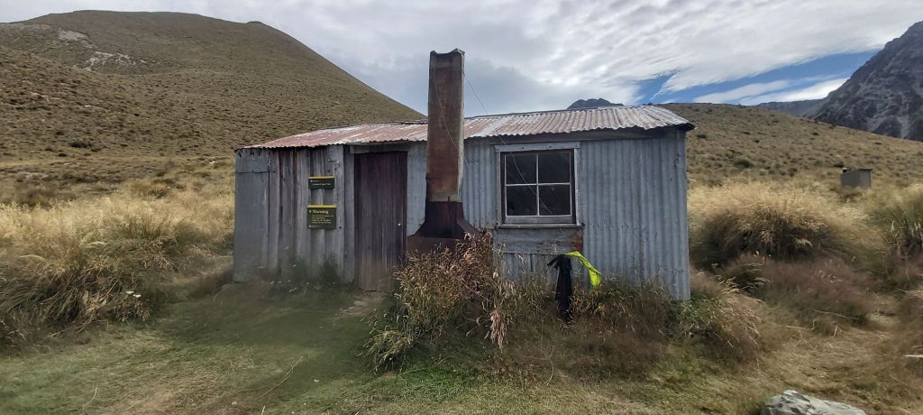
A very tempting sight awaited us inside: blue mattresses. For those unaware, these new, thick, blue mattresses are in high demand on the TA, and for good reason. They. Are. So. Amazingly. Comfy. I almost wanted to stay just for them.
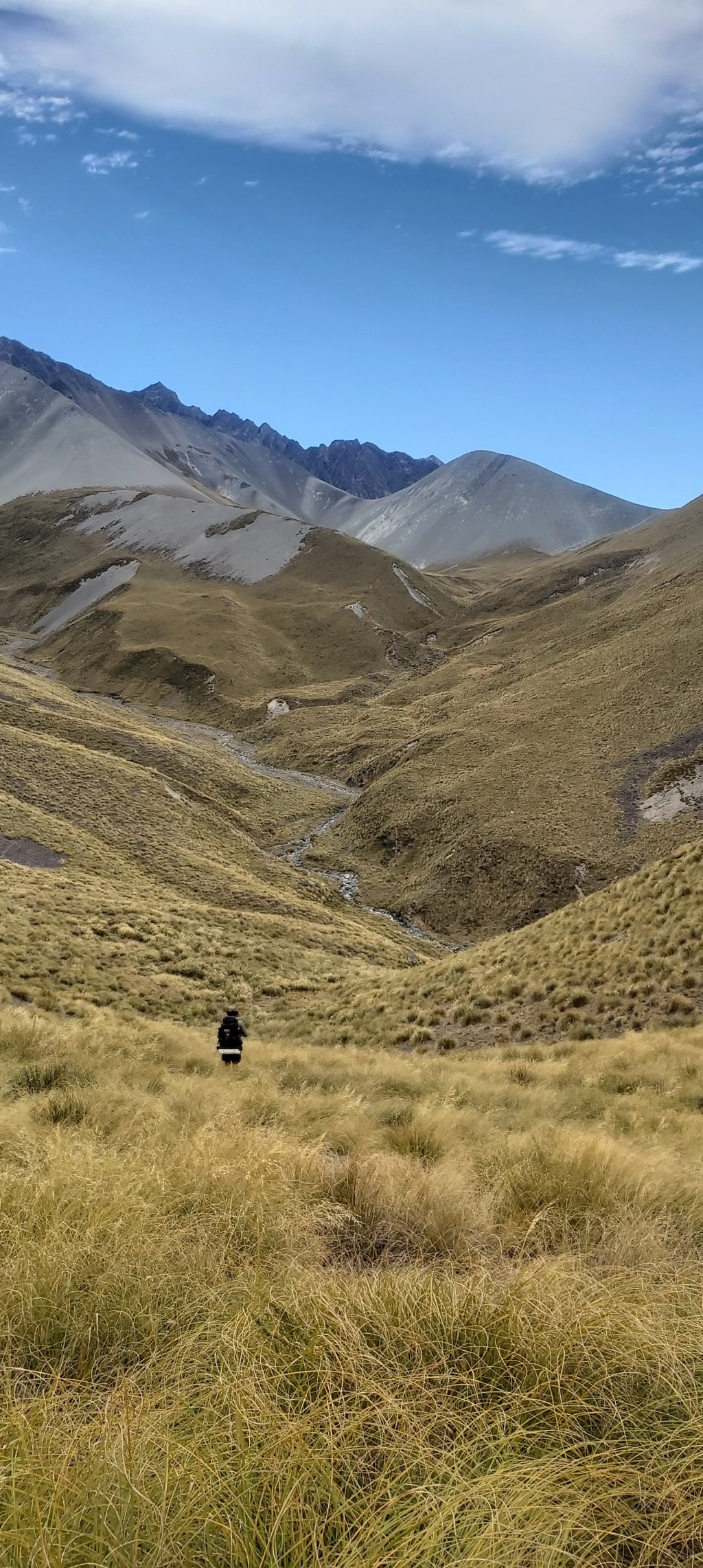
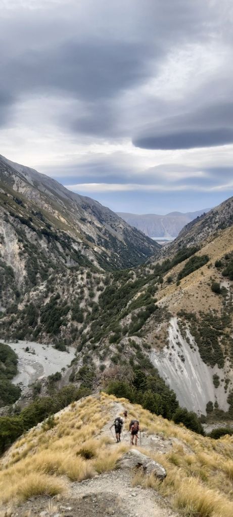
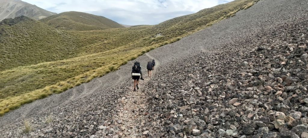
But not today, there was still a saddle to climb to. Marker poles were hard to come by making navigation through the tussock minefields tricky when there wasn’t a clear track to follow. At least the ascent was gradual. Until it wasn’t, arriving at a scree slope that sapped all my energy away. Gasping for air, my goals changed to only wanting to reach the next marker pole. Then I could rest and press on to the next one. My motivation increased when I saw the final one at the top, and with a few more steps I could now look over a wonderful valley and mountain range, very much in another “how did I get here” moment.
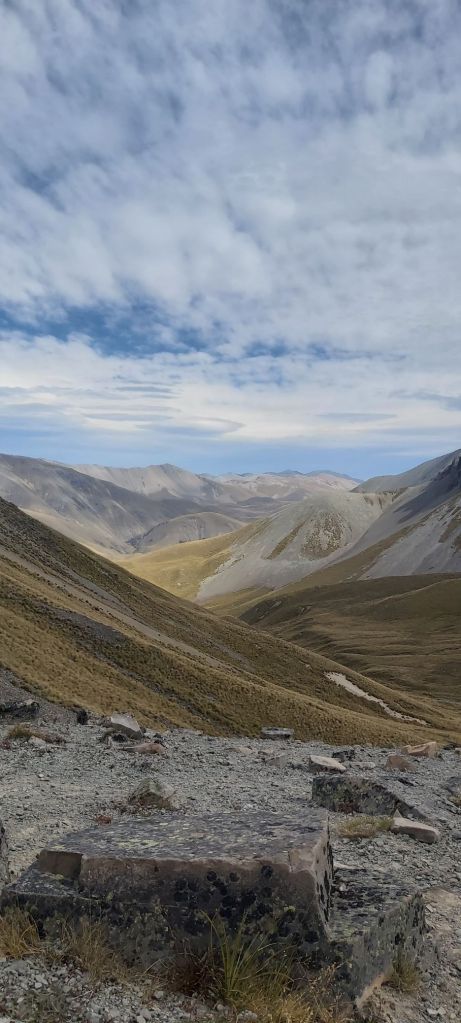
Surrounding our group on every side were these gravelly, tussock-covered mountains. The wind was calm and all was quiet, save for the chirping of cicadas sitting on the ground around us. Even better, there were no sandflies bothering us. We could just sit there and marvel at what our eyes were seeing and our ears hearing. This unnamed saddle had become one of the most beautiful places I have visited on trail.
But we still had a hut to get to. As with the climb, marker pokes were hard to find. Thankfully the descent began on scree (the good, thick kind of scree) where the stomping of many a shoe had created a scar on the side of the mountain for us to follow.
Then it was back into the tussock and over a few smaller hills, rock hopping over the handful of small stream crossings this side of the saddle; my feet were dry by this point and I wanted to keep them that way. However, I was beginning to get quite a bit of pain in my toes so I was taking a gingerly approach to these final few kilometres. Now past 7pm, the sun was dipping below the tops of the northwestern mountains, the added coolness of which a welcome relief to four tired, sweaty hikers. More relief came when sighting the hut, a small corrugated iron building situated at the foot of a rocky avalanche path that is named Stone Hut. To be fair, one side of the hut is built from stone, but surely a more accurate name would be Corrugated Iron Hut.

To my surprise, the hut was only occupied by two hikers when we arrived: Joe from the UK and Camille from France. Oh, and this hut also had those sweet, sweet blue mattresses. I am gonna sleep well tonight. Like the other musterering huts I’ve been in, the interior doesn’t get much light, with only a single window letting in the little daylight left today. With that said, it was nice and spacious. Dinner was eaten, but before I could brew up a hot choccie for dessert, Matt stopped me, requested my pot, filled it with water, and placed it on top of his own stove. He then revealed a block of Whittaker’s milk chocolate, broke it up, and placed it in his own pot which floated in mine. Oh, I see what you’re doing there. He’s making a proper hot chocolate.
Once the chocolate was melted, he added milk (yes, actual milk) and water and served us. It was as delicious as it sounds. You could really taste that it was proper chocolate and not the sachets I’m used to. Thanks Matt, that was a great end to a great day. Now it was time to settle into a supremely comfy blue mattress and begin thinking about tomorrow’s walk up to the highest point on Te Araroa at Stag Saddle. One more climb and then it’s all downhill from there, right?

Leave a comment