


Date: 16th January 2024
Start: Mid Wairoa Hut (km 1911.8)
End: Hunters Hut (km 1928.9)
Distance Travelled: 17.1 km
Total Distance Completed: 1768.8 km
Song Currently Stuck in Head: Chariot by Hillsong United
Today’s Environment: oddly reminiscent of Australia
No, don’t make me leave the hut! Let me be comfy for just a little bit longer. What do you mean I’ve gotta walk 17 km today? Haven’t I gone far enough? No? Oh fine, let’s get moving.
Today promised to me quite a bit more challenging than yesterday. It’s rather bold of the trail notes to assume I wasn’t sufficiently challenged by yesterday’s walk. Today would be another big climb almost to the top of Mt Ellis, although that would be happening towards the end of the walk. First things first, we’d be following the Wairoa River upstream from Mid Wairoa Hut to the creatively named Top Wairoa Hut. The track started with a bang, getting right into a cliffside sidle, including a small section requiring the use of a wire bolted into the rock.
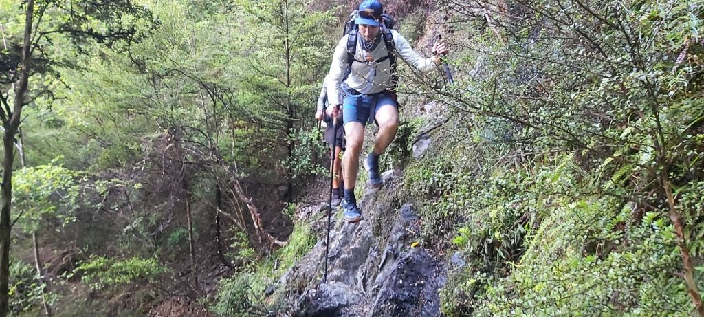
We then cycled between this and dropping down to the river to cross it. All four of us were in trail runners, three of us just waded through the deep bits, one avoided the water at all costs. Can you guess who that person was? If you said me, you’d be wrong. Oli, sometimes taking steps/jumps I instsly ruled out as foolish, always found a way to rock hop his way over the river. I changed to runners specifically for situations like this. Yeah, it did suck getting my socks wet, but I realised as I walked along that they did indeed dry out remarkably quickly. Not fully, but enough that my feet weren’t constantly squelching for the entire day like they were with my boots.
The complex terrain did nothing for our pace, nor did the subtle yet constant climbing we were doing. Beyond focusing on our footing over the river and along the cliffs, we also had to contend with a much greater density of wasps flying around. I know I said yesterday they tended to be more docile this time of year, I still didn’t fancy testing that theory. Anytime I passed by a blackened beech tree, I did so swiftly.
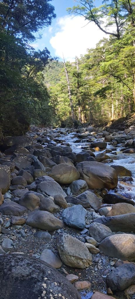
The further upstream we got, the steeper the track became. Soon the trees ended, transported seemingly into a completely different world.
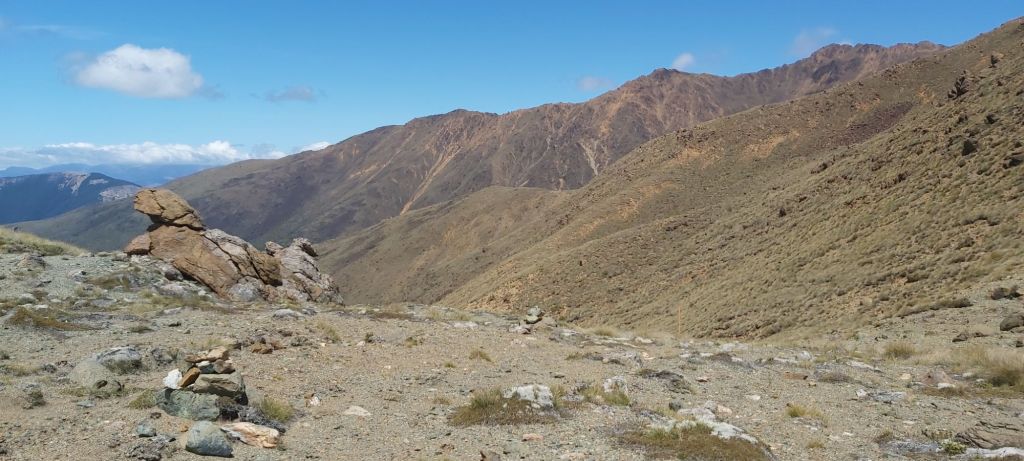
Apart from the river, the surrounding land had suddenly become much more arid, the trees shorter and less lush, in many ways resembling an Australian bush setting. The new red-orange colour scheme continued with Top Wairoa Hut itself, although much less subtle than the trees.
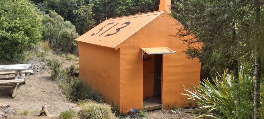
The number is a legacy of the Forest Service days I believe, the exact number of this hut remains a mystery to me. Shade was hard to come by while we ate lunch, choosing to eat noodles rather than the usual wraps. Knowing how much food was waiting for me in St Arnaud, I wanted to eat more or less all the food in my pack before I arrived there. Besides, it would help if I ate a few more calories before the climb up to Mt Ellis.
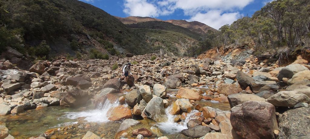
Speaking of which, my expectations of an easier track after this hut were quickly quashed when I saw the route we had to cross. Large red boulders with gaps in between them and a constant doubt as to whether they were stable or not.

Oh, and did I mention we were still climbing? And now we didn’t have a forest to shelter us from the sun. My arms were soon coated in a thin layer of sweat as I struggled over each rock. Looking around I could see that the surrounding mountains were of a similar colour and composition. How surprising it was that I started this traverse of the Richmond’s in a very green forest following a very green river, then crossed over two very rocky mountains into another lush forest, and now I’m in Australia.
Instead of going up to the summit of Ellis, the track takes us underneath its southern face, passing over a scree slope.

The mountain also provided a tiny bit of mobile reception which Matt used to book our accommodation at St Arnaud and a dinner reservation when we arrived. I was still fretting over my phone’s battery and how much I had left in my power bank, not entirely sure it would last the rest of the journey. With that said, whilst it lasted I wanted to take as many photos as I could.
On our way down I could feel myself getting the same frustrations that I had on my way down from Mt Rintoul, annoyed as I watched Melly and Matt disappear ahead of me. Oli – bless him – stuck with me, offering encouragement and a few tips, although I wasn’t in the mood to take the latter onboard.

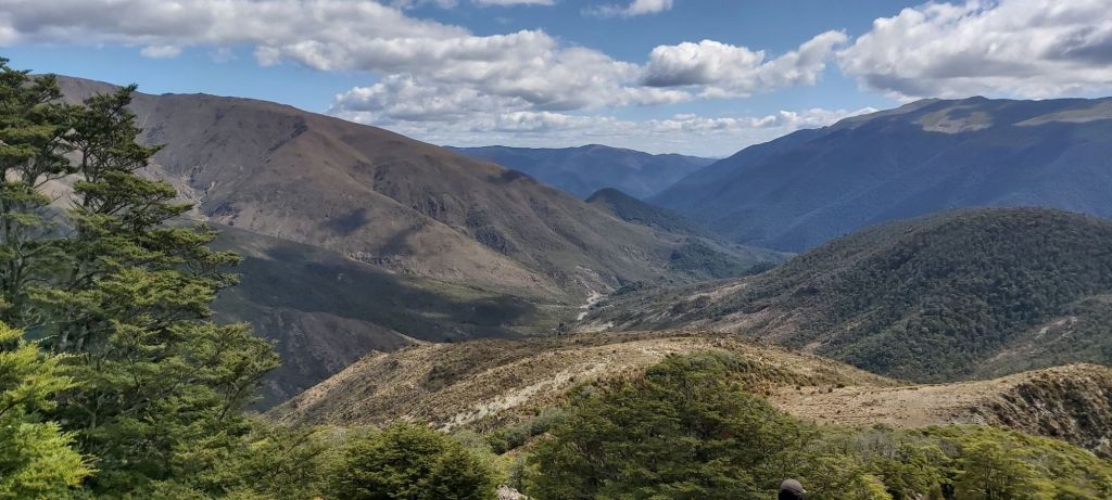
We were now following yet another river valley which contrasted the arid terrain surrounding it. After a couple days of arriving at that night’s hut by mid-arvo, it felt slightly odd coming into Hitners Hut close to 6pm, despite the fact we still had 3 hours of daylight left by the time we climbed the final hill up to the hut’s location.
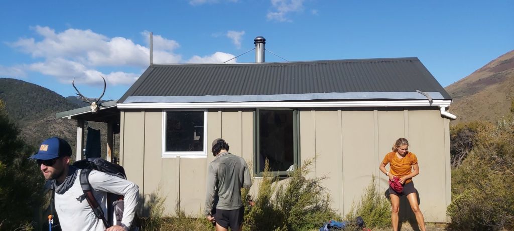
In 1995, there was another hut situated next to the river below us housing two DOC workers finishing up a successful goat hunt. In the night, a flash flood smashed into the hut, destroying it and sadly killing its occupants. This hut was built as a memorial for them and would now be our home for the night, another small, cosy 8 bunk hut, complete with deer skull over the front. Team Camera opted for cowboy camping again, Oli opted for a regular camping set up again, and I opted for the final available bunk in the hut… again. I was quite tired by the time I arrived and didn’t feel like talking with anyone, mostly keeping to myself and my own thoughts. From the sounds of things, the final two days won’t be as draining as today’s hike was. Time has lost most of its meaning out here. I’m struggling to work out where I was a week ago. Was I in Havelock? Or was I still on the Queen Charlotte? All I can really think about is what I just walked over today: a trail with an incredible amount of variety that I wasn’t expecting at all.

Leave a comment