

Date: 10th January 2024
Start: Davies Bay Campsite (km 1782.8)
End: Havelock Holiday Park (km 1805.5)
Distance Travelled: 22.7 km
Total Distance Completed: 1645.4 km
Song Currently Stuck in Head: Sabotage/Home by Kings Kaleidoscope
Food Stuffed in Pack: about 12 days worth
It’s… cloudy? That wasn’t in the script. I was told it should be dry and hot the whole way through the Queen Charlotte and now you’re gonna dump clouds on me with only 3 km to go? Slightly rude, but thanks for the cooler temperatures. It’s not like I’m in a rush to get anywhere. We’ve got a nice, short day to Havelock, with a stop in Linkwater for lunch. As they only open at 12 and they’re only 9.5 km away, we might as well take it easy this morning, setting off after 9am to finish the final kilometres of the Queen Charlotte and arrive in Anakiwa.

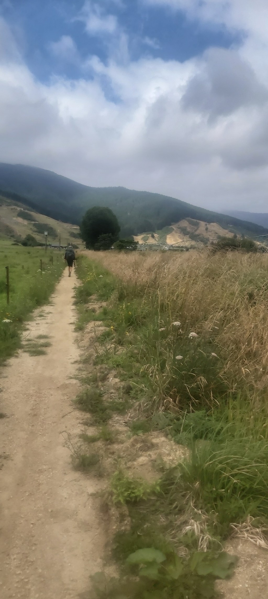
It was once again time to hit the roads. At least that’s what I thought when I looked at the maps. What they didn’t show was a community built pathway linking Anakiwa with Picton and Havelock, eliminating a good portion of road walking. Granted the Link Pathway, as it’s called, does run parallel to the highway so it’s not exactly what I’d call scenic, but having that separation from the traffic is nice.
There’s not much to talk about on this section. The road and path are both very flat, tracing their way through a dry valley between the Queen Charlotte and Pelorus sounds. Not a great deal was said and done, most of us were driven along by our respective podcasts and whatnot to the Queen Charlotte Tavern in Linkwater for a solid lunch of burgers and fries. Whilst we were eating, some workers had lit a fire in a field right next door. The flames grew quickly and there was some concern over what they were doing and if it was in control. From what I could gather, the field they typically allocate for TA hikers to camp in was needed for other uses, so they were clearing this little bit of land for that purpose.

Outside Linkwater the pathway ended as there wasn’t enough room between the road and the beach to build one. We were now looking upon Pelorus Sound which looked a lot more sparse than the Queen Charlotte. Very little boat traffic, no one housed on the far bank, and a generally less pleasant vibe.

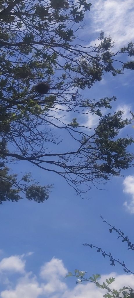
That isn’t to say that it was completely devoid of beauty or anything worth noting. Along the shore was this unidentified bird guarding a nest. If you know what it is please let me know.
As the highway stopped being dead straight and started to wind it’s way around a hill, the pathway left the road and began climbing up said hill. The track posed very little challenge, the main difficulty – as with the last couple days – came with the heat. Those clouds that had greeted us in the morning had left a long time ago, and with shade hard to come by, it made for a very sweaty hike. Motivation was hard to come by, mainly relying on staring out at the sound for a while.

To be fair, the views were pretty sweet. The road section we did today appears to be the only flat ground for miles around. Well, apart from Havelock, a small town right on the banks of the sound that is famous for its mussels.

The descent included a couple of small stream crossings in some of the few shady spots on the track. The first had a lovely little waterfall coming out of a tree.

Once at the bottom, a short pathway took us over the estuary and into town, popping out right at the front gate of the holiday park. Despite the short distance everyone was feeling very tired due to the heat, not helped at all by the lack of snakes anywhere in the camping area. Once again it felt like the owners had just shoved us into the back corner of the grounds, right next to the sheds in the marina. I couldn’t care much though, I just wanted to get my tent set up and retreat for the camp kitchen.
I didn’t retreat for long, however. This was the last town – and therefore the last chance to resupply – before arriving in St Arnaud in 9 days time. Praying the Four Square had a decent selection of goods, I entered the store. It’s certainly no Countdown or New World, but it was good enough. Now the question of how I would store it all. That would wait, I needed to have a final proper dinner at the hotel. A big plate of fried squid greeted me and was handsomely demolished all too quickly. Finally, at 8:30pm, it was cool enough to enter my tent and see how I would fit everything in. Immediately there was a problem: I already had 2 days worth of food in my food bag. And I’d just bought 10 more days. 12 days of food for a 9 day crossing. Well at least I won’t starve but this is gonna be really heavy.
Somehow I got everything in. A few items were shoved in the bottom of my pack and a couple would have to ride in the outside pocket, but it was all secure. The other thing on my mind was power. I will be fully reliant on my power bank for the same distance so I wanted to get everything fully charged before I left. The bank itself took a while so I didn’t have time to charge my GoPro. With two batteries I’m sure I can make it work. The phone will be the bigger problem. It’s old and the battery is on its way out. Even with flight mode on it drains annoyingly quickly. I like writing up these posts as soon as I can so I can remember all the details of the day but I may have to cut back on that. We’ll see how we go. I think the important thing for the Richmond’s is to take things one day at a time. No matter how you tackle it, it’s going to be a long hard testing tramp.

Leave a comment