


Date: 30th November 2023
Start: Mercer Motel (km 687.6)
End: Rangiriri (km 713.4)
Distance Travelled: 25.7 km
Total Distance Completed: 710 km
Song Currently Stuck in Head: Move Your Feet by Junior Senior
Track Visibility: worse than my eyes
Guess what? I still suck at waking up in the morning. It’s always slightly demoralising when I poke my head out and I already see 2 tents put away and someone about to leave. I didn’t know of this was supposed to be a day where I should be getting away early or if it was ok to take my time. From the sounds of things it might be a bit slow at times, so motoring through to Rangiriri in 5 hours wasn’t going to be feasible.
I decided to compromise: pack up early, grab brekkie at Maccas and get going around 8:30. That seemed to work for the most part, although Matt and I were the last to leave. We’d been met by Jazz Hands and Lupi a bit prior to our departure, as they had chosen to stay at a farmstay a little out of town. Being in the company of familiar faces was nice after spending a night in Bombay alone.
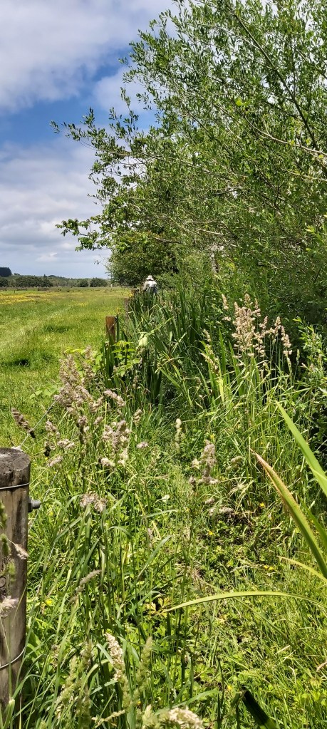
So anyway, I left camp and headed up the road to the Whangamarino Redoubt Track. I understood immediately why Melly had said the track is absolute hell for anyone with hay fever.
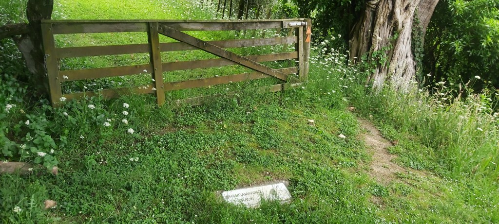
It was basically a continuation of the track taking us into Mercer yesterday. Very overgrown, very steep, and a bit slippery. I may or may not have fallen over a couple times onto the soft grass, so the only thing hurt was my pride. The trail notes said I was walking through the second largest bog in the North Island. It was boggy in places, but the mud was never more than surface level.
We’d go up to the top of a hill, then drop down into a boggy valley, then back up again. Finally, on the last hill the trees opened up and gave us a view over the surrounding region.
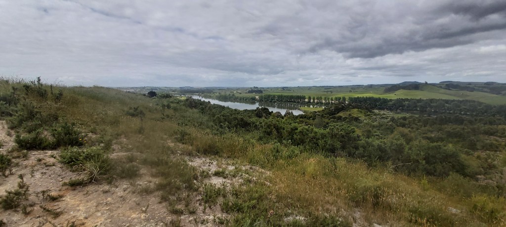
Turns out 19th Century British soldiers also liked this view but for very different reasons. During the Waikato Wars, they built a redoubt on top of this hill, lugged massive 40 pounder cannons up it, which they used to shell Meremere, a Maori stronghold at the time. I really ought to research Kiwi history at some point.
Off the redoubt we came, back underneath SH1 onto a path right beside the highway. This one wasn’t as overgrown as it had been mowed recently. Still wasn’t the easiest to walk through but we could at least see where we were going. That lasted very briefly, with the trail leading away from the motorway by the old Meremere power station towards the bank of the Waikato. Apart from a sketchy start, this too was pretty easy walking, leading onto a similarly easy levee walk where I stopped for lunch with Lupi and Jazz and passed the 700 km mark shortly after.
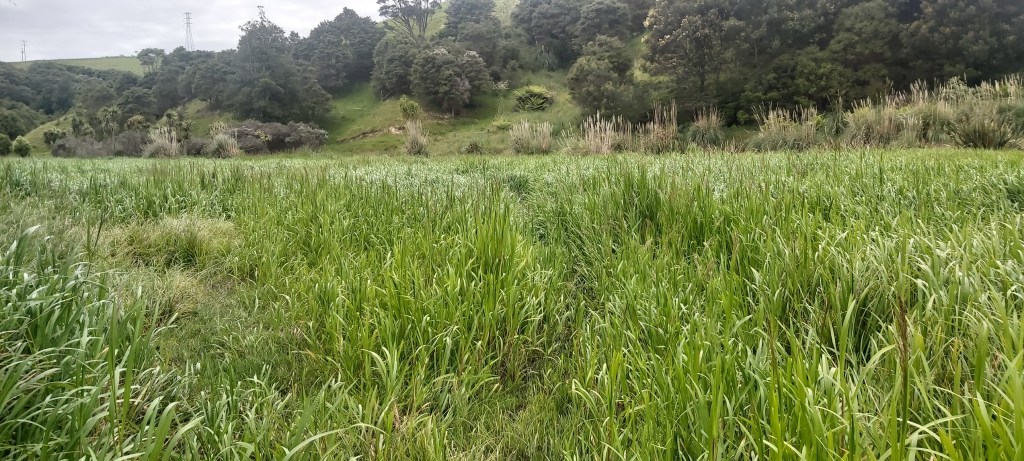
That’s where the easy walking stopped, as did the levee coincidentally. We were now basically sandwiched on a narrow strip between private farmland and the river, a strip that clearly no one wants to maintain.
I resorted to walking like I did on the Carnarvon Great Walk, with my eyes constantly lpookijgnst the ground, although this time I was less worried about snakes and more about sudden potholes that wanted my ankles for lunch. The going was flat at least, so I could still make some good time, trying to keep Jazz Hands and Jenny (trail name: Snacks) from Sweden in my line of sight. I don’t suffer from hay fever, but I saw first-hand from Matt and Tom later on what this long grass did to their bodies and noses. It was not pretty.
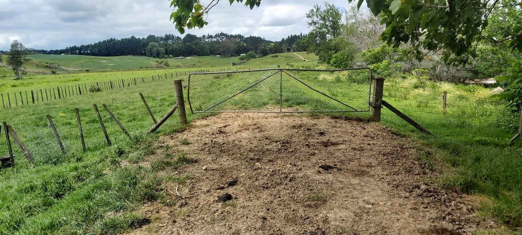
Nothing of note happened in the long grass, it was just stupidly long. It only lasted for 4 km before arriving at a pump station where a water tap has been installed for hikers. Jazz, Jenny, and myself all filled up from here and got stuck into the last 8.5 km to Rangiriri. Technically the trail goes through many a field on a levee. It wasn’t anywhere near as overgrown as the last part, but the grass was still pretty long and there was a stile to traverse every 100 m or so. There’s a road that conveniently runs right alongside the proper route that all of the Far Out notes recommended. I can’t believe I’m saying this, but I opted for a road walk. Yes, I feel incredibly dirty saying that.
The road was pretty quiet and most of the time there was plenty of room on the side to walk on. I was fully prepared to plug in my earphones and barrel through the road walk without a care about what was happening around me. That was until I passed by a field full of juvenile cows. They were all happily eating and minding their own business, except one of them. He eyed me off from a distance and got a case of the zoomies when I got closer, a display which caught the attention of every other cow in the paddock.
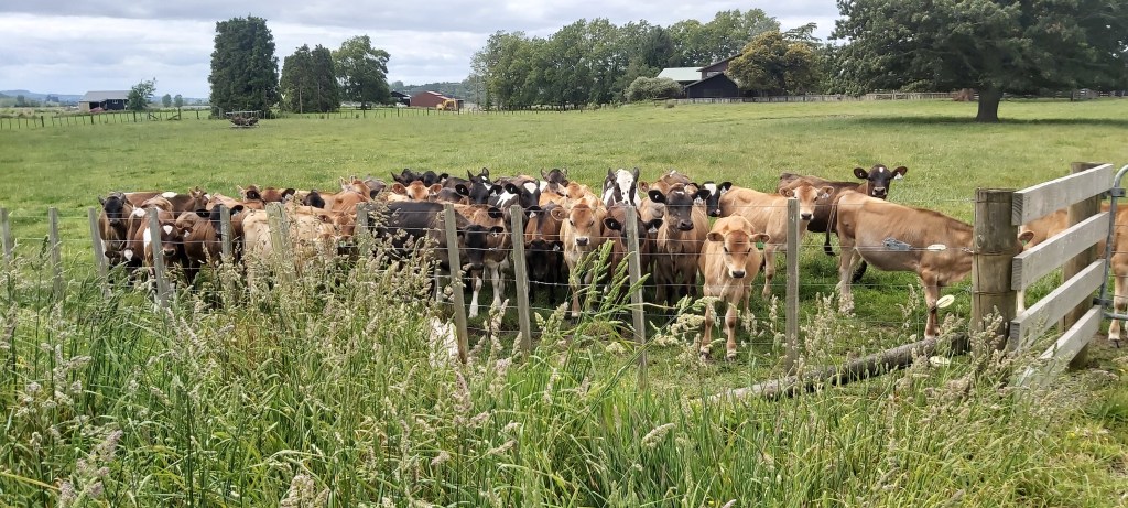
I’ve never known cows to be so inquisitive before. I didn’t have anything in my hands that could be construed as food (I think). Not really knowing what to do, I bid them a sad farewell and went on my way.
After that, you guessed it, nothing happened until reaching Rangiriri. We’d arranged to stay the night on the lawn of a local resident, Cathy. She’d once ran a pie shop in town and although her business appeared to be closed, she was still offering to bake them for TA hikers. Jazz and I opted for a lamb pie to share.
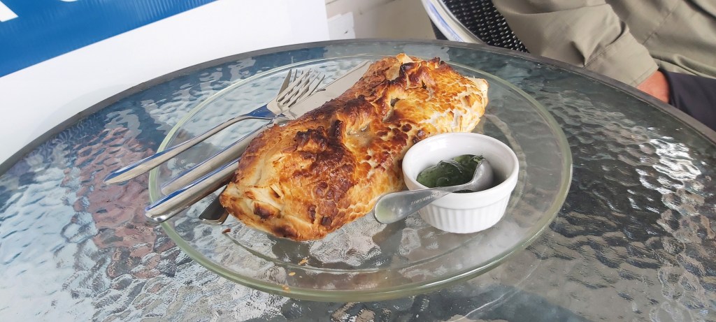
Dare I say it, that might be the best pie I’ve ever eaten. The pastry was flaky, the filling was exquisite and the mint sauce, don’t even get me started on the mint sauce. I’d make a terrible food critic.
Camp was pretty busy. Along with the regulars (Tom, Jazz Hands, Matt), we also had Jenny, Antoine from Belgium, and Mirjam! And she was walking normally! That was a nice surprise, I haven’t seen her since Kaitaia when she was in a pretty rough shape after that beach.
The evening was a quiet one, going to bed early so as to start early tomorrow. Most of us were planning on pushing all the way to Ngaruawahia, around 35 km including a pretty good climb up onto the Hakarimata Range. Cathy had told us that the trail up top was in pretty good condition, steps all the way there, gravel path, little mud. All the things I like on a trail. It would still be a stupidly long day, so that sadly means a very early alarm for me. Ugh.

Leave a comment