

Date: 29th November 2023
Start: Bombay (km 669.6)
End: Mercer Motel (km 687.6)
Distance Travelled: ~2 km shortcut + 18 km trail (20 km total)
Total Distance Completed: 684.3 km
Song Currently Stuck in Head: American Pie by Don McLean
State of the Levee Track: lumpy
By morning the rain had passed, leaving a cold, overcast morning for me to wake up to. Despite the weather I had slept exceptionally and felt ready to go and tackle the day ahead.
Except that isn’t what happened. Beyond my usual slow antics in the morning, Kerryl offered me breakfast, coming out with a plate of toast, an avocado and a fried egg. I’m not exactly going to say no to that, am I? Both her and Tom have been lovely hosts, as seems to be the case with all of the trail angels I’ve met so far. If you’re ever passing through Bombay, I believe their place is listed on Airbnb.
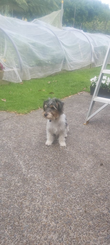
But the cherry on top of the cake wasn’t all that, it was meeting their dogs in the morning and not being barked at.
The eagle-eyed among you might’ve noticed that the starting point for today doesn’t match the end point from yesterday. The reason is Kerryl and Tom’s place is right at the foot of Mt William and going around on the actual trail would take 5 km before I even reach the summit trail. Instead, they showed me a shortcut up the hill next to their house that would cut out most of that distance. I had also misread the distance to Mercer, so what I thought would be a 26 km day was actually only about 20 km. Don’t mind that at all!
That isn’t to say that the climb up to Mt William would be easy. We may have done most of the climbing yesterday, but the road up the hill was still pretty steep. Going past a TV tower (I’m assuming here, it could’ve been anything emitting stuff on the electromagnetic spectrum for all I knew), I then followed a fenceline down the first hill past fields of sheep and the mines they’d left behind.

One slight issue: I was on the wrong side of the fence. I kept coming across orange marker poles, but they – along with many a stile – were on the other side. Not wanting anyone possibly watching to think I was trespassing, I tried to find a spot in the fence where I could cross over to the right side. That didn’t take long, I could now roam over the undulating hills care-free. Except for the wind smacking my face.

It was in that zone between barely noticeable breeze and being worried about it blowing me over; strong (and therefore mildly annoying) but not dangerously so. There’s not much I can really do about that apart from keeping moving, each step taking me closer to the summit and my campsite for the night. Some stairs would’ve been nice at this point, but again I’ve just gotta take what I’ve been given. Besides, I know I’m strong enough to get up a 370 m hill. How do I know this? Well, I made the summit of Mt William, didn’t I?

Not including my rest day, it had only taken me 9 days to cross through the entire Auckland region. 189 km at an average of 21 km per day, although I don’t think I had many days close to that figure. It was mostly short days north of Orewa and then a couple monster legs through the city itself. Still, it feels a bit surreal to already be done with Auckland after spending so much time in Northland. The days have kinda blended together in my head. Sometimes I think I was just in Kaitaia a few days ago when I actually left 25 days ago. I can’t get my head around that figure. My entire reality has become slightly warped; most people wouldn’t even consider walking 20+ km in a day, yet here I am doing that several days in succession, surrounded by people doing the exact same thing making it feel like the normal thing to do.
Ok, enough existential crisis, back to the trail, which had taken me off Mt William just as steeply as it had take be up it. I got to enjoy a peaceful forest walk for a kilometre or so before it was back to a good old gravel road that led me to… checks notes… State Highway 2. That can’t be right, you want me to walk alongside a major highway for 2 km? Are you kidding me?
No. No they weren’t. This was the trail. A busy highway with trucks hurtling past at 100 km/h. At least there was a shoulder? Except for the two bridges where I had to physically step foot in the lane carrying said trucks. I didn’t exactly vision this as the day where I’d become strawberry jam spread over asphalt and to my luck neither did any of the drivers that came past. Most gave me a couple extra metres of space if it was possible.
If there’s any positives to take out of the highway walk, it only lasted for 25 minutes. Time for a nice quiet farm track. And it was quiet, but it was also very bumpy.
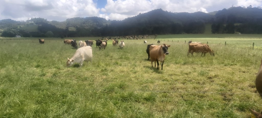
It thankfully didn’t last long, evening out onto a track running around the perimeter of several fields, some of which contained many newborn calves and their mothers. It was here that I stopped to have lunch in what I thought was a fairly protected area. It wasn’t, the wind blew strongly on my back for my entire break, although this provided a nice balance to the sun that was also shining on my hapless legs.
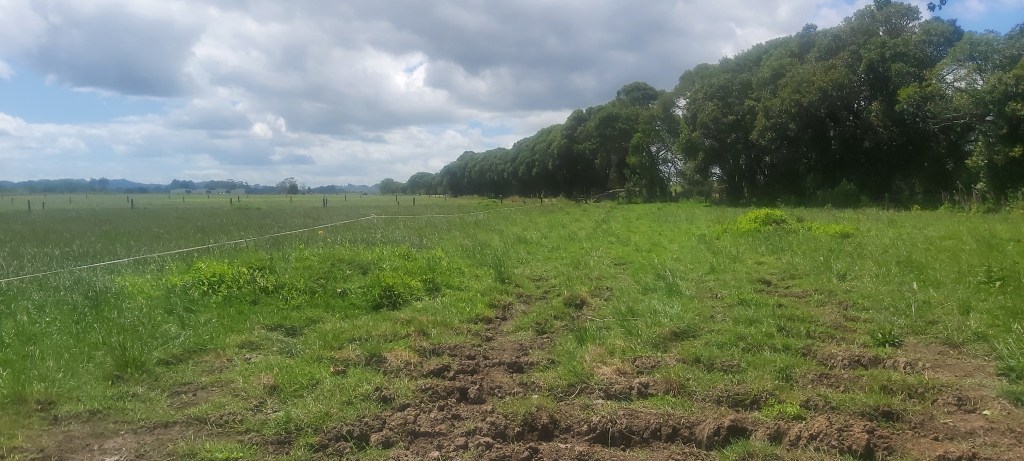
After lunch I continued down the farm track until I reached what the notes referred to as a “stopbank”. This is one of the rare instances where I prefer the American word for something. It’s a levee. Just call it a levee.
But it wasn’t this levee that I’d be walking along. First there was a stream crossing that was just too deep for my boots. It’s the one annoying thing about boots; river crossings take a stupidly long time to do. Once across I climbed up the levee on the other side and kept walking.
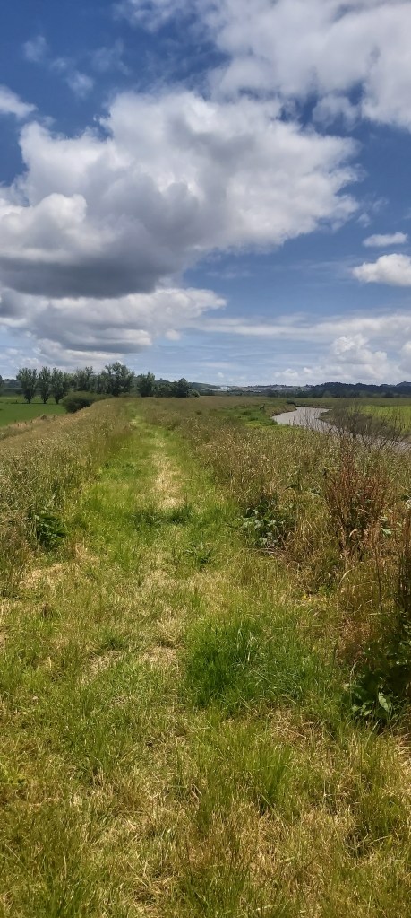
It was still a bit lumpy but not enough to be concerned by it. What it did give me was a decent amount of time to get lost in my own thoughts. No, you don’t get to know what they are; I’m sure Google already knows them.
The levee dumped me onto a gravel road that took me towards SH1. To their credit, the TA routemakers weren’t stupid enough to have us go down a literal motorway. No, instead we’d walk right beside it on a severely overgrown “trail”.

To say it wasn’t that scenic would be an understatement. The grass was higher than me, the soundtrack was dominated by cars and trucks screaming past me, but at least it wasn’t muddy. It also only lasted for 2 km, right on the doorstep Mercer which from what I could see appeared to be little more than a truck stop. There was a servo, a Maccas, the motel, a pub, and a few houses on the other side of the motorway. Everything seemed a bit dead. I checked into the motel in the restaurant next door (which was completely empty), the camping ground being a small lawn out the back. All this considered, I wasn’t complaining. It was only $20 for the night and I got a hot shower without a timer for free.
I was – thankfully- not alone at this campsite either, with several hikers pouring in over the next couple hours, most of whom had begun their days in Drury. Tim and Tom were the only walkers I had met before, along with two from Canada and a French and Belgian couple whose names I can’t remember. Oh, and Matt also showed up fashionably late as I was getting into bed. Dinner tonight was rice with some spices and biltong. Honestly it tastes a lot better than it sounds. On trail, one’s idea of what classifies as tasty food does get skewed somewhat. For dessert I grabbed a sundae from the Maccas next door. With that, I got in my tent and settled in for the night, not really sure where I’ll be going tomorrow. My plan was to reach Rangiriri, but with the Hakarimata Range standing in between me and Ngaruawahia, getting a bit closer wouldn’t be a bad idea so I kinda want to push onto Huntly. It’ll really depend on the track conditions. The elevation profile suggests a nice, flat track but the trail notes and report from Melly suggest otherwise. We’ll just have to take it as it comes, one step at a time.

Leave a comment