

Date: 6th November 2023
Start: Blackbridge Rd Campsite (km 177)
End: Puketi Campsite (km 197.5)
Distance Travelled: 20.5 km
Total Distance Completed: 190.4 km
Song Currently Stuck in Head: In Christ Alone
Energy: completely and utterly drained
WHY IS MY TENT ALWAYS SATURATED WITH DEW?
Ok, rant over. It was actually a lovely morning, albeit a cold one as the sun hadn’t risen above the trees yet. The night has been filled with the sounds of possums running around the campsite on what I presume was important possum business. Part of this involved stealing people’s food that had been left in their tents’ vestibules. Being an Aussie, I’m used to possums (although it’s important to remember that they’re pests in New Zealand and a real threat to native wildlife), but I did wonder how everyone else reacted; they don’t exactly sound the nicest to put it mildly.
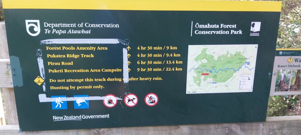
Today’s walk would be through the Omahuta and Puketi forests. Depending on who you ask, they’re just as tough as the Raetea Forest or they’re a walk in the park. As much as I hoped it’d be the former, this sign at the entrance suggested it would be a slow, challenging walk.
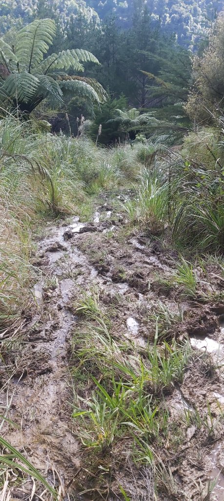
I would’ve really liked to have gotten away from camp earlier, but there was no way I wanted to enter these forests alone. Our trio got away at 9:15, passing through a Kauri dieback cleaning station and onto a slippery, muddy descent towards Mangapukahukahu Stream. That should’ve been the first clue that today would be a slow one, but I chose to ignore it. DOC signs can be pretty conservative with their time estimates so I figured three fit guys could get it done in around 8ish hours.
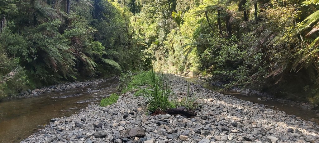
Of course, the trick to going fast is to be on a well formed track following fairly flat terrain. To be fair, the track did flatten out after only 1.5 km. It also became the stream.
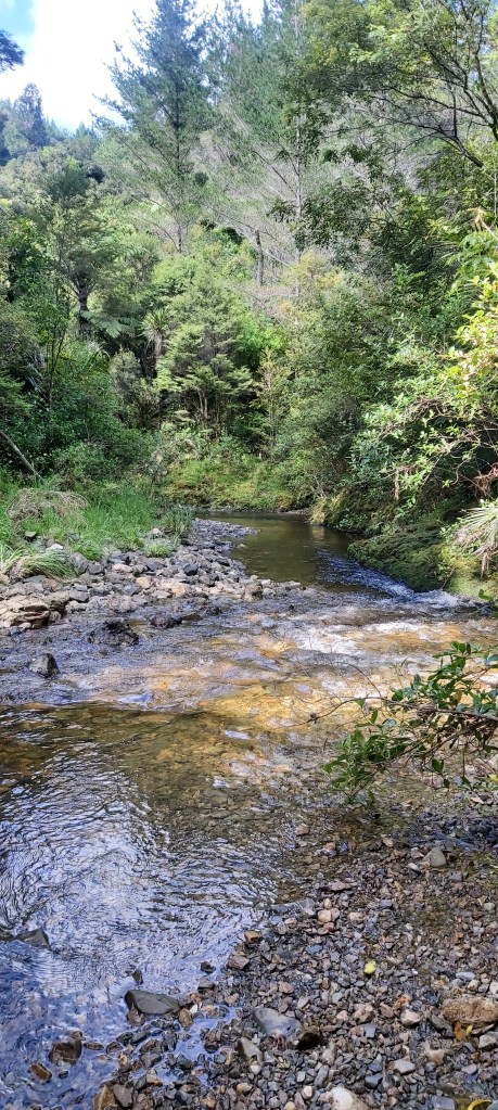
Off came the boots and on went the reef shoes. This was the highlight of the day. The stream was very cold and the soft soles of my shoes offered little protection against the rocks in the stream and on its banks, but it was very peaceful, cris-crossing between shallow shoals. It was slow going and I was getting a teeny bit frustrated by our pace (and wishing we had left earlier), but I didn’t let that take away from my enjoyment of the stream, something that you don’t typically get to experience when going bushwalking.
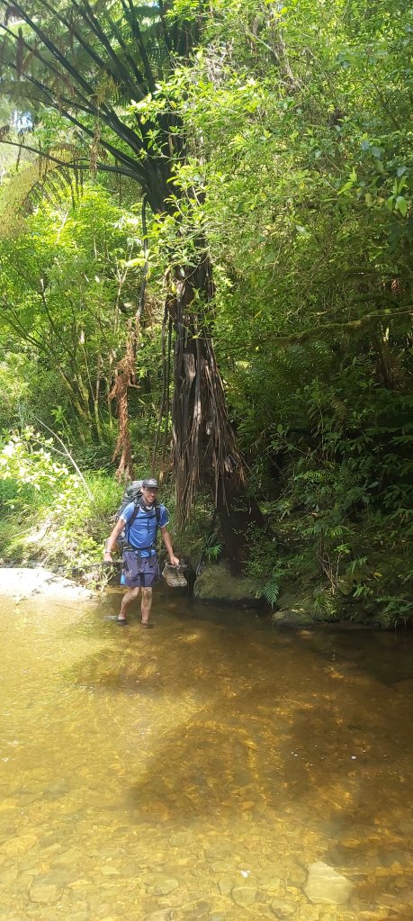
The stream flows into the Waipapa River, with the track rising sharply onto the right bank over to a spot of comparatively shallower water. That’s honestly being a bit generous, as the river was still quite high and was flowing fast. The track leading down to the river also did us no favours, almost resembling a muddy cliff edge. I think the three of us spent about 20 minutes trying to work out what our best course of action is. Marlon, being the most confident of us at river crossings, went across first, then helping Vadem and I cross. I won’t lie, even though the route he had found meant the water only came just above my knees, it was still pretty daunting. But we all made it, and settled down on the bank for lunch.
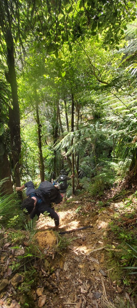
We has been walking for about 3.5 hours by this point and had only covered 4.5 km. And we still had over 15 km to go. At this point I was getting pretty concerned that we wouldn’t make it to camp before sunset, something that I always try to avoid when hiking. I like reaching camp with enough daylight left to actually relax instead of frantically putting up my tent and eating dinner before going to bed. These concerns were exacerbated once we continued walking after lunch and saw the state of the track ahead of us. I’m afraid I didn’t take many photos of this bit, it just wasn’t safe enough to get my phone out. Presumably still carrying the scars from Cyclone Gabrielle, the track was narrow, slippery, and steep. More than once we had to descend parts of it backwards like a ladder. Occasionally it was downright treacherous. In one instance, Marlon slipped and had to cling to a tree for dear life after stepping over a gully.
None of this did anything for our pace, as we completed the next 3 km in 2 hours. And this was the flat part of the trail. For the next 3 km, we would have to climb around 400 m up onto a ridge. A sign at the bottom suggested we still had 5 hours of walking between us and our campsite. This was at 3pm, meaning we would be arriving at 8pm, giving us about half an hour of decent light to set up our tents. Needless to say, I had a massive spike of impatience at this point; under no circumstances would I be taking 5 hours to do the final 12 km of the track, despite the climb ahead of me.
So I started climbing, loaded with confidence in my strength to carry me up this hill without major difficulty. That lasted for maybe 10 minutes, after which it became almost unbearable. The first part, although steep, was up proper stairs. It was taxing but I could at least get a decent bit of traction with every step. But then the steps ended, and the mud began. I was already exhausted, not factoring in that I wasn’t at full health thanks to the cold I had caught earlier on. My breathing became laboured, no matter how much I inhaled, it never felt satisfying. That was the scary bit, even on bigger climbs like Battleship Spur I never felt like I was running out of air.
It’s at this point that I need an honour Marlon and Vadem. Both of them were much faster than me, but still stopped frequently to let me catch up and have a break. Eventually, once they saw the state I was in, they insisted on lightening my load. For the red for the walk, Marlon carried my tent, relieving my body of around 1.5 kg of weight. Even though my attitude sucked, they were very patient with me and supported me the whole way up. If you two are reading this, thank you so much. This climb pushed me to my limits and I’m not sure if I would’ve gotten through it without you.
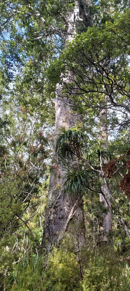
Nearing the top of the ridge, the track turned into a well manicured gravel path, flanked on both sides by giant kauri trees.
At the top, we emerged onto a 4WD track and a sign telling us we had 9 km and 2.5 hours of walking to go. Despite what I thought was a very slow pace, we had completed the climb in less than 2 hours and were how guaranteed an arrival before sunset. We set off and after an uneventful trek along the ridge, we reached our campsite, welcomed warmly by the other hikers who had set off before us who were beginning to get worried we wouldn’t make it on time.
The tents were set up, dinner was eaten, and by 8:30 I was in bed, not really sure what to feel about this track. Was it the hardest track I’d ever done? Yes, by a long shot. I certainly don’t plan on doing it again anytime soon, but I can look back on it with a sense of satisfaction in that I did it. It took us just under 10 hours, but we did it. I’m now looking forward to a few days of gentler walking before the next inevitable challenge arises.

Leave a comment