

Date: 14th September 2023
Start: Johanna Beach Campsite
End: Devil’s Kitchen Campsite
Distance Travelled: 27 km
Current Song Stuck in Head: Hold Me Like A Grudge by Fall Out Boy
Number of Midges Flying Around My Head: a non-zero number, please go away!
Welp, it’s here. The longest and more arduous day of this hike. Both sections are rated as medium/hard, and looking at the elevation profile I can see why. It’s basically a rollercoaster of ups and downs for the entire day, the flat bits becoming a well sought after luxury.
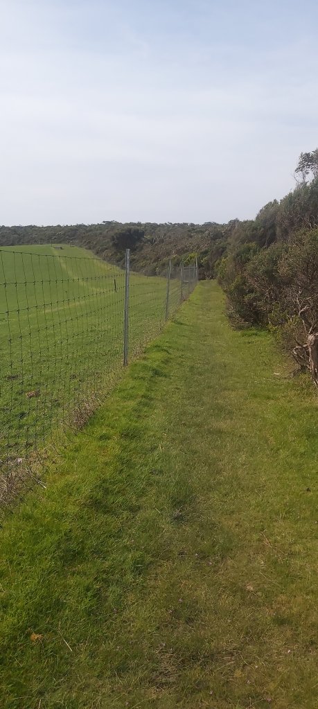
At long last, I finally managed to drag myself out of bed and pack up at a reasonably early time of 8am. Trying to drag myself away from Johanna Beach was the hard bit. I dare not think about what it’d be like to be here in bad weather, but on a day like this, it had to be the best campsite I’ve ever stayed at. But leave it I did, climbing on farm tracks overlooking rolling green hills.

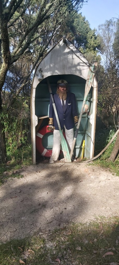
The farm track turned into an honest-to-goodness road after a kilometre or so, climbing to what I believe is the highest point on the track. Thankfully, it was fairly steady with no steep sections, despite the warnings shown on the map. By this point, I was a fair ways inland, and considering this is called the Great Ocean Walk, I suppose I need to start heading back towards where the ocean is. All that altitude that I gained now had to be removed, descending down another unsealed road that turned into a management trail, but not before saying g’day to this fine gentleman.
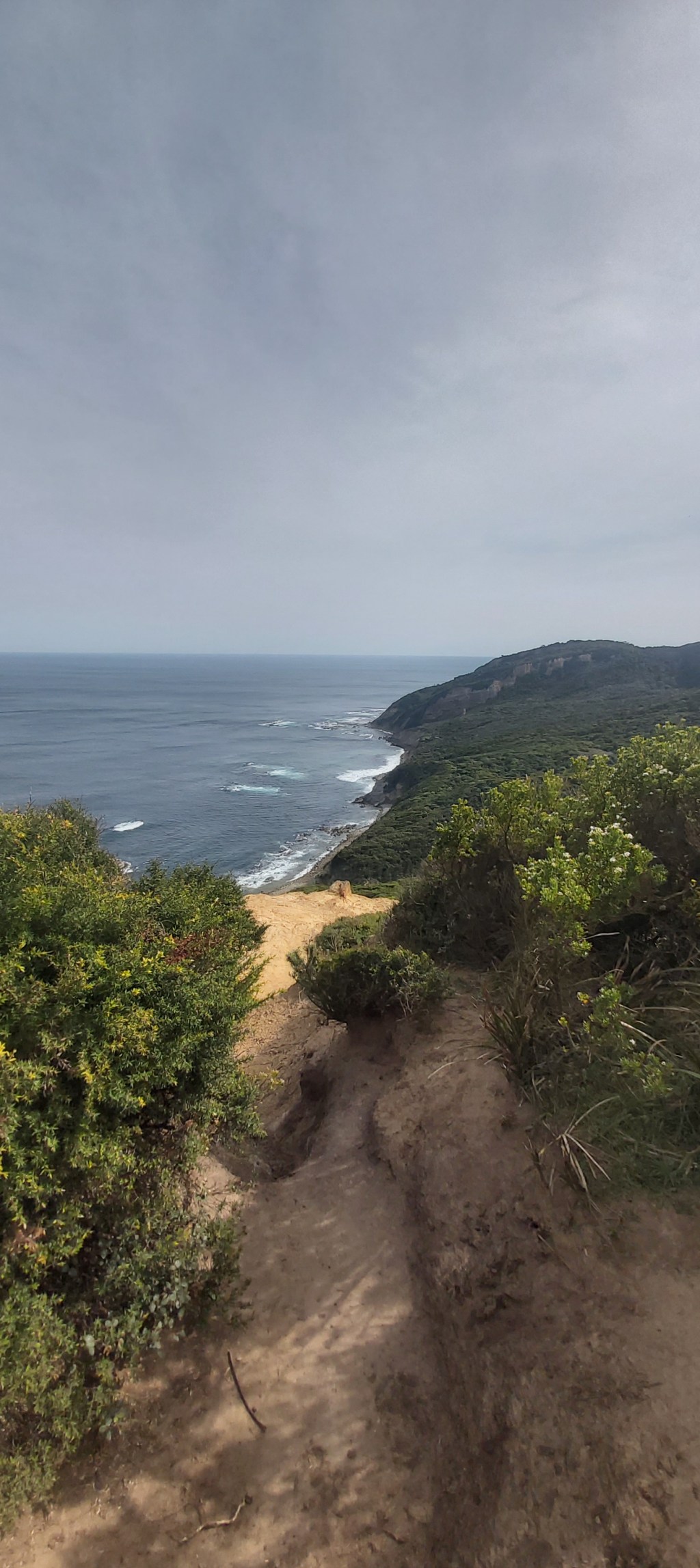
This trail – thankfully sans mud – led down to the last piece of compulsory beach walking on Melanesia Beach. Like basically every other beach that I’ve passed on this track, I think I’d like it a lot more if I wasn’t needing to walk across it with a heavy pack on my back.

Exiting the beach marked the beginning of what I am going to refer to as The Pain Zone. See, this part of the track between here and Moonlight Head did not know the meaning of flat. It was a constant barrage of steep ascents up one hill followed immediately by a steep descent down into a valley, repeated ad infinitum. I was really testing my hamstrings abilities to carry me up and my knees to stop me from meeting a rather painful fate at the bottom.
Throughout this time, although I had no reception I was still able to fought track my progress on Google Maps, which included a marker for where Ryan’s Den campsite should be. The key word there is should. The closer I got, the more encouraged I was to complete this stint of the walk. But the campsite never came, even when it looked like I was right on top of it. When I passed the marker, I just about lost it. Had I missed the turnoff? Unlikely, the trail is very well signposted and it’s pretty easy to follow the track itself. So I kept walking, with the idea of turning back if I hadn’t reached it in 10 minutes. Lo and behold, a couple minutes later I stumble into the shelter at Ryan’s Den, greeted by James, the hiker who I had met at Cape Otway. In short, the Maps marker was about 200 m north of where the campsite actually is. As I had signal, I set about rectifying that very annoying error.
On a more positive note, I had got to camp earlier than I expected, so I allowed myself to have a longer break, eating another lunch of salami and cheddar on flatbread. It tastes better than it sounds. I overstayed a little bit, but I wasn’t worried. I knew today would be long, allowing 4 hours per stint. My thinking was that because the section to Devil’s Kitchen is 1 km shorter, it should go faster.
It didn’t go faster.
First off, I was still smack bang in the middle of The Pain Zone. The hills didn’t stop. In fact, they got worse.

They weren’t big hills, there was just a lot of them with seemingly no reprieve. It was also the middle of the day so it was also getting pretty hot. All of this was becoming a recipe to make a very frustrated Jonathan, much akin to how I felt for long stretches on the Carnarvon Great Walk. I was making a concerted effort to stop caring so much about my pace on track, but I can only hold out for so long. This is also why I didn’t take many photos on this part of the track, all my energy was going into forcing myself to keep walking.
That isn’t to say that this bit wasn’t memorable. Oh no, it was thanks to two pieces of wildlife holding me up. The first blockage was a red-bellied black snake.

My thinking was that because it was a lot cooler down here than in western Queensland that I wouldn’t have any worries about running into snakes. After all, I didn’t see any up there, so why should I see any down here? Of course, I forgot that the snakes down here would’ve clearly adapted to loving in a colder climate and it was also quite a warm day. If I was a snake, sitting out on a warm path sounds like a lovely time. But not for human me. I was already annoyed by how slow I was going and now I’m being delayed by old mate who doesn’t wasn’t to let me past. I did get close thinking my presence would spook him, but quickly backed off once I saw that he’d flattened his head out – a typical sign of an angry snake that wants to be left alone. I contemplated my options and perhaps foolishly began scooching around him, thinking I could jump out of the way if he lunged at me. All that happened, thankfully, is he darted into the bushes.
Blockage number two was a grumpy, beefy, kangaroo on his lunch break. Unfortunately, his lunch break happened to be on the track, and when I tried to go around him, he growled at me. Now, a roo won’t kill me in the same way that a snake could, but he could still do a decent amount of damage if he felt like it. Once again, my “solution” was to divert through a bit of bush and hope he wouldn’t come after me. Thankfully, once he heard all the noise I made trying to do this, he bolted.
Many hills later, I reached the end of The Pain Zone at the top of Moonlight Head. The rest of today’s walk would be a lot flatter, but I still had around 7.5 km to go.
Although it was less painful, the damage had already been done. I was very sore, it was getting to mid-afternoon, so all I wanted to do was get to camp, hence the lack of photos along this part. There was one highlight from this section, that being the sighting of a small flock of gang-gang cockatoos. I have been wanting to see these birds for years, and here they were just calmly munching on some gum nuts above me. They didn’t know it, but their presence lifted my spirits greatly.
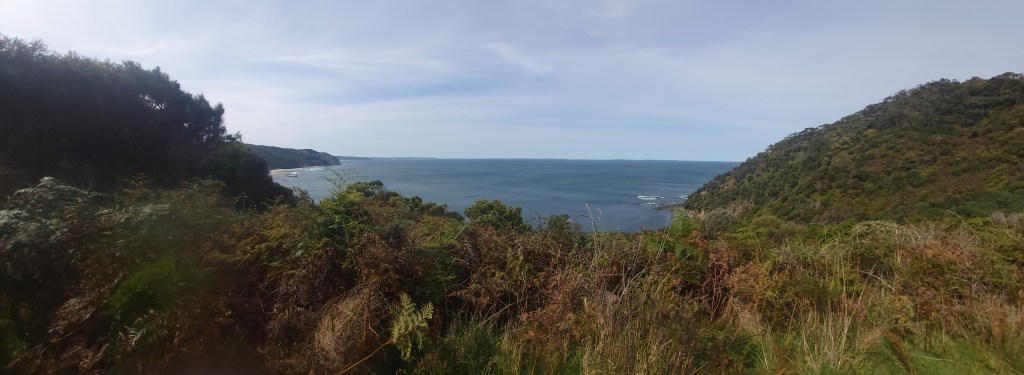
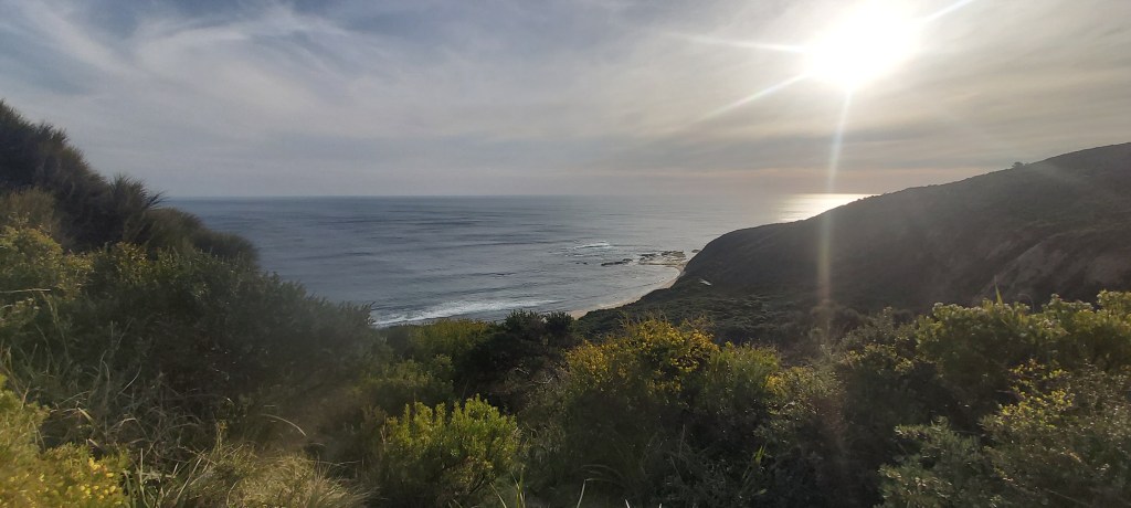
For the last couple of k’s, I caught up with James and got to camp around 4:45pm, by far the latest arrival so far, although not unexpected. Waiting for us at camp was another hiker named Tom, a doctor from Melbourne. He’d been walking at a more leisurely pace than either of us, doing the smart thing and not doing massive days like we did today. Yet again, our campsite rewarded our efforts with some gorgeous views.
After I had caught my breath, I finally got my tent set up and headed down to the shelter to make dinner just as the sun began to disappear over the horizon. We talked for a couple hours about the trail, other hiking adventures, and life in general. I’ve really loved having the opportunity to have those sort of discussions on this adventure, being able to meet people from different walks of life and share in our common love for walking through the outdoors.
It started getting late and frankly I was exhausted after my efforts on trail. This is when I made a colossal mistake. As it was well and truly nighttime when we packed up, I was navigating around using a headtorch. Normally, this is perfectly fine. Normally, I’m not camping at places infested with midges. This was not a normal situation. I opened up my tent’s fly screen… and was greeted by a swarm of midges thinking my headtorch was the sun. So what does one do in this situation. Well, I turned my headtorch onto its red light mode and did a little bit of insect mass murder. I didn’t get them all, but their population was sufficiently dwindled that I could rest easy knowing they wouldn’t be bothering me during the night.

Leave a comment