

Date: 12th September 2023
Start: Elliot Ridge Campsite
End: Cape Otway Campsite
Distance Travelled: 23 km
Song Currently Stuck in Head: Underdressed by Gable Price and Friends
Spiky Friends Made: 1
This morning was a classic Jono Southward wake up: set an early alarm, wake up, lie there for 20 minutes trying to pluck up the courage to get out of bed, immediately realise how cold it is outside my sleeping bag, wanting to get back in but forcing myself to leave my tent, then finally making breakfast. I was soon joined by Sam and Dana, but not my the other couple that were with us. Bit of a shame that, they had offered to make us a proper coffee with an Aeropress, but I couldn’t wait around for too long, so I had to cope with one of my Moccona sachets to get my caffeine fix. One thing I’ve come to learn after 4 nights now hiking with a tent is that packing everything up takes quite a while. It took me 2 hours between waking up and setting off on trail. If it’s gonna take me this long normally, I’m gonna have to get used to getting up earlier if I’ve got a long day ahead of me.
I said my goodbyes to Dana at 8:40 and set off at the same time as Sam, although I was moving quite a bit faster than they were, so we quickly separated. The story of this first leg to Blanket Bay: mud. So. Much. Mud.

To be fair, it’s been a while since I’ve had to deal with muddy terrain, and this was quite testing. I spent quite a bit of time zig-zagging across the track in a vain attempt to find the least muddy side. It was slow going, which meant I had to adjust my expected arrival time at Blanket Bay campsite. I’ve promised myself to not rush like I did on Carnarvon, but there’s still a part of me that wants to go fast even though I know I’m risking injury if I do so. Honestly, the mud forcing me to go slowly was probably a good thing. Another good thing were my boots. They held up very well, and I’m very glad I decided to go with them instead of a pair of trail runners. Sure, they would’ve dried out quickly, but I’m definitely in team “keep feet dry at all costs”.
It doesn’t help that the week prior to me starting was incredibly wet, so these areas would’ve gotten completely soaked with no sunlight to evaporate any excess moisture.
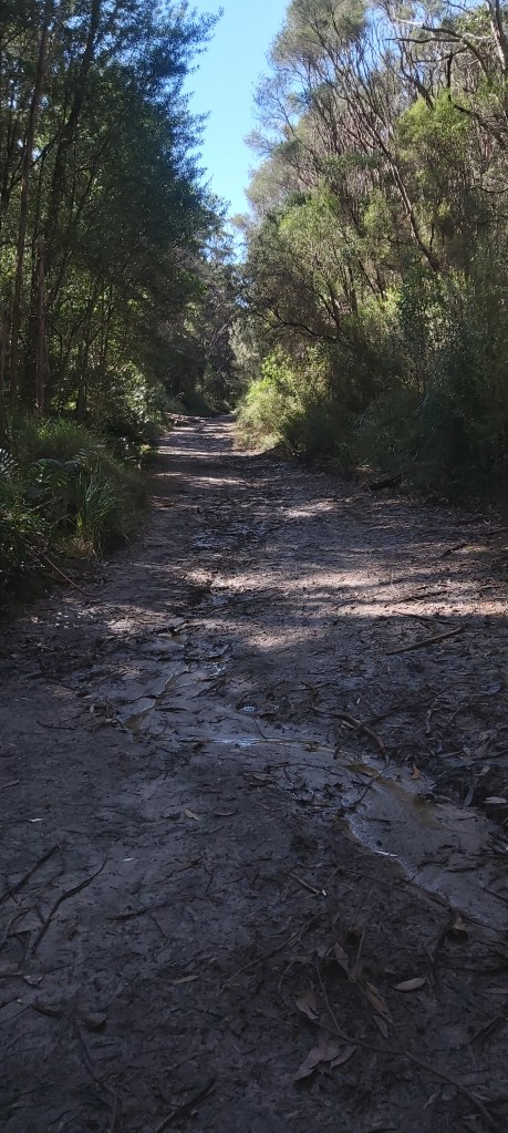
I’m realising that I can get rather impatient when I’m on trail (shocker, I know!). This first section from Elliot Ridge to Blanket Bay is listed as 12 km. Even going at a fast pace it’d take me a minimum of 3 hours to complete it. And yet an hour in I found myself thinking “why am I not here yet?” Exactly how delusional can I be? I signed up to walk 23 km today, that takes time. It just happens that most of the time on this first stint would be taken up by navigating through muddy fire management trails.
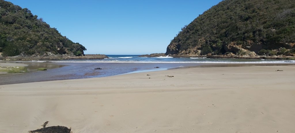
With that said, Blanket Bay was definitely worth the effort. The campsite is right on the beachfront which tempted me to stay here for the day. Perhaps I would enjoy the track more if I did the full 8 days. But I have to remember that the reason I’m out here is to train for Te Araroa. There’ll be some long days out there and I need to get some experience in putting in 6-8 hours and 20+ km of walking each day, learning how to manage the strain that’ll put of my body. That’s not to say I can’t enjoy myself out here, I just need to also push myself along the way.

Lo and behold, barely 10 minutes into my scheduled rest period, Dana shows up! She must’ve been motoring considering she wasn’t even fully packed by the time I set off. Granted, hiking is her job so it’s sage to assume she’s pretty good at it. We spent the next half an hour just shooting the breeze before we had to part ways. Again, very tempting to stay put and spend another night with the gang from Elliot Ridge, but that’s not the schedule I planned. I still had 11 km to go.
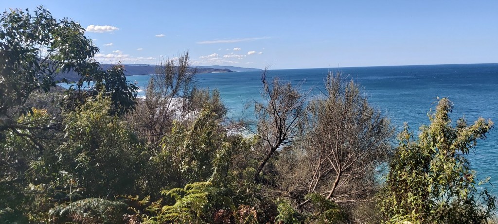
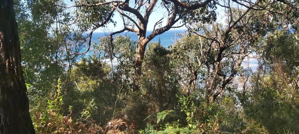
This section to Cape Otway seemed to have an allergy of being flat. It was constantly going up and down over various hills. On the plus side, the mud had stopped. About two-thirds of the way in, I reached Parker Inlet, an unbridged estuary. Unlike the Elliot River I had to cross yesterday, there were no stepping stones here. I just had to pick a shallow enough spot to cross, which (thankfully) wasn’t too difficult.
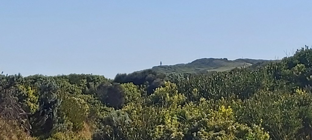
Rising sharply back onto the clifftops above the Southern Ocean, the track meandered its way towards Cape Otway Lightstation. This part of the trail was pretty uneventful, save for another echidna sighting.
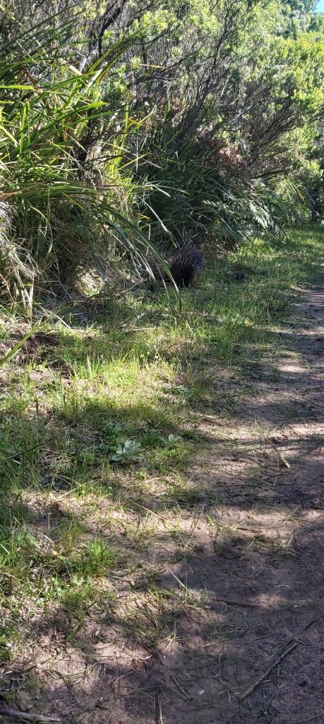
How could something so cute also be unpattable? Yes, unpattable is a word. If it wasn’t already, it is now. Once he disappeared into the foliage, I continued on my way to the lighthouse, which slowly hoved into view. Having a physical landmark on the horizon is very handy at helping you understand how you’re progressing.

This bit of the Victorian coast is littered with shipwrecks from years past and is the reason why lighthouses like the one on Cape Otway were vult. There’s a particularly nasty reef off the top of the Cape, hence why this one was constructed; basically a big sign saying, “BACK OFF, DON’T COME NEAR ME!” Although I’m on dry land, I also decided to oblige with that message as the campsite is a few hundred metres further on. When I arrived, there was a group of 4 hikers from the Geelong/Torquay area just chilling, presumably having come from Blanket Bay. Annoyingly, the individual camps were about 50 metres away from the shelter, but it was equipped with lights and USB chargers. An unexpected feature, but certainly not an unwelcome one.
Setting up camp was a breeze, leaving me with about an hour or so to relax before making dinner. As I’m about to start cooking, another hiker shows up having walked all the way from Apollo Bay! Turns out he’s a bit of a veteran of this long walks, having completed the Camino de Santiago in Spain. We chatted for a good hour or so before I turned in for the evening. He’s following the same schedule as me, so we’ll be seeing more of each other in the coming days.

Leave a comment