

Well then, here’s goes nothing, I guess…
In mid-2021 during one of my many phases of feeling jaded at my uni studies and the career/s it was supposed to unlock for me, I did what I do best and started planning a holiday. This isn’t a new thing for me, I’ve been doing it for several years at this point whenever I was itching to research something not related to engineering. Most of these trips were pure pipe dreams, like cycling from Dover to the Shetland islands or seeing how fast I could visit all 47 prefectures of Japan if I only travelled by rail (and ferry, can’t exactly catch a train to Okinawa). I had no reason to think that this new plan would be any different. Having recently been exposed to the concept of thru-hiking by watching several accounts of people doing the Appalachian, Pacific Crest, and Continental Divide trails in the US (commonly known as the Tripe Crown of Hiking), I thought it’d be fun if I planned a thru-hike of my own. The US and Europe seemed out of reach, however New Zealand had a trail of their own called Te Araroa, Māori for The Long Pathway. Starting at Cape Reinga, the northernmost point of the country1, the trail meanders down the North Island before reaching Wellington, where a ferry across to Picton begins the South Island portion of the trail, eventually finishing at Bluff, the southernmost point of the main islands2. To help me plan was a comprehensive list of trail notes and a set of highly detailed topographical maps with which I was able to come up with a pretty sweet plan thanks to the wonders of Excel.
Then I did something very dangerous: I started thinking. After having an absolute horror show at uni in 2020 (I wonder what could’ve caused that…), I made the decision to scale back in 2021, adding an extra 6 months to my degree, halfway through 2023. I also learned during this period that most engineering firms want new graduates to join them at the beginning of the new year.
I suddenly have 6 months to fill…
…I could actually do this.
Obviously, I couldn’t start straight away, because I’d be finishing in winter. Here in Queensland, we really don’t get a winter. For us, a really cold day is if the temperature doesn’t get past 20oC. Over in Kiwiland, their mountains, and therefore large chunks of the Te Araroa route, would be blanketed in snow and ice, which I have been told is rather slippery. Despite this, I believed I could still fit it in nicely between the starting window and commencing a prospective job back home (the latter is still a work in progress).
Fast forward a couple years, I’m now faced with the fact that in two months, I’m actually going to be doing this thing. In other words, I have two months left to prepare for this trip. Having just bought a new pair of boots (yes, I’m bringing boots, not trail runners, please don’t hurt me), I needed to break them in before I started my proper warm-up hikes.
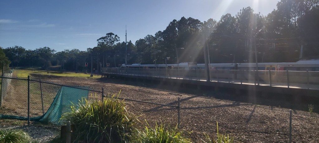
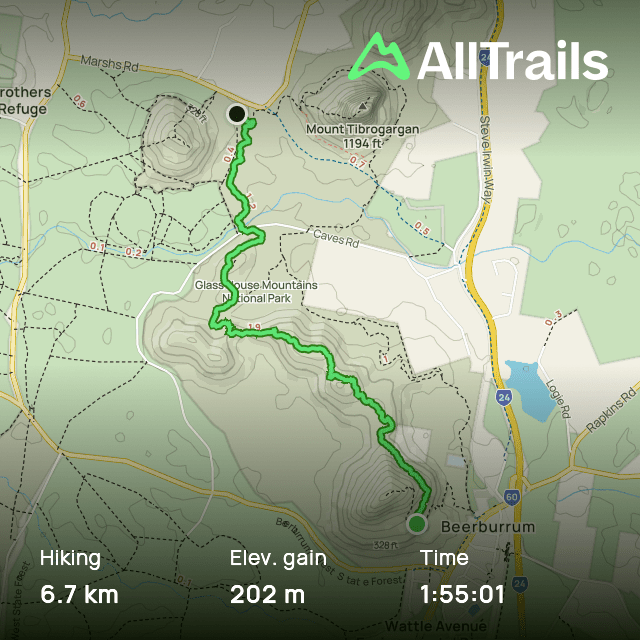
So that’s what I did, and I could think of no better spot to do so than the Glass House Mountains. For the past couple years, I came here before uni started to clear my head. This time I decided to take a different trail, taking the train to Beerburrum, climb the mountain of the same name, then walk through the national park to the Glass House Mountains township and take the train home.

From the Beerburrum trailhead, it’s 1.7 km to the summit of the mountain, climbing around 210 m in the process. Doing the maths, that gives an average gradient of roughly 1 in 8. That’s pretty steep. What those numbers don’t tell you is that the first kilometre is rather gentle, with the last 700 m climbing what felt like a 1 in 2 gradient.
Now, steep ascents aren’t anything new to me, but normally when it gets this bad I’d expect to be walking up steps. But no, clearly whoever decided to pave this track either didn’t know that steps are a thing that exists, or deliberately didn’t put them in.
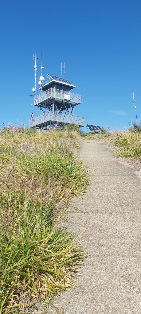
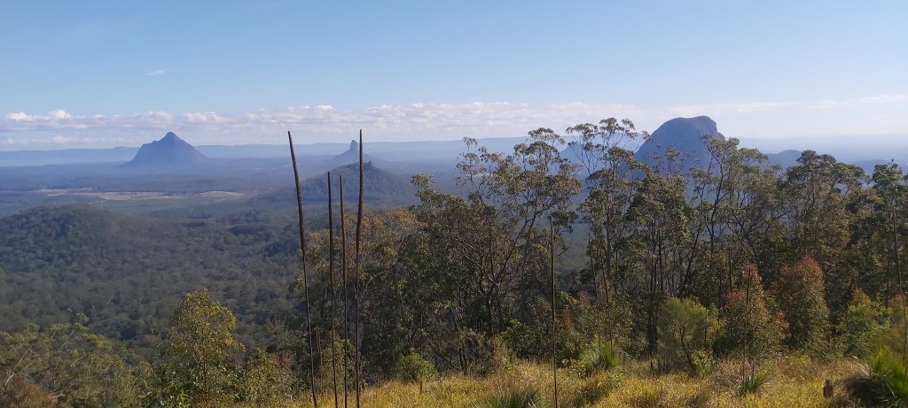
I shouldn’t whinge too much, the views from the summit were pretty sweet. It was rather hazy when I was there so I couldn’t get any good views of the coast. I had to make do with looking at the surrounding peaks jutting out from the surrounding forests and farmlands. The summit also has a fire lookout tower that I believe is still used by QPWS (Queensland Parks & Wildlife Service) to, well, spot fires.
Then came the fun task of getting down from the mountain, which I can confidently say was a lot harder than the climb up. A lot of that for me comes down to trusting my shoes’ grip on the path that they won’t slip out from underneath me, which I wouldn’t be able to do confidently if I was wearing a regular pair of runners. These boots, however, were excellent, almost locking my foot into the path until I was ready to take my next step.
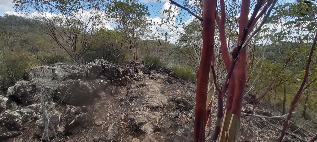
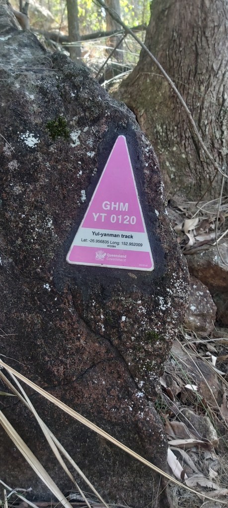
Once back at the trailhead, I then turned onto the Yul-yan-man track towards Mt Tibrogargan. It’s only 6.7 km, which I thought would be a breeze. For some reason, its grade 5 classification3 didn’t phase me in the slightest. I’ve done multi-day trips on rough trails before, how hard can it be?
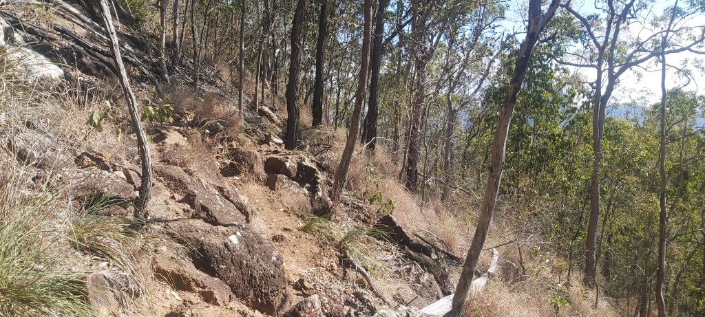
Turns out the answer to that is very hard! Not even 100 m in and I’m having to scramble over rocks on a very narrow, poorly marked track. At multiple points, I had to stop to either look for the next bright pink route marker or for what looked like the most obvious route to take.
This did not always work out. At some point, I took a wrong turn. It was only once I realised that I hadn’t seen a marker in a while that I stopped, checked AllTrails and saw that the actual track was to my right. Thankfully I wasn’t that far off and managed to sight a marker… 20 metres below me.
That was quite an eye-opening experience. My overconfidence in my abilities led to me potentially getting badly lost if it wasn’t for me using an app to plot my hike. That can’t be something that I can rely on, but I’m thankful that I learnt this lesson in a place with reception instead of somewhere more remote. From then on, I didn’t move until I could spot the next marker or it was painfully obvious where the trail was going.
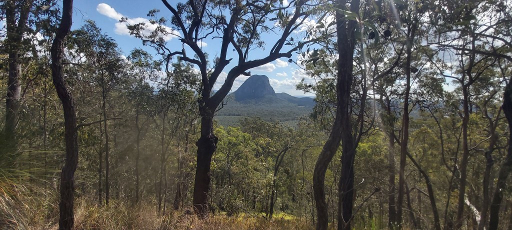
Through all of this, my average speed was painfully slow. At one point I was only doing 2 km/h. It picked up once the track opened up a bit, but I had still really underestimated how demanding it would be. On the flipside, I was still walking through a really pretty part of this national park and I enjoyed the challenges that the Yul-yan-man track gave me.
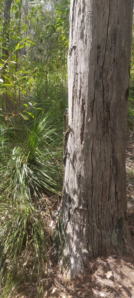
Upon joining the Trachyte circuit, the trail opened up quite a bit, meaning I could pick up the pace for the last 2 km to the Tibrogargan trailhead, only stopping when I got jumpscared by this goanna.
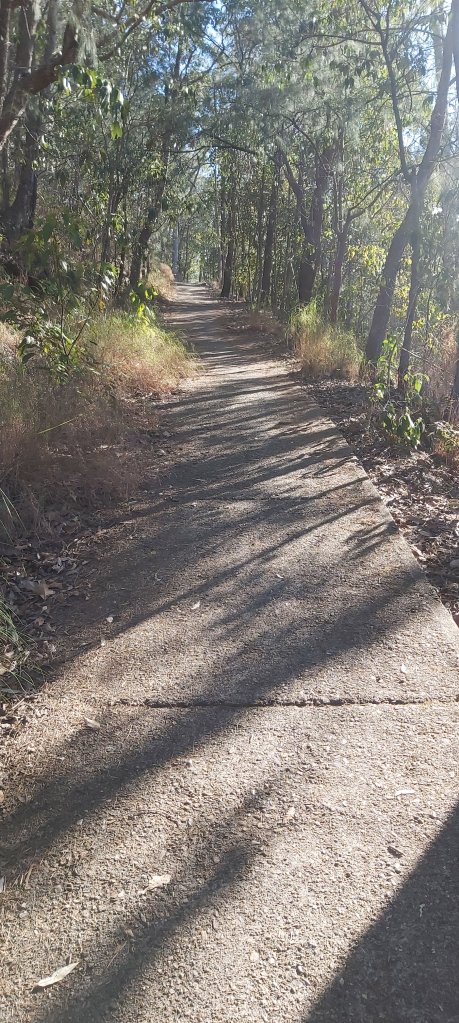
The trailhead is about 5 km from the Glass House Mountains township, forcing me to partake in a time-honoured tradition that all Te Araroa hikers must do: R O A D W A L K I N G !
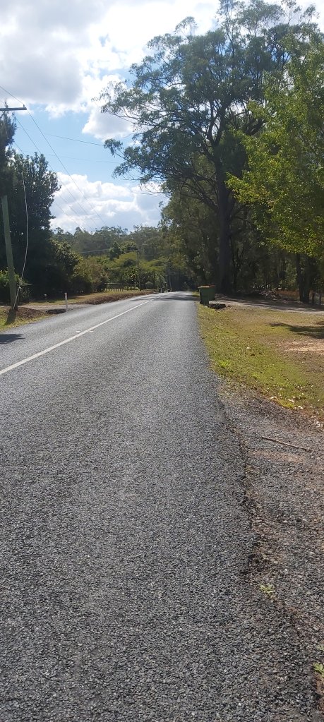
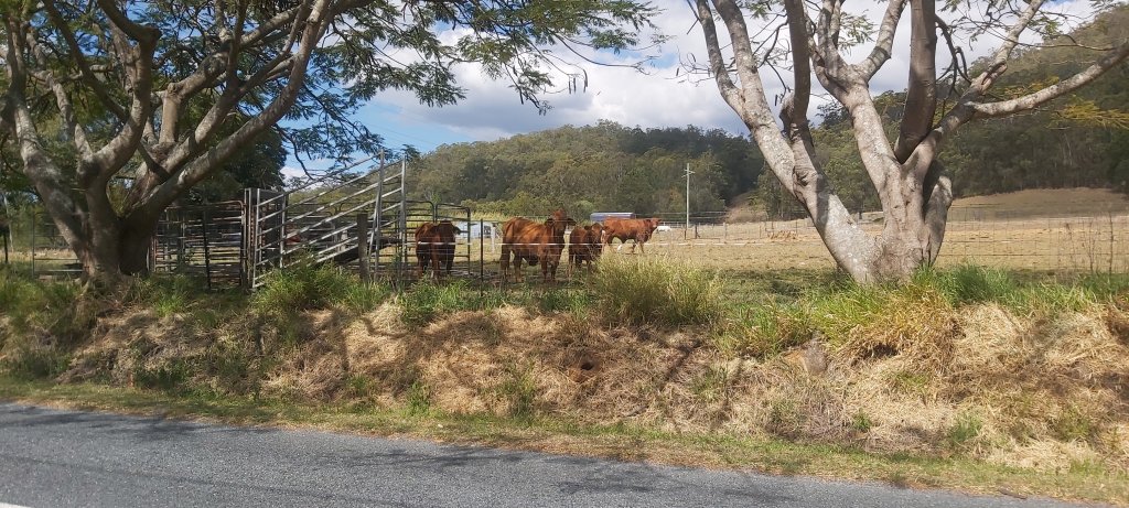
Honestly, it wasn’t that bad. It was fairly quiet, maybe a handful of cars went past me, and I could walk at a fairly quick pace. The highlight of this section was definitely the cows that stared at me for far too long.
Arriving at the town 20 minutes before my train, I stopped at the local bakery for a steak & mushroom pie and an apple turnover. If I had more impulse control, I would’ve taken some pics showing how great they were. But I don’t. I was hungry.
The whole point of this trip was to test out and get used to my new hiking boots that I’d be taking on Te Araroa and on my two warm-up hikes. My feet were a bit sore, but my feeling is that’s due to this being the first time using them. At least I hope so. I’m supposed to be starting the Carnarvon Great Walk in just over a week, where I’ll be carrying a larger pack over longer distances than I did here. If these boots aren’t as comfortable or supportive as I thought they were in the store, that’s gonna be a problem. I guess that only way of knowing that is with time…
- If we’re being pedantic, Cape Reinga is the northernmost accessible point in New Zealand. The true northernmost point belongs to the very creatively named North Cape 30km east of Cape Reinga. ↩︎
- Same energy, Slope Point is further south, but it’s roughly 70 km east of Bluff and there’s no road to it so… ¯\_(ツ)_/¯ ↩︎
- For those unfamiliar with Queensland’s trail grading system, grade 5 is described as being “for very experienced bushwalkers with specialised skills, including navigation and emergency first aid”. Such trails are typically very rough, very steep, and unmarked. ↩︎

Leave a comment